
Srikakulam is a city and the headquarters of Srikakulam district in the Indian state of Andhra Pradesh. As of 2011 census,. it has a population of 165,735. There are many other places of Buddhist Tourism such as Salihundam, Calinga Patnam, Dabbaka Vaani Peta, Nagari Peta, Jagati Metta, Singupuram etc. in Srikakulam District. The Buddhist heritage site of Salihundam has some unique features. It has a beautiful star atop a stupa, rock cut massive stupaas inside chaitya grihas, brick stupas with wheel pattern plan, votive stupas, inscriptions on the steps leading to the stupas and museum housing over two dozen sculpted statue and figurines of Buddha, Jain Teerthankars and other deities

Vizianagaram is a city and the headquarters of Vizianagaram district in the Indian state of Andhra Pradesh. It is central Eastern Ghats, about 24 km (15 mi) west of the Bay of Bengal and 40 km (25 mi) north-northeast of Visakhapatnam. The city has a population of 228,025 and was established as the capital of Vizianagaram estate by Raja Vijayaram Raj of Pusapati dynasty. The rulers had a notable role in the history of the region in 18th century and were patrons of education and arts.

Vizianagaram district is one of the eleven districts in the Coastal Andhra region of the Indian state of Andhra Pradesh with its headquarters located at Vizianagaram. The district is bounded on the east by the district of Srikakulam, north by Parvathipuram Manyam southeast by Visakhapatnam, south by Anakapalli, southeast by the Bay of Bengal, and northwest by the state of Odisha. It was formed on 1 June 1979, with some parts carved from the neighbouring districts of Srikakulam and Visakhapatnam. The district is named after the princely state of Vizianagaram. It is the least populous district in Andhra Pradesh.

Bobbili is a town in Vizianagaram district of the Indian state of Andhra Pradesh.

Proddatur is a city in the YSR Kadapa District of Andhra Pradesh.
Bandarulanka is a census town in Amalapuram Mandal, Dr. B.R. Ambedkar Konaseema district of the Indian state of Andhra Pradesh.
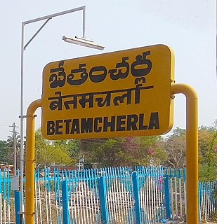
Bethamcherla is a town with Nagar panchayat civic status and mandal headquarters located in Nandyal district of the Indian state of Andhra Pradesh. It comes under Dhone assembly constituency and Nandyal Parliament Constituency.
Chintalavalasa is a census town in Vizianagaram district of the Indian state of Andhra Pradesh. It is located in Denkada mandal of Vizianagaram revenue division.

Gajapathinagaram is a census town in Vizianagaram district of the Indian state of Andhra Pradesh. It is located in Gajapathinagaram mandal of Vizianagaram revenue division. It is located on National Highway 26 between Vizianagaram and Ramabhadrapuram.
Kanapaka is a census town in Vizianagaram district in the Indian state of Andhra Pradesh.
Kantabamsuguda is a census town in Anakapalli district of the Indian state of Andhra Pradesh.

Kothavalasa is a Suburb in Visakhapatnam city but present in Vizianagaram district of the Indian state of Andhra Pradesh. It is located in Kothavalasa mandal of Vizianagaram revenue division. It is located 30 km from the city of Visakhapatanam
Moragudi is a census town in Kadapa district in the Indian state of Andhra Pradesh.
Pedana is a municipality and the headquarters of Pedana mandal under Machilipatnam revenue division of Krishna district of the Indian state of Andhra Pradesh. It is located at a distance of 8 km (5.0 mi) from the district headquarters, Machilipatnam.
Ramanayyapeta is a census town in Kakinada district of the Indian state of Andhra Pradesh. It is located in Kakinada (rural) mandal of Kakinada revenue division. The town is a constituent of Kakinada urban agglomeration.
Sriramnagar is a census town in Vizianagaram district of the Indian state of Andhra Pradesh. It is located in Garividi mandal of Vizianagaram revenue division.
Suryaraopeta is a census town in Kakinada district of the Indian state of Andhra Pradesh. It is located in Kakinada (rural) mandal of Kakinada revenue division. The town is a constituent of Kakinada urban agglomeration.
Vetapalem is a census town in Bapatla district of the Indian state of Andhra Pradesh. It is the mandal headquarters of Vetapalem mandal in Ongole revenue division.
Rameswaram is a census town in Cuddapah district inside Proddatur in the Indian state of Andhra Pradesh.

As per the 2011 census of India, Andhra Pradesh has an overall literacy rate of 67.35%, significantly lower than the overall national average of 74.04%. Among the Indian states and union territories, it stands at 32nd position. During the same census, there are a total of 29,859,982 literates: 16,549,514 males and 13,310,468 females. In terms of district-wise literates, East Godavari has the most with 3,348,077 and Vizianagaram has the least with 1,238,388. While, in terms of district-wise literacy rates, West Godavari stands top with 74.32% and Vizianagaram at bottom with 58.89%. The government also implements fee reimbursement scheme for the economically backward sections of the state.
