
Vizianagaram is a city and the headquarters of Vizianagaram district in the Indian state of Andhra Pradesh. It is central Eastern Ghats, about 24 km (15 mi) west of the Bay of Bengal and 40 km (25 mi) north-northeast of Visakhapatnam. The city has a population of 228,025 and was established as the capital of Vizianagaram estate by Raja Vijayaram Raj of Pusapati dynasty. The rulers had a notable role in the history of the region in 18th century and were patrons of education and arts.

Vizianagaram district is one of the nine districts in the Coastal Andhra region of the Indian state of Andhra Pradesh with its headquarters located at Vizianagaram. The district is bounded on the east by the district of Srikakulam, southwest by the City of Bheemunipatnam, southeast by the Bay of Bengal, and northwest by the state of Odisha. It was formed on 1 June 1979, with some parts carved from the neighbouring districts of Srikakulam and Visakhapatnam. The district is named after the princely state of Vizianagaram. It is the least populous district in Andhra Pradesh.

Chintalavalasa is a census town in Vizianagaram district of the Indian state of Andhra Pradesh. It is located in Denkada mandal of Vizianagaram revenue division.

Gajapathinagaram is a census town in Vizianagaram district of the Indian state of Andhra Pradesh. It is located in Gajapathinagaram mandal of Vizianagaram revenue division. It is located on National Highway 26 between Vizianagaram and Ramabhadrapuram.
Jarajapupeta is a census town in Vizianagaram district of the Indian state of Andhra Pradesh. It is located in Nellimarla mandal of Vizianagaram revenue division.

Kothavalasa is a Suburb in Visakhapatnam city but present in Vizianagaram district of the Indian state of Andhra Pradesh. It is located in Kothavalasa mandal of Vizianagaram revenue division. It is located 30 km from the city of Visakhapatanam

Sompeta is a census town in Srikakulam district of the Indian state of Andhra Pradesh. It is the mandal headquarters of Sompeta mandal in Tekkali revenue division.
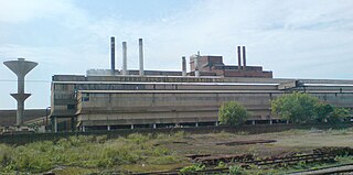
Sriramnagar is a census town in Vizianagaram district of the Indian state of Andhra Pradesh. It is located in Garividi mandal of Vizianagaram revenue division.
Kurupam is a village in Vizianagaram district of the Indian state of Andhra Pradesh.
Mentada is a village in Vizianagaram district of the Indian state of Andhra Pradesh, India.

Bhogapuram is a village in Vizianagaram district of the Indian state of Andhra Pradesh. It is located in Bhogapuram mandal of Vizianagaram revenue division.

Srungavarapukota popularly known by its abbreviated form S.Kota is a neighbourhood in the district of Vizianagaram, India. S.Kota is located on Visakhapatnam – Araku road. The town was upgraded from gram panchayat to Nagar Panchayat in the year 2011.
Therlam is a village in Vizianagaram district of the Indian state of Andhra Pradesh, India.

Denkada is a village in Vizianagaram district of the Indian state of Andhra Pradesh, India. Denkada is located on the banks of River Champavathi.
Pathapatnam is a town in Srikakulam district of the Indian state of Andhra Pradesh. It is located in Pathapatnam mandal of Palakonda revenue division. Pathapatnam is located on the border of Srikakulam district of Andhra Pradesh and Gajapati district of Odisha. Parlakhemundi, the headquarters of Gajapati District, can be considered as twin town of Pathapatnam because of its close proximity. It is located around 65 km from srikakulam.
Tekkali is a census town in Srikakulam district of the Indian state of Andhra Pradesh. It is the mandal headquarters of Tekkali mandal in Tekkali revenue division and is located at a distance of 51 KM from the district headquarters. The prominent actor Nandhamuri Taraka RamaRao represented this assembly constituency in AndhraPradesh General Legislative assembly Elections 1994.

Natavalasa is a village and panchayat in Denkada mandal of Vizianagaram district, Andhra Pradesh, India. It is located on the banks of River Champavathi.
River Champavathi is a small river which originates in the Eastern Ghats at an altitude of 1,200 metres above mean sea level near Andra village and flows eastwards and joins the Bay of Bengal near the village Konada. The river passes through Gajapathinagaram, Nellimarla, Saripalli, Denkada, Palem and Natavalasa of Vizianagaram district. The river has four main tributaries Eduvampula Gedda, Chitta Gedda, Pothula Gedda and Gadi Gedda. The basin has a drainage area of 1,410 square kilometres. This area is divisible into Hilly terrain, Vizianagaram plains and Coastal plains.

Saripalli is a village in Nellimarla mandal of Vizianagaram district in Andhra Pradesh, India.
Vizianagaram mandal is one of the 34 mandals in Vizianagaram district of Andhra Pradesh, India. Vizianagaram city is the headquarters of the mandal. The mandal is bounded by Gantyada, Bondapalle, Nellimarla, Denkada, Jami mandals and Visakhapatnam district.

