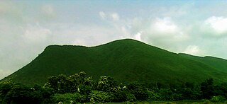
Vizianagaram district is one of the six districts in the Uttarandhra region of the Indian state of Andhra Pradesh with its headquarters located at Vizianagaram. The district was once the part of ancient Kalinga.Saripilli Dibbilingeswara temple, Jayathi Mallikarjuna Temple are the finest examples of ancient Eastern Ganga Dynasty built monuments in the district. The district is bounded on the east by the district of Srikakulam, north by Parvathipuram Manyam south by Visakhapatnam, Anakapalli, southeast by the Bay of Bengal, and west by Alluri Sitharama Raju district. It was formed on 1 June 1979, with some parts carved from the neighbouring districts of Srikakulam and Visakhapatnam. The district is named after the princely state of Vizianagaram. In 2011, it was the least populous district in Andhra Pradesh.

Penukonda also called Penugonda is a town in the Sri Sathya Sai district of Andhra Pradesh, India. It is 70 km away from Anantapur town.

Gajapathinagaram is a census town in Vizianagaram district of the Indian state of Andhra Pradesh. It is located in Gajapathinagaram mandal of Vizianagaram revenue division. It is located on National Highway 26 between Vizianagaram and Ramabhadrapuram.

Parvathipuram is a municipality located at Parvathipuram Manyam district of Indian state of Andhra Pradesh. It is the administrative headquarters of Parvathipuram Manyam district and headquarters of Parvathipuram revenue division and Parvathipuram mandal. This revenue division shares a border with various districts in Odisha.
Ponnur is a major city/town in Guntur district of the Indian state of Andhra Pradesh. A road to Chandole goes south-east and comes to Nidubrolu, where there is a temple with a stone bearing inscription recording the erection of 90 temple in A.D. 1132. An ancient Telugu manuscript entitled 'Ponnuru-Chandavolu Shasanam' was present in Potti Sreeramulu Telugu University. Kilari Venkata Rosaiah of YSRCP party is the current MLA of the constituency, who won the 2019 Andhra Pradesh Legislative Assembly election. It is a municipality and the mandal headquarter of Ponnur mandal under Tenali revenue division.
Rayachoti is a Municipality and District headquarters of Annamayya district which is formed after Rajampet of the Indian state of Andhra Pradesh. Also It is the headquarters of Rayachoti revenue division. It is one of the oldest towns in Andhra Pradesh.

Nelli-marla is a census town in Vizianagaram district of the Indian state of Andhra Pradesh. It is in Nellimarla mandal of Vizianagaram revenue division.

Baliji-peta or Baligi-peta is a village in Parvathipuram Manyam district of the Indian state of Andhra Pradesh.

Kurupam is a village in Parvathipuram Manyam district of the Indian state of Andhra Pradesh.
Therlam is a village in Vizianagaram district of the Indian state of Andhra Pradesh, India.
Kotturu is a village in Srikakulam district of the Indian state of Andhra Pradesh. It is located in Kothuru mandal of Palakonda revenue division.

Parawada is a mandal in Anakapalli district in the state of Andhra Pradesh in India.
Srirangarajapuram is a village in Chittoor district of the Indian state of Andhra Pradesh. It is the mandal headquarters of Srirangarajapuram mandal.
Relli-valasa is a village in Pusapatirega mandal of Vizianagaram district. It is one of the villages in Nellimarla constituency. Surrounded and protected by three goddess. Politically strong and developed village.
Makkuva mandal is one of the 34 mandals in Parvathipuram Manyam district of the Indian state of Andhra Pradesh. It is administration under Parvathipuram revenue division and headquartered at Makkuva. The mandal is bounded by Salur mandal on South & West, Parvathipuram mandal on North, Seethanagaram mandal on east and Bobbili mandal on south east. A portion of it also borders the Narayanapatna block of the Koraput district of Odisha on north west.
Badangi mandal is one of the 34 mandals in Vizianagaram district of Andhra Pradesh, India. Badangi is the headquarters of the mandal. In Early 18th century Pinpenki, Badangi, Anavaram and kusumur ruled by Shri Ravu Venkata Rayanym Dora Garu now their family also residing in Pinapenki near Gadhaba valasa their family members Started "RVR Foundation" on the name of Shri Ravu Vittal Rao Dora Garu to help poor children. Founder & President "Shri Ravu Venkata Aditya Mohan", He is conducting child development activities and giving financial / moral support. The mandal is bounded by Bobbili, Therlam, Merakamudidam and Ramabhadrapuram mandals.
Uttarapalli was a constituency of the Andhra Pradesh Legislative Assembly, India. It is one of 9 constituencies in the Vizianagaram district.
Pathivada Narayanaswamy Naidu is an Indian politician. He was elected six times from the Bhogapuram constituency before it was reconstituted as the Nelimarla constituency.
Baddukonda Appala Naidu, alternatively Baddukonda Appalanaidu, is an Andhra Pradesh politician and YSR Congress Party leader.
Kondapalli Appala Naidu / Kondapalli Appalanaidu is also known as 'K.A. Naidu'. is an Andhra Pradesh politician. Telugu Desam Party leader.


