Chintalavalasa

Last updated

Chintalavalasa
Location map India Andhra Pradesh EN.svg
Red pog.svg
Chintalavalasa
Location in Andhra Pradesh, India
Coordinates: 18°04′03″N83°24′34″E / 18.06750°N 83.40944°E / 18.06750; 83.40944 Coordinates: 18°04′03″N83°24′34″E / 18.06750°N 83.40944°E / 18.06750; 83.40944
CountryFlag of India.svg  India
State Andhra Pradesh
District Vizianagaram
Area
[1]
  Total3.59 km2 (1.39 sq mi)
Population
 (2011)
  Total5,921
  Density1,600/km2 (4,300/sq mi)
Languages
  Official Telugu
Time zone UTC+5:30 (IST)
Vehicle registration AP

Chintalavalasa is a census town in Vizianagaram district of the Indian state of Andhra Pradesh. It is located in Denkada mandal of Vizianagaram revenue division. [1]

A census town is a type of town that satisfies certain characteristics, depending on the country in which it is located.

Vizianagaram district District of Andhra Pradesh in India

Vizianagaram district is one of the thirteen districts in the Indian state of Andhra Pradeshwith the headquarters located at Vizianagaram. The district is bounded on the east by the district of Srikakulam, southwest by the City of Bheemunipatnam, southeast by the Bay of Bengal, and northwest by the state of Odisha. It was formed on 1 June 1979, with some parts carved from the neighbouring districts of Srikakulam and Visakhapatnam. The district is named after the princely state of Vizianagaram. It is the least populous district in Andhra Pradesh.

India Country in South Asia

India is a country in South Asia. It is the seventh-largest country by area, the second-most populous country, and the most populous democracy in the world. Bounded by the Indian Ocean on the south, the Arabian Sea on the southwest, and the Bay of Bengal on the southeast, it shares land borders with Pakistan to the west; China, Nepal, and Bhutan to the north; and Bangladesh and Myanmar to the east. In the Indian Ocean, India is in the vicinity of Sri Lanka and the Maldives; its Andaman and Nicobar Islands share a maritime border with Thailand and Indonesia.

Contents

Demographics

As of 2001 India census, [2] Chintalavalasa had a population of 6421. Males constitute 52% of the population and females 48%. Chintalavalasa has an average literacy rate of 67%, higher than the national average of 59.5%; with male literacy of 72% and female literacy of 61%. 12% of the population is under 6 years of age.

Education

The primary and secondary school education is imparted by government, aided and private schools, under the School Education Department of the state. [3] [4] The medium of instruction followed by different schools are English, Telugu.

Telugu language Dravidian language

Telugu is a Dravidian language spoken in the Indian states of Andhra Pradesh, Telangana and the union territories of Puducherry (Yanam) by the Telugu people. It stands alongside Hindi, English and Bengali as one of the few languages with primary official language status in more than one Indian state. There are also significant linguistic minorities in neighbouring states. It is one of six languages designated a classical language of India by the country's government.

Related Research Articles

Srikakulam City in Andhra Pradesh, India

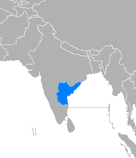
Srikakulam is a city and the headquarters of Srikakulam district in the Indian state of Andhra Pradesh. As of 2011 census, it was most populous city of the district with a population of 146,988. There are many other places of Buddhist Tourism such as Saalihundam, Kalinga Patnam, Dabbaka Vaani Peta, Nagari Peta, Jagati Metta etc in Srikakulam District. The Budist heritage site of Salihundam has some unique features. It has a beautifyl star atop a stupa, rock cut massive stupaas insidechaitya grihas, brick stupas with wheel pattern plan, votive stupas, inscriptions on the steps leading to the stupas and msueum housing over two dozen sculpted statue and figurines of Budha, Jain Teerthankars and other deities

Bobbili Town in Andhra Pradesh, India

Bobbili is a town in Vizianagaram district of the Indian state of Andhra Pradesh..

Gajapathinagaram Census Town in Andhra Pradesh, India

Gajapathinagaram is a census town in Vizianagaram district of the Indian state of Andhra Pradesh. It is located in Gajapathinagaram mandal of Vizianagaram revenue division. It is located on National Highway 26 between Vizianagaram and Ramabhadrapuram.

Jarjapupeta Census Town in Andhra Pradesh, India

Jarajapupeta is a census town in Vizianagaram district of the Indian state of Andhra Pradesh. It is located in Nellimarla mandal of Vizianagaram revenue division.

Kanapaka Census Town in Andhra Pradesh, India

Kanapaka is a census town in Vizianagaram district in the Indian state of Andhra Pradesh.

Kandukur, Prakasam district Town in Andhra Pradesh, India

Kandukur or Kandukuru is a town in Prakasam district of the Indian state of Andhra Pradesh. It is a municipality and the mandal headquarters of Kandukur mandal in Kandukur revenue division.

Kothavalasa Census Town in Andhra Pradesh, India

Kothavalasa is a census town in Vizianagaram district of the Indian state of Andhra Pradesh. It is located in Kothavalasa mandal of Vizianagaram revenue division. It is located 30 km from City Visakhapatanam

Moragudi Census Town in Andhra Pradesh, India

Moragudi is a census town in Kadapa district in the Indian state of Andhra Pradesh.

Narayanavanam Census Town in Andhra Pradesh, India

Narayanavanam is a census town in Chittoor district of the Indian state of Andhra Pradesh. It is the mandal headquarters of Narayanavanam mandal in Chittoor revenue division. The town is known for Kalyana Venkateswara Temple dedicated to Lord Venkateswara and was constructed in the year 1541 AD.

Papampeta Census Town in Andhra Pradesh, India

Papampeta is a census town in Anantapur district of the Indian state of Andhra Pradesh. It is located in Anantapur mandal of Anantapur revenue division. The town is a constituent of Anantapur urban agglomeration.

Ramanayyapeta Census Town in Andhra Pradesh, India

Ramanayyapeta is a census town in East Godavari district of the Indian state of Andhra Pradesh. It is located in Kakinada (rural) mandal of Kakinada revenue division. The town is a constituent of Kakinada urban agglomeration.

Salur Town in Andhra Pradesh, India

Salur or Saluru is a municipal town and mandal headquarters in Vizianagaram district, of the Indian state of Andhra Pradesh.

Sriramnagar, Vizianagaram district Census Town in Andhra Pradesh, India

Sriramnagar is a census town in Vizianagaram district of the Indian state of Andhra Pradesh. It is located in Garividi mandal of Vizianagaram revenue division.

Suryaraopeta Census Town in Andhra Pradesh, India

Suryaraopeta is a census town in East Godavari district of the Indian state of Andhra Pradesh. It is located in Kakinada (rural) mandal of Kakinada revenue division. The town is a constituent of Kakinada urban agglomeration.

Uravakonda Census Town in Andhra Pradesh, India

Uravakonda is a census town in Anantapur district of the Indian state of Andhra Pradesh. It is the headquarters of Uravakonda mandal in Anantapur revenue division. The town is a constituent of urban agglomeration.

Vetapalem Census Town in Andhra Pradesh, India

Vetapalem is a census town in Prakasam district of the Indian state of Andhra Pradesh. It is the mandal headquarters of Vetapalem mandal in Ongole revenue division.

Rameswaram, Kadapa district Census Town in Andhra Pradesh, India

Rameswaram is a census town in Cuddapah district in the Indian state of Andhra Pradesh.

Guntupalli, Krishna district Census Town in Andhra Pradesh, India

Guntupalli is a census town in Krishna district of the Indian state of Andhra Pradesh. It is located in Ibrahimpatnam mandal of Vijayawada revenue division. It is a suburb of Vijayawada.

Gavaravaram Census Town in Andhra Pradesh, India

Gavaravaram is a census town in West Godavari district of the Indian state of Andhra Pradesh. It is located in Eluru mandal of Eluru revenue division. The town is a constituent of Eluru urban agglomeration.

References

  1. 1 2 "District Census Handbook - Vizianagaram" (PDF). Census of India. p. 18–19,380. Retrieved 5 December 2015.
  2. "Census of India 2001: Data from the 2001 Census, including cities, villages and towns (Provisional)". Census Commission of India. Archived from the original on 16 June 2004. Retrieved 1 November 2008.
  3. "School Education Department" (PDF). School Education Department, Government of Andhra Pradesh. Archived from the original (PDF) on 19 March 2016. Retrieved 7 November 2016.
  4. "The Department of School Education - Official AP State Government Portal | AP State Portal". www.ap.gov.in. Archived from the original on 7 November 2016. Retrieved 7 November 2016.