Vizianagaram district is one of the six districts in the Uttarandhra region of the Indian state of Andhra Pradesh with its headquarters located at Vizianagaram. The district was once the part of ancient Kalinga.Saripilli Dibbilingeswara temple, Jayathi Mallikarjuna Temple are the finest examples of ancient Eastern Ganga Dynasty built monuments in the district. The district is bounded on the east by the district of Srikakulam, north by Parvathipuram Manyam south by Visakhapatnam, Anakapalli, southeast by the Bay of Bengal, and west by Alluri Sitharama Raju district. It was formed on 1 June 1979, with some parts carved from the neighbouring districts of Srikakulam and Visakhapatnam. The district is named after the princely state of Vizianagaram. In 2011, it was the least populous district in Andhra Pradesh.
Vijayawada Rural mandal is one of the 20 mandals in NTR district of the Indian state of Andhra Pradesh. It is under the administration of Vijayawada revenue division and has its headquarters at Nunna. The mandal is bounded by Ibrahimpatnam, G. Konduru, Gannavaram, Kankipadu, Penamaluru and Patamata Mandals. The mandal is also a part of the Andhra Pradesh Capital Region under the jurisdiction of APCRDA.
Tirupati Urban mandal is one of the 34 mandals in Tirupati district of the Indian state of Andhra Pradesh. It has its headquarters at Tirupati city&Tirupati district. The mandal is bounded by Chandragiri, Tirupati (rural) mandals. A part of it also borders Annamayya district.
Obulavaripalle mandal is one of the 50 mandals in Annamayya district of the Indian state of Andhra Pradesh. It is under the administration of Rajampeta revenue division, with its headquarters at Mangampet town. The mandal is bounded by Kodur, Chitvel and Pullampeta mandals. Construction of a new railway line Obulavaripalle–Krishnapatnam section connecting Obulavaripalle railway station to Krishnapatnam port is in progress.
Bhimavaram mandal is one of the 19 mandals in West Godavari district of the Indian state of Andhra Pradesh. It has headquarters at Bhimavaram town. The mandal is bounded by Undi mandal, Palacoderu mandal, Veeravasaram mandal, Narasapuram mandal, Mogalthur mandal and Kalla mandal mandals.

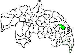
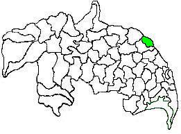
Mangalagiri mandal is one of the 18 mandals in Guntur district of the Indian state of Andhra Pradesh. It is under the administration of Tenali revenue division and the headquarters are located at Mangalagiri town part of Mangalagiri Tadepalli Municipal Corporation. The mandal is bounded by Thullur, Tadepalle, Tadikonda, Pedakakani and Duggirala mandals and a portion of the mandal lies on the banks of Krishna River.

Tenali mandal is one of the 18 mandals in Guntur district of the Indian state of Andhra Pradesh. It is under the administration of Tenali revenue division, headquartered at Tenali. The mandal is located in Velanadu region, bounded by Pedakakani, Duggirala, Kollipara, Vemuru, Amruthalur, Tsundur and Chebrole mandals.

Tadepalli mandal is one of the 18 mandals in Guntur district of the Indian state of Andhra Pradesh. It is under the administration of Tenali revenue division and the headquarters are located at Tadepalli town. The mandal is situated on the banks of Krishna River, bounded by Thullur and Mangalagiri mandals. from the mandal are under the jurisdiction of Andhra Pradesh Capital City.
Bapatla mandal is one of the 25 mandals in Bapatla district of the state of Andhra Pradesh, India. It is under the administration of Bapatla revenue division and the headquarters are located at Bapatla. The mandal is bounded by Kakumanu, Ponnur, Karlapalem mandals of Guntur district. It also shares borders with Prakasam district and a portion of it lies on the coast of Bay of Bengal.
Chirala mandal is one of the 25 mandals in Bapatla district of the Indian state of Andhra Pradesh. It is administered under Chirala revenue division and its headquarters are located at Chirala. The mandal is situated at the shore of Bay of Bengal and is bounded by Parchur, Karamchedu and Vetapalem mandals.
Eluru mandal is one of the 28 mandals in Eluru district of the Indian state of Andhra Pradesh. It is administered under Eluru revenue division and its headquarters are located at Eluru city. The mandal is bounded by Pedapadu mandal, Pedavegi mandal, Denduluru mandal, Bhimadole mandal and it also borders Krishna district.
Penamaluru mandal is one of the 25 mandals in Krishna district of the Indian state of Andhra Pradesh. Penamaluru Mandal is the major suburb of Vijayawada.It is under the administration of Vuyyuru revenue division and its headquarters are located at Penamaluru. The mandal lies on the banks of Krishna River and is bounded by Vijayawada (urban), Vijayawada (rural) and Kankipadu mandals. The mandal is also a part of the Andhra Pradesh Capital Region under the jurisdiction of APCRDA.
Narasaraopet mandal is one of the 28 mandals in Guntur district of the India state of Andhra Pradesh. It is under the administration of Narasaraopet revenue division and the headquarters are located at Narasaraopet city. The mandal is bounded by Rompicherla, Nekarikallu, Muppalla, Phirangipuram, Nadendla and Chilakaluripeta. It also borders Prakasam district.

Ponnur mandal is one of the 18 mandals in Guntur district of the Indian state of Andhra Pradesh.Dhulipalla Narendra Kumar – Telugu Desam Party is the present MLA of the constituency, having won the 2024 assembly elections. It is under the administration of Tenali revenue division and the headquarters are located at Ponnur town. The mandal is bounded by Vatticherukuru, Chebrole, Tsundur, Kakumanu, Amruthalur, Pittalavanipalem, Karlapalem and Bapatla mandals.
Kovvur mandal is one of the 19 mandals in East Godavari district of the Indian state of Andhra Pradesh. Its headquarters are located in the town of Kovvur. The mandal is bounded by Nidadavole, Chagallu, Devarapalle, Tallapaudi mandals and on the east by the Godavari River.
Chilakaluripet mandal, officially designated as Chilakaluripet H/O Purshothama Patnam is one of the 28 mandals in Palnadu district of the Indian state of Andhra Pradesh. It is under the administration of Narasaraopet revenue division and the headquarters are located at Chilakaluripet city. The mandal is bounded by Nadendla, Edlapadu, Pedanandipadu and Narasaraopet mandals.
Salur mandal is one of the 34 mandals in Parvathipuram Manyam district of the Indian state of Andhra Pradesh. It is administration under Parvathipuram revenue division and headquartered at Salur. The mandal is bounded by Makkuva, Ramabhadrapuram, Pachipenta and Bobbili mandals. A portion of it also borders the state of Odisha.
Srikakulam mandal is one of the 38 mandals in Srikakulam district of the Indian state of Andhra Pradesh. It is under the administration of Srikakulam revenue division and the headquarters are located at Srikakulam. The mandal is bounded Amudalavalasa, Etcherla and Gara mandals. A portion of it lies on the banks of Vamsadhara River and Bay of Bengal.
Macherla mandal is one of the 28 mandals in the Palnadu district of the Indian state of Andhra Pradesh. It is under the administration of Gurazala revenue division and the headquarters are located at Macherla. The mandal is bounded by Rentachintala, Durgi and Veldurthi mandals and a portion of the mandal also borders the state of Telangana.


