
Chittoor is a city and district headquarters in Chittoor district of the Indian state of Andhra Pradesh. It is also the mandal and divisional headquarters of Chittoor mandal and Chittoor revenue division respectively. The city has a population of 153,756 and that of the agglomeration is 175,647.

Madanapalle is the largest city in Annamayya district and Rajampet Lok Sabha constituency of the Indian state of Andhra Pradesh. It is a Selection Grade Municipal City Council. Madanapalle is headquarters of Madanapalle Mandal,Madanapalle revenue division and PKM Urban Development Authority.

Chittoor district is one of the eight districts in the Rayalaseema region of the Indian state of Andhra Pradesh. It has a population of 18,72,951 according to 2011 census of India. It is a major market centre for mangoes, grains, sugarcane, and peanuts. The district headquarters is located at Chittoor.

Renigunta is a neighbourhood and suburb of Tirupati located in Tirupati district of the Indian state of Andhra Pradesh. Tirupati Airport is located in Renigunta. It is a part of Tirupati urban agglomeration. It is also the mandal headquarters of Renigunta mandal in Tirupati district. It also falls in the jurisdictional limit of Tirupati Urban Development Authority.

Nagari is a town in Chittoor district of the Indian state of Andhra Pradesh. It is the mandal headquarters of Nagari mandal in Nagari revenue division.

Pakala is a town in Tirupati district of the Indian state of Andhra Pradesh. It is the mandal headquarters of Pakala mandal. It comes under Tirupati revenue division.

Railway Koduru is a town in Annamayya district of the Indian state of Andhra Pradesh, located in the Rayalaseema Region.

Pileru is a census town in Annamayya district of Rayalaseema region of the Indian state of Andhra Pradesh. Pileru is located 197 Km North East of Bangalore, The Capital City Of Karnataka and 189 Km North West of Chennai, The Capital City Of Tamil Nadu and 464 Km South To The State Capital Amaravati .It is the mandal headquarters of Pileru mandal in Rayachoti revenue division. The name 'Pileru' means a "small river stream" or "Pilla Eru" in Telugu.
Palamaner or Palamaneru is a town in Chittoor district of the Indian state of Andhra Pradesh. It is the mandal headquarters of Palamaner mandal and Palamaner Revenue Division
Bangarupalyam mandal is one of the 66 mandals in the Chittoor district of the Indian state of Andhra Pradesh. Its headquarters are located at Bangarupalyam. The mandal borders Tamil Nadu and is bounded by Palamaner, Gangavaram, Thavanampalle and Yadamari mandals of Chittoor district.
Tirupati Rural mandal is one of the 34 mandals in Tirupati district of Andhra Pradesh in India. It is under the administration of Tirupati revenue division and the headquarters are located at Tirupati.
Buchinaidu Kandriga mandal or B. N. Kandriga mandal is one of the 34 mandals in Tirupati district of the Indian state of Andhra Pradesh. The mandal headquarters are located at Kanamanambedu. The mandal is bounded by Varadaiahpalem, K.V.B. Puram, Thottambedu mandals.
Kurabalakota is a census town in Annamayya district of the Indian state of Andhra Pradesh. It is a mandal headquarters of Thamballapalle Constituency in Madanapalle Revenue division
Santhipuram mandal is one of the 66 mandals in Chittoor district of the Indian state of Andhra Pradesh. The headquarters are located at Arimuthanapalle. The mandal is bounded by Ramakuppam, Kuppam and Gudupalle mandals..This mandal is under Kuppam Revenue Division.
Tirupati Urban mandal is one of the 34 mandals in Tirupati district of the Indian state of Andhra Pradesh. It has its headquarters at Tirupati city&Tirupati district. The mandal is bounded by Chandragiri, Tirupati (rural) mandals. A part of it also borders Annamayya district.
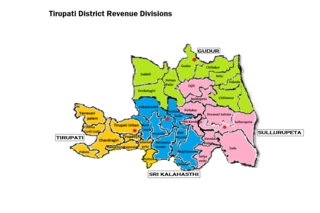
Tirupati revenue division is an administrative division in the Tirupati district of the Indian state of Andhra Pradesh. It is one of the 3 revenue divisions in the district with 9 mandals under its administration. Tirupati serves as the headquarters of the division. The division has 1 municipalities and 1 municipal corporation.
Srikalahasti mandal is one of the 34 mandals in Tirupati district of the Indian state of Andhra Pradesh. It is under the administration of Srikalahasti revenue division and the headquarters are located at Srikalahasti. The mandal is bounded by Renigunta, Yerpedu, Narayanavanam and Thottambedu.

Madanapalle revenue division is an administrative division in the Annamayya district of the Indian state of Andhra Pradesh. It is the largest and one of the 3 revenue divisions in the district with 11 mandals under its administration. Madanapalle serves as the headquarters of the division. The division has only one Municipal Corporation in Madanapalle. Administered by IAS cadre officer as SUB collector.
Annamayya district is one of the eight districts in the Rayalaseema region of Andhra Pradesh, established in 2022. Rayachoti is the district administrative headquarters and Madanapalle is the most populated City in the district.
Chinnagottigallu mandal is one of the 34 mandals in Tirupati district in the Indian state of Andhra Pradesh. It is a part of Tirupati revenue division with its headquarters at Chinnagottigallu.

