Pileru

Last updated

Pileru
Pileru rly.station.JPG
Pileru Cross Roads .jpg
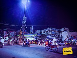
Pileru Railway Road, Pileru NH Cross Roads
Nickname: 
PLR
India Andhra Pradesh location map (current).svg
Red pog.svg
Pileru
Location in Andhra Pradesh, India
India location map.svg
Red pog.svg
Pileru
Pileru (India)
Asia laea location map.svg
Red pog.svg
Pileru
Pileru (Asia)
Coordinates: 13°39′18″N78°56′50″E / 13.6549°N 78.9471°E / 13.6549; 78.9471
Country Flag of India.svg  India
State Andhra Pradesh
Region Rayalaseema
District Annamayya
Sub-District/Mandal Pileru
Government
  Type Major Panchayath
   MP P. V. Midhun Reddy (YSRCP)
   MLA C Ramachandra Reddy
   Assembly Pileru
   Lok Sabha Rajampeta
Area
  Total15.85 km2 (6.12 sq mi)
Population
 (2011)
  Total60,253
  Density3,800/km2 (9,800/sq mi)
Languages
  Official Telugu
Time zone UTC+5:30 (IST)
PIN
517214
Telephone code+91–8584
Vehicle registration AP-03(Until 2019)
AP-39,AP-40
RTO AP403-Piler MVI Office

Pileru is a census town in Annamayya district of Rayalaseema region of the Indian state of Andhra Pradesh. Pileru is located 197 Km North East of Bangalore, The Capital City Of Karnataka and 189 Km North West of Chennai, The Capital City Of Tamil Nadu and 464 Km South To The State Capital Amaravati .It is the mandal headquarters of Pileru mandal in Rayachoti revenue division. The name 'Pileru' means a "small river stream" or "Pilla Eru" in Telugu.

Contents

Geography

It is located at an average elevation of 458 m (1,502 ft) above mean sea level.

Pileru is located at 13°39′18″N78°56′50″E / 13.6549°N 78.9471°E / 13.6549; 78.9471

There are 14 villages in this mandal apart from Pileru:

  1. Agraharam
  2. Avuvaripalle
  3. Bodumalluvaripalle
  4. Doddipalle
  5. Gudarevupalle
  6. Jandla
  7. Kavalipalle
  8. Maddelacheruvu
  9. Mellacheruvu
  10. Mudupulavemula
  11. Regullu
  12. Talupula
  13. Vepulabylu
  14. Yerraguntlapalle
Climate data for Piler
MonthJanFebMarAprMayJunJulAugSepOctNovDecYear
Mean daily maximum °C (°F)27.3
(81.1)
30.2
(86.4)
33.4
(92.1)
34.9
(94.8)
35
(95)
32.1
(89.8)
30.2
(86.4)
30.1
(86.2)
29.9
(85.8)
28.6
(83.5)
26.8
(80.2)
25.7
(78.3)
30.4
(86.6)
Mean daily minimum °C (°F)15.5
(59.9)
16.8
(62.2)
19.4
(66.9)
22.2
(72.0)
23.6
(74.5)
22.8
(73.0)
21.8
(71.2)
21.8
(71.2)
21.2
(70.2)
20.2
(68.4)
17.8
(64.0)
15.6
(60.1)
19.9
(67.8)
Average precipitation mm (inches)4
(0.2)
2
(0.1)
3
(0.1)
28
(1.1)
61
(2.4)
51
(2.0)
81
(3.2)
73
(2.9)
111
(4.4)
143
(5.6)
54
(2.1)
32
(1.3)
643
(25.4)
[ citation needed ]

Education

The primary and secondary school education is imparted by government, aided and private schools, under the School Education Department of the state. [1] [2] The medium of instruction followed by different schools are English, Telugu and Urdu.

Schools In Pileru:

Junior Colleges In Pileru:

Degree Colleges In Pileru:

Engineering Colleges In Pileru:

Notable People

Transport

Pileru is the junction of two National highways (NH-40 and NH-71), also Pileru is the equidistant to four Cities.

Pileru.....jpg
  1. Chittoor to the South (57 Km)
  2. Tirupati to the east (56Km)
  3. Madanapalle to the west (58Km)
  4. Rayachoti to the north (55Km)

Pileru is located at the center Spot where the Annamayya, Chittoor and Tirupati districts share their borders.


Pileru is also well connected by Railways Under Guntakal Railway Division (Southern Central Railways). Pileru serves as a bus depot headquarter of the Pileru region and the Bus services are provided by state corporations APSRTC (Andhra Pradesh), and KSRTC(Karnataka).

See also

Related Research Articles

<span class="mw-page-title-main">Chittoor</span> City in Andhra Pradesh, India

Chittoor is a city and district headquarters in Chittoor district of the Indian state of Andhra Pradesh. It is also the mandal and divisional headquarters of Chittoor mandal and Chittoor revenue division respectively. The city has a population of 153,756 and that of the agglomeration is 175,647.

<span class="mw-page-title-main">Madanapalle</span> City in Andhra Pradesh, India

Madanapalle is the largest city in Annamayya district and Rajampet Lok Sabha constituency of the Indian state of Andhra Pradesh. It is a Selection Grade Municipal City Council. Madanapalle is headquarters of Madanapalle Mandal,Madanapalle revenue division and PKM Urban Development Authority.

<span class="mw-page-title-main">Chittoor district</span> District of Andhra Pradesh in India

Chittoor district is one of the eight districts in the Rayalaseema region of the Indian state of Andhra Pradesh. It had a population of 18,72,951 at the 2011 census of India. It is a major market centre for mangoes, grains, sugarcane, and peanuts. The district headquarters is at Chittoor City.

Rajampeta is a Municipality in Annamayya district of the Indian state of Andhra Pradesh, located in the Rayalaseema Region formed on the banks of Cheyyeru River. The town has an average elevation of 139 meters (456 ft). Rajampet is a Grade II Municipality which upgraded in 2019 and has an area of 35.38 square kilometres (13.66 sq mi). It consists of 29 election wards.

Rayachoti is a Municipality and District headquarters of Annamayya district which is formed after Rajampet of the Indian state of Andhra Pradesh. Also It is the headquarters of Rayachoti revenue division. It is one of the oldest towns in Andhra Pradesh.

<span class="mw-page-title-main">Srikalahasti</span> Town in Andhra Pradesh, India

Srikalahasti is a town in Tirupati district located in the Indian state of Andhra Pradesh. It is a municipality and the revenue division of Srikalahasti mandal and Srikalahasti revenue division. It is a part of the Tirupati Urban Development Authority, which is located on the banks of the River Swarnamukhi.

<span class="mw-page-title-main">Puttur, Andhra Pradesh</span> Town in Andhra Pradesh, India

Puttur is a town in Tirupati district of the Indian state of Andhra Pradesh. It is the mandal headquarters of Puttur mandal in Tirupati revenue division. It is known for a traditional method of splinting/bandaging bone fractures.

<span class="mw-page-title-main">Pakala, Tirupati district</span> Town in Andhra Pradesh, India

Pakala is a town in Tirupati district of the Indian state of Andhra Pradesh. It is the mandal headquarters of Pakala mandal. It comes under Tirupati revenue division.

<span class="mw-page-title-main">Railway Koduru</span> Town in Andhra Pradesh, India

Railway Koduru is a town in Annamayya district of the Indian state of Andhra Pradesh, located in the Rayalaseema Region.

<span class="mw-page-title-main">Puthalapattu</span> Mandal in Andhra Pradesh, India

Puthalapattu is a Mandalam in Chittoor district of the Indian state of Andhra Pradesh. It is the mandal headquarters of Puthalapattu mandal. Puthalapattuis suburban of Chittoor city.

National Highway 40, a combination of previous national highways 4 and 18, is a national highway in India. It starts at National Highway 44 junction at Kurnool and passes through Kadapa and Chittoor and terminates at Ranipet in Tamil Nadu. It is called Rayalaseema Express Highway. The highway was transformed into four lanes between Kurnool and Kadapa.

<span class="mw-page-title-main">Tirupati revenue division</span> Revenue division in Tirupati district in Andhra Pradesh, India

Tirupati revenue division is an administrative division in the Tirupati district of the Indian state of Andhra Pradesh. It is one of the 4 revenue divisions in the district with 9 mandals under its administration. Tirupati serves as the headquarters of the division. The division has 1 municipalities and 1 municipal corporation.

<span class="mw-page-title-main">Tirupati district</span> District in Andhra Pradesh, India

Tirupati district is one of the eight districts of Rayalaseema region in the Indian state of Andhra Pradesh. The district headquarters is located at Tirupati city. This district is known for its numerous historic temples, including the Hindu shrine of Tirumala Venkateswara Temple and Sri Kalahasteeswara temple. The district is also home to Satish Dhawan Space Centre, a rocket launch centre located in Sriharikota. The river Swarnamukhi flows through Tirupati, Srikalahasti and joins the Bay of Bengal.

<span class="mw-page-title-main">Annamayya district</span> District of Andhra Pradesh, India

Annamayya district is one of the eight districts in the Rayalaseema region of Andhra Pradesh, established in 2022. Rayachoti is the district administrative headquarters, and Madanapalle is the most populated city in the district.

Chinnamandyam mandal is one of the 30 mandals in Annamayya district in the Indian state of Andhra Pradesh. It is a part of Rayachoti revenue division. The mandal used to be a part of Kadapa district and was made part of the newly formed Annamayya district on 4 April 2022.

Gurramkonda mandal is one of the 30 mandals in Annamayya district in the Indian state of Andhra Pradesh. It is a part of Rayachoti revenue division. The mandal used to be a part of Chittoor district and was made part of the newly formed Annamayya district on 4 April 2022. Gurramkonda is mandal headquarter.

Lakkireddypalli mandal is one of the 30 mandals in Annamayya district in the Indian state of Andhra Pradesh. It is a part of Rayachoti revenue division. The mandal used to be a part of Kadapa district and was made part of the newly formed Annamayya district on 4 April 2022.

Ramapuram mandal is one of the 30 mandals in Annamayya district in the Indian state of Andhra Pradesh. It is a part of Rayachoti revenue division. The mandal used to be a part of Kadapa district and was made part of the newly formed Annamayya district on 4 April 2022.

Pileru mandal is one of the 30 mandals in Annamayya district of the Indian state of Andhra Pradesh. It is under the administration of Rayachoti revenue division the headquarters are located at Pileru.The mandal is bounded by Sodam, Rompicherla, Pulicherla Mandals Of Chittoor District, Yerravaripalem mandal of Tirupati District and Kalikiri, KV Palle mandals Of Annamayya District. The mandal used to be a part of Chittoor district and was made part of the newly formed Annamayya District on 4 April 2022.

K. V. Palle mandal is one of the 30 mandals in Annamayya district in the Indian state of Andhra Pradesh. It is a part of Rayachoti revenue division. The mandal used to be a part of Chittoor district and was made part of the newly formed Annamayya district on 4 April 2022.

References

  1. "School Education Department" (PDF). School Education Department, Government of Andhra Pradesh. Archived from the original (PDF) on 7 November 2016. Retrieved 7 November 2016.
  2. "The Department of School Education - Official AP State Government Portal | AP State Portal". www.ap.gov.in. Archived from the original on 7 November 2016. Retrieved 7 November 2016.