Butchayyapeta is a Mandal in Visakhapatnam district of the Indian state of Andhra Pradesh. It is located in Butchayyapeta mandal of Visakhapatnam revenue division.
Tirupati (rural) mandal is one of the 66 mandals in Chittoor district of Andhra Pradesh in India. It has its headquarters at Tirupati (rural) town. The mandal is bounded by Chandragiri mandal, Tirupati (urban) mandal, Renigunta mandal, Kammapalle mandal and Vadamalapeta mandal.
Kakinada (rural) mandal is one of the 59 mandals in East Godavari of the state of Andhra Pradesh, India. It has its headquarters at Kakinada. The mandal is bounded by Samalkota mandal, Pedapudi mandal, Karapa mandal, Kothapalle mandal and waters of Bay of Bengal.
Rajahmundry Rural mandal, officially known as Rajamahendravaram Rural mandal, is one of the 59 mandals in East Godavari district of the state of Andhra Pradesh, India. It has its headquarters at Rajahmundry. The mandal is bounded by Seethanagaram mandal, Korukonda mandal, Rajanagaram mandal, Kadiam mandal and Atreyapuram mandal.
Bobbili is one of the 34 mandals in Vizianagaram district of Andhra Pradesh, India. Bobbili town is the headquarters of the mandal. The mandal is bounded by Makkuva, Seethanagaram, Balajipeta, Salur, Ramabhadrapuram, Badangi and Therlam mandals.

Nizampatnam mandal is one of the 57 mandals in Guntur district of the state of Andhra Pradesh, India. It is under the administration of Tenali Revenue Division and the headquarters are located at Nizampatnam. The mandal is bounded by Repalle, Nagaram, Pittalavanipalem and Karlapalem mandals. The mandals lies on the shore of Bay of Bengal and a portion of the mandal lies on the banks of Krishna River.
Ongole mandal is one of the 56 mandals in Prakasam district of the state of Andhra Pradesh, India. It is administered under Ongole revenue division and its headquarters are located at Ongole. The mandal is bounded by Naguluppalapadu, Maddipadu, Santhanuthlapadu, and Kothapatnam Tangutur mandals. The mandals lies on the shore of Bay of Bengal.
Nellore mandal is one of the 46 mandals in Nellore district of the state of Andhra Pradesh, India. Its headquarters are located at Nellore. The mandal is bounded by Sangam, Butchireddipalem, Indukurpet, Kovur, Podlakur, Thotapalligudur, Venkatachalam and Muthukur mandals.

Machilipatnam mandal is one of the 50 mandals in Krishna district of the Indian state of Andhra Pradesh. It is under the administration of Machilipatnam revenue division and the headquarters are located at Machilipatnam town. The mandal is bounded by Bantumilli, Pedana, Gudur, Ghantasala, Challapalli and Koduru mandals.
Eluru mandal is one of the 46 mandals in West Godavari district of the Indian state of Andhra Pradesh. It is administered under Eluru revenue division and its headquarters are located at Eluru city. The mandal is bounded by Pedapadu mandal, Pedavegi mandal, Denduluru mandal, Bhimadole mandal and it also borders Krishna district.

Gannavaram mandal is one of the 50 mandals in Krishna district of the Indian state of Andhra Pradesh. It is under the administration of Nuzvid revenue division and the headquarters are located at Gannavaram. The mandal is bounded by Agiripalle, Bapulapadu, Unguturu, Vijayawada (rural) and Kankipadu mandals. The mandal is also a part of the Andhra Pradesh Capital Region under the jurisdiction of APCRDA.
Sullurpeta mandal is one of the 46 mandals in Nellore district of the state of Andhra Pradesh, India. Its headquarters are located at Sullurpeta. The mandal is situated on the coast of Bay of Bengal, bounded by Vakadu, Chittamur, Doravarisatram and Tada mandals.
Naidupeta mandal is one of the 46 mandals in Nellore district of the state of Andhra Pradesh, India. Its headquarters are located at Naidupeta. The mandal is bounded by Balayapalle, Ojili, Pellakur, Doravarisatram and Chittamur mandals.
Tada mandal is one of the 46 mandals in Nellore district of the state of Andhra Pradesh, India. Its headquarters are located at Tada. The mandal is situated on the coast of Bay of Bengal, bounded by Sullurpeta mandal of Nellore district, Chittoor district of Andhra Pradesh and also borders the state of Tamil Nadu.
Kollipara mandal is one of the 57 mandals in Guntur district of the state of Andhra Pradesh, India. It is under the administration of Tenali revenue division and the headquarters are located at Kollipara. The mandal is situated on the banks of the Krishna River, bordered by Duggirala, Tenali, Vemuru and Kollur mandal.
Singarayakonda mandal is one of the 56 mandals in Prakasam district of the Indian state of Andhra Pradesh. Its headquarters are located at Singarayakonda. The mandal is bounded by Tangutur, Zarugumilli, Kandukur, and Ulavapadu mandals.
Renigunta mandal is one of the 66 mandals in Chittoor district of the Indian state of Andhra Pradesh. Its headquarters are located at Renigunta. The mandal is bounded by Tirupati (urban), Tirupati (urban), Vadamalapeta, Yerpedu, Srikalahasti mandals and it also borders Nellore district.
Gudur mandal is one of the 46 mandals in Nellore district of the state of Andhra Pradesh, India. Its headquarters are located at Gudur. The mandal is situated on the coast of Bay of Bengal, bounded by Sydapuram, Manubolu, Balayapalle, Ojili and Chillakur mandals.
Chittoor mandal is one of the 66 mandals in Chittoor district of the state of Andhra Pradesh in India. Its headquarters are located at Chittoor. The mandal is bounded by Yadamari, Gudipala, Thavanampalle, Puthalapattu, Penumuru, Gangadhara Nellore mandals.
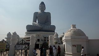
Kamalapuram mandal is one of the 50 mandals in Kadapa district of the Indian state of Andhra Pradesh. It is under the administration of Kadapa revenue division and the headquarters are located at Kamalapuram. The mandal is bounded by Yerraguntla, Proddutur, Chapad, Khajipet, Vallur, Pendlimarri and Veerapunayunipalle mandals.