Nizamabad district

Last updated

Nizamabad district
Induru
Fort Entrance,Nizamabad.jpeg
Nizamabad Fort Entrance
Nizamabad in Telangana (India).svg
Location in Telangana
Nizamabad district
Nizamabad district
State Telangana
Mandalas 29
Founded1905
Headquarters Nizamabad
Government
  BodyZilla Parishad
   MLA (Urban)Sri Dhanpal Suryanarayana
   MLA (Rural)Sri Bhoopathi Reddy Rekulapally
Area
[1]
  Total4,288 km2 (1,656 sq mi)
  Rank 10th (in state)
Population
 (2011) [1]
  Total1,571,022
  Rank 5th
  Density370/km2 (950/sq mi)
Demonym Nizamabadi
Languages
  Official Telugu, Urdu
Time zone UTC+5:30 (IST)
PIN
503 xxx
Telephone code+91-08462
Vehicle registration TS 16 [2]
Website nizamabad.telangana.gov.in

Nizamabad district is a district located in the north-western region of the Indian state of Telangana. The city of Nizamabad is the district headquarters. The district share boundaries with Jagtial, Sircilla, Nirmal, Kamareddy districts and with Nanded district of the state boundary of Maharashtra.

Contents

Etymology

Nizam stands for Nizam, the governor (of the empire) of Hyderabad State and also Abad means 'Long Live'. Nizamabad was founded in the year 1905 [3] when Nizam's Dominion were it recognized, where up to it was known as Indur which was supposed to have originated from the name of the King was Indradatta who seems to have flourished it during the 5th century A.D. [4] [5] Later during the 18th century the Nizams ruled over the Deccan region and the district got its name from him.

History

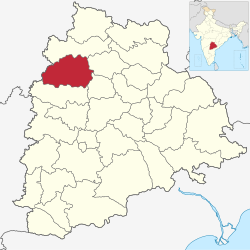
In October 2016, the districts of Telangana were reorganized and Kamareddy district was carved out of Nizamabad district making it one of the 31 districts of state.[ citation needed ]

Geography

The geographical area of the district is 4,288 square kilometres (1,656 sq mi) and it is located at 18°41′N78°6′E / 18.683°N 78.100°E / 18.683; 78.100 . [6] Nizamabad is bounded on the North by Nirmal district, on the East by Jagtial and Rajanna Sircilla district, on the South lies Kamareddy district, and on the West by Nanded district of Maharashtra State. The Godavari River enters into Telangana from Nizamabad district at Kandakurthi.

Demographics

Religion in Nizamabad district (2011) [7]
Hinduism
79.69%
Islam
18.57%
Christianity
0.99%
Other or not stated
0.75%

As of 2011 Census of India, the district has a population of 1,571,022. Nizamabad has a sex ratio of 1044 females per 1000 males and a literacy rate of 64.25%. 169,621 (10.80%) were under 6 years of age. 464,750 (29.58%) lived in urban areas. Scheduled Castes and Scheduled Tribes made up 217,267 (13.83%) and 107,035 (6.81%) of the population respectively. [8]

In 2006, the Indian government named Nizāmābād one of the country's 250 most backward districts (out of a total of 640). [9] It is one of the ten districts of Telangana currently receiving funds from the Backward Regions Grant Fund Programme (BRGF). [9]

Languages of Nizamabad district (2011) [10]

   Telugu (71.58%)
   Urdu (18.26%)
   Lambadi (5.63%)
   Marathi (2.17%)
  Others (2.36%)

At the time of the 2011 census, 71.58% of the population spoke Telugu, 18.26% Urdu, 5.63% Lambadi and 2.17% Marathi as their first language. [10]

Administrative divisions

The district is divided into 3 revenue divisions of Bodhan, Armoor and Nizamabad. These are sub-divided into 33 mandals and has 530 villages. [1] C.Narayana Reddy is the present collector of the district. [11]

Mandals

The below table categorizes 29 mandals into their respective revenue divisions in the district: [12]

Armoor revenue divisionBodhan revenue divisionNizamabad revenue division
Armoor Bodhan Nizamabad South
Balkonda Yedapally Nizamabad North
Mupkal Ranjal Nizamabad Rural
Mendora Kotagiri Mugpal
Kammar palle Varni Dichpally
Velpur Rudrur Dharpally
Morthad ChandurIndalwai
Bheemgal Mosra Makloor
Jakranpally SalooraSirikonda
Nandipet PothangalNavipet
Yergatla
Aloor
Donkeshwar

Villages

Constituencies

Parliamentary Constituency

Assembly Constituencies

There are 6 assembly constituencies in the district. They are, Armur, Bodhan, Banswada – Partly (Varni, Chandur, Mosra, Rudrur, Pothangal and Kotagiri Mandals), Nizamabad (Urban), Nizamabad (Rural), Balkonda

Transport

Roads

Nizamabad district has good road connectivity. Almost all the towns and villages in the district have well laid asphalt roads and are connected to district headquarters. Nizamabad has 2 National Highways passing through it, one being NH 44 which connects Kanyakumari and Varanasi and the other is NH16 which starts from Nizamabad and passes through Karimnagar to Jagadalpur in the state of Chhattisgarh. [16] The Telangana State Road Transport Corporation (TSRTC) runs around 700 [17] buses from district headquarters on a daily basis.

Rail

Nizamabad railway station is the major train station in the district which is located on Secunderabad–Manmad line of Hyderabad Division of the South Central Railway Zone (SCR). All the towns in the district have a rail network coverage and Nizamabad being one of the important stations on the line carters the need of the people. Jankampet Junction which lies in the west of Nizamabad city connects to Bodhan town. [18]

The Nizamabad–Peddapalli section connects Nizamabad with the Grand Trunk route of New Delhi–Chennai main line and the distance from Nizamabad to Karimnagar and Warangal reduced to a large extent. [19] [20] This line also increased the railway network in the district and the northern cities of Telangana.

Airway

Nizamabad currently doesn't have its own aerodrome however the state government of Telangana has proposed an airport at Jakranpalli in Nizamabad. The nearest international facility is Rajiv Gandhi International Airport in Hyderabad located at a distance of 200 km, and a partly functional domestic airport is Shri Guru Gobind Singh Ji Airport located at 110 km in Nanded of Maharashtra State. The city houses 5 Helipads located each at Nagaram Stadium, Parade Grounds, Dichpally and two at GG College.

Education

VREC, A Block, Nizamabad VREC at dusk.jpg
VREC, A Block, Nizamabad

Many engineering colleges are located in the district. Kshatriya College of Engineering, Armoor (KCEA) Vijay Rural Engineering College (VREC), affiliated with Jawaharlal Nehru Technological University, Hyderabad (JNTUH) is the reputed engineering college located in Telangana. Kakatiya Institutions of Nizamabad is a group of institutions known for their excellence in state of Telangana and the erstwhile Andhra Pradesh.

Telangana University is a public university under the government of AP, located at Dichpally, 15 km from the city. There are many educational institutions that provide education namely VREC, Arkay College of Engineering and Technology, [21] Kshatriya College of Engineering, [22] Kakatiya Engineering College for Women, Government Medical College, [23] Nishitha Degree College, etc.

RGUKT, Basar popularly known as IIIT Basar is an autonomous institution located 35 km from Nizamabad. The official name of the institute is Rajiv Gandhi University of Knowledge Technologies. It offers six-year integrated BTech programme with three semesters every year for those passing SSC, for award of dual degrees in different specializations of engineering and science. [24]

Tourism

Pocharam lake A view from Pocharam Lake with Herons, Egrets, Openbills etc W IMG 9727.jpg
Pocharam lake

Notable people

For people from Nizamabad city, not the surrounding district, please see Nizamabad

See also

Related Research Articles

<span class="mw-page-title-main">Karimnagar</span> City in Telangana, India

Karimnagar is also known as Elagandula is a city and District Headquarters in the Indian state of Telangana. Karimnagar is a major urban agglomeration and third largest city in the state. It is governed by the Municipal Corporation and is the headquarters of the Karimnagar district It is situated on the banks of Manair River, which is a tributary of the Godavari River. It is the third largest and fastest growing urban settlement in the state, according to 2011 census. It has registered a population growth rate of 45.46% and 38.87% respectively over the past two decades between 1991 and 2011, which is highest growth rate among major cities of Telangana. It serves as a major educational and health hub for the northern districts of Telangana. It is a major business center and widely known for its agricultural and granite industries, earning the nickname "City of Granites."

<span class="mw-page-title-main">Nizamabad, Telangana</span> City in Telangana, India

Nizamabad, also known as Induru, is a city in the Indian state of Telangana. It is governed by municipal corporation and is the headquarters of the Nizamabad district. Although previously part of Hyderabad State and then Andhra Pradesh state, Nizamabad became a part of the newly formed state of Telangana by the Andhra Pradesh Reorganisation Act, 2014. It is located about 186 kilometres (116 mi) north of the state capital, Hyderabad.

<span class="mw-page-title-main">Nanded</span> City in Maharashtra, India

Nanded is a city in Maharashtra state, India. It is the tenth largest city in the state and the seventy-ninth most populous city in India. It is the second largest city in Marathwada region. It is the district headquarters of Nanded district.

<span class="mw-page-title-main">Jagtial</span> City in Telangana, India

Jagtial is a city in and the district headquarters of Jagtial district of Telangana state, India. Located about 190 kilometres (118 mi) north of the state capital Hyderabad, it has an average elevation of 293 metres (961 ft). In 2011 the population was about 104,000

Kamareddy is a town and headquarters of the Kamareddy district in Telangana state in India. It is located about 117 kilometres (73 mi) north of the state capital Hyderabad, 56 kilometres (35 mi) from Nizamabad and 96 kilometres (60 mi) from Karimnagar.

<span class="mw-page-title-main">Medak district</span> District of Telangana in India

Medak district is in the Indian state of Telangana. Medak is the district headquarters. The district shares boundaries with Sangareddy, Kamareddy, Siddipet and Medchal districts.

<span class="mw-page-title-main">Hanamkonda district</span> District of Telangana in India

Hanumakonda district, is a district located in the northern region of the Indian state of Telangana. The district headquarters are located at Hanumakonda. The district borders the districts of Jangaon, Karimnagar, Warangal, Bhupalpally and Siddipet.

<span class="mw-page-title-main">Bodhan</span> Town in Telangana, India

Bodhan town in Nizamabad district of the Indian state Telangana. Bodhan is primarily known for the Nizam Sugar Factory founded by the Nizam of Hyderabad, and some historical places such as The Jalal Bukhari Dargah at Ranjalbase, The Chakreshwara Shiva Temple, The Renuka Temple, Bheemuni Gutta at Rakasipet and prominent other historical places, such as the Pandu Teertha, Chakra Teertha and many other temples and shrines.

<span class="mw-page-title-main">Navipet</span> Mandal in Telangana, India

Navipet is a Mandal in Nizamabad district in the state of Telangana in India Navipet is top mandal in Nizamabad district Which has good market value for crops and small revenue business. Navipet lies on Nizamabad Bhainsa main road. Navipet is famous for weekly goats market.

Banswada is a Town and Revenue division in Kamareddy district of the Indian state of Telangana.

<span class="mw-page-title-main">Nizamabad Junction railway station</span> Railway junction station in Nizamabad, Telangana

Nizamabad Junction railway station is an Indian Railways station, which serves the city of Nizamabad in Telangana. It is a major station on Secunderabad–Manmad railway line, also serving as the junction point for Secunderabad, Peddapalli, Jankampet/Mudkhed junctions. It is administered under Hyderabad railway division of South Central Railway zone. Jankampet Junction railway station is another station located in the city from where the Secunderabad–Manmad line branch towards Bodhan.

Badapahad Dargah, Peddagutta is a small town, village and Muslim pilgrim center. Built in the memory of the saint Syed Sadullah Hussain, the mosque is situated atop a hillock paidimal village in the Varni Mandal of Nizamabad district.

<span class="mw-page-title-main">Secunderabad–Manmad line</span> Railway line in India

Secunderabad–Manmad is an important railway line connecting the states of Telangana and Maharashtra. It is administered by South Central Railway and was formerly known as Hyderabad–Manmad railway line and Godavari Valley railway for some period. as of 2016, this line is single broad gauged, and electrification is under progress. In March 2023, South Central Railway announced the electrification of an additional 75km on the line

<span class="mw-page-title-main">Mancherial district</span> District in Telangana, India

Mancherial district is a district located in the northern region of the Indian state of Telangana. The district comprises 18 mandals and two revenue divisions – Mancherial and Bellampalli. The district headquarters is located at Mancherial town. It is surrounded by Komaram Bheem, Nirmal, Jagtial, Peddapalli and Bhupalpally districts of Telangana and with Maharashtra state.

<span class="mw-page-title-main">Nirmal district</span> District of Telangana in India

Nirmal district is a district located in the northern region of the Indian state of Telangana. The district headquarters is located in the town of Nirmal. It borders the Telangana districts of Adilabad, Nizamabad, Mancherial, Asifabad, Jagtial districts as well as Nanded district of the state Maharashtra.

<span class="mw-page-title-main">Kamareddy district</span> District in Telangana, India

Kamareddy district is a district located in the northern region of the Indian state of Telangana. The district shares boundaries with Medak, Nizamabad, Sangareddy, Siddipet and Rajanna Sircilla districts and with the state boundary of Maharashtra and Karnataka.

<span class="mw-page-title-main">Sangareddy district</span> District of Telangana in India

Sangareddy district, is a district in the Indian state of Telangana. This district contains a part of the Hyderabad Metropolitan Region.Sangareddy is the district headquarters of the district. It was named after the ruler Sanga, the son of queen Shankaramba, who was the ruler of Medak during the period of Nizams. The district shares boundaries with Medak, Medchal, Vikarabad, Kamareddy and Rangareddy districts and with the state boundary of Karnataka.

<span class="mw-page-title-main">Jagtial district</span> District of Telangana in India

Jagtial district is a district located in the northern region of the Indian state of Telangana. Its headquarters is Jagtial. The district shares boundaries with Nirmal, Mancherial, Karimnagar, Peddapalli, Sircilla and Nizamabad districts.

<span class="mw-page-title-main">Rajanna Sircilla district</span> District of Telangana in India

Rajanna Sircilla district is a district in the Indian state of Telangana. Sircilla is the district headquarters. The district shares boundaries with Karimnagar, Siddipet, Jagtial, Kamareddy, and Nizamabad districts.

References

  1. 1 2 3 "New districts". Andhra Jyothy.com. 8 October 2016. Retrieved 8 October 2016.
  2. "District Codes". Government of Telangana Transport Department. Retrieved 4 September 2014.
  3. ":: Welcome to Nizamabd.com ::".
  4. "History of Indur". Archived from the original on 19 June 2015. Retrieved 7 June 2015.
  5. "District Census Handbook – Adilabad" (PDF). Census of India. p. 9. Retrieved 20 November 2015.
  6. "Falling Rain Genomics, Inc – Nizamabād". Fallingrain.com. Retrieved 20 November 2012.
  7. "Population by Religion - Andhra Pradesh". Census of India . Registrar General and Census Commissioner of India. 2011.
  8. "Know your district Plan your district - Nizamabad" (PDF). trac.telangana.gov.in. Telangana State Remote Sensing Applications Centre.
  9. 1 2 Ministry of Panchayati Raj (8 September 2009). "A Note on the Backward Regions Grant Fund Programme" (PDF). National Institute of Rural Development. Archived from the original (PDF) on 5 April 2012. Retrieved 27 September 2011.
  10. 1 2 "Table C-16 Population by Mother Tongue: Andhra Pradesh". Census of India . Registrar General and Census Commissioner of India.
  11. "K Chandrasekhar Rao appoints collectors for new districts". Deccan Chronicle. 11 October 2016. Retrieved 13 October 2016.
  12. "Clipping of Andhra Jyothy Telugu Daily – Hyderabad". Andhra Jyothy. Retrieved 8 October 2016.
  13. "Shabbir, Suresh gheraoed". The Times of India . 17 April 2009. Archived from the original on 16 October 2013. Retrieved 9 October 2013.
  14. "Palem Population 2023, Village in Mortad Mandal, Pincode". www.indiagrowing.com.
  15. "Thimmanagar Population - Nizamabad, Andhra Pradesh". www.census2011.co.in. Retrieved 13 September 2023.
  16. "North South East West Map". National Highway Development Project. Archived from the original on 14 May 2008. Retrieved 16 June 2008.
  17. "Archived copy". Archived from the original on 6 November 2015. Retrieved 2 January 2016.{{cite web}}: CS1 maint: archived copy as title (link)
  18. "NZB/Nizamabad (3 PFs) Railway Station – Today's Train Departure Timings". India Rail Info.
  19. "Press Release". South Central Railway zone. Indian Railways. Retrieved 29 October 2016.
  20. "Rail budget boost to 2 last-mile projects". The Times of India. 28 February 2016. Retrieved 29 October 2016.
  21. "Arkay College of Engineering & Technology". Archived from the original on 7 March 2016. Retrieved 9 October 2014.
  22. "Welcome to Kshatriya College of Engineering".
  23. Nizamabad Medical College Meghana Dental College
  24. "Sonia to inaugurate IIIT at Idupulapaya today". The Hindu.
  25. "APFD Website". Archived from the original on 25 January 2014. Retrieved 28 June 2015.
  26. "13-year-old Purna becomes youngest girl to scale Everest". The Times of India. 26 May 2014. Retrieved 27 May 2014.

18°41′N78°6′E / 18.683°N 78.100°E / 18.683; 78.100