Jagtial district

Last updated

Jagtial district
Lakshmi Narasimha Swamy temple, Dharmapuri Telangana - 33.jpg
Lakshmi Narasimha Swami temple, Dharmapuri
Jagtial in Telangana (India).svg
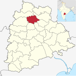
Location in Telangana
Jagtial district
Jagtial district
Coordinates(Jagtial): 18°42′N78°54′E / 18.7°N 78.9°E / 18.7; 78.9
CountryFlag of India.svg  India
State Telangana
Headquarters Jagtial
Mandalas 18
Government
   District Collector Shaik Yasmeen Basha
   Parliament constituenciesNizamabad
   Assembly constituencies Jagtial, Korutla, Dharmapuri
Area
  Total2,419.00 km2 (933.98 sq mi)
Population
 (2011)
  Total988,913
  Density410/km2 (1,100/sq mi)
Time zone UTC+05:30 (IST)
Website jagtial.telangana.gov.in

Jagtial district is a district located in the northern region of the Indian state of Telangana. [1] Its administrative headquarters is the city of Jagtial. The district shares boundaries with Nirmal, Mancherial, Karimnagar, Peddapalli, Sircilla and Nizamabad districts. [2] [3]

Contents

Geography

The district is spread over an area of 2,419.00 square kilometres (933.98 sq mi). [4] Jagtial district shares it boundaries with Nirmal district and Mancherial district on North and North East respectively, it is bounded on South and South West by Karimnagar district and Peddapalli district respectively and on the West by Nizamabad district

Demographics

Religions in Jagtial district (2011) [5]
ReligionPercent
Hinduism
91.55%
Islam
7.80%
Christianity
0.45%
Other or not stated
0.20%
Distribution of religions

As of 2011 Census of India, the district has a population of 985,417, of which 221,336 (22.46%) live in urban areas. Jagtial district has a sex ratio of 1036 females per 1000 males and a literacy rate of 60.26%. [6] 93,272 (9.47%) were under 10 years of age. Scheduled Castes and Scheduled Tribes comprised 164,596 (16.70%) and 23,351 (2.37%) of the population, respectively. [7] [8]

Languages of Jagtial district (2011) [9]

   Telugu (90.90%)
   Urdu (7.17%)
   Lambadi (0.91%)
  Others (1.02%)

At the 2011 census, 90.90% of the population spoke Telugu, 7.17% Urdu and 0.91% Lambadi as their first language. [9]

Administrative divisions

Logo of the Jagtial Police. Jagtial Police is the agency responsible for enforcing law & order throughout the district Jagtial Police Logo.jpg
Logo of the Jagtial Police. Jagtial Police is the agency responsible for enforcing law & order throughout the district

The district has three revenue divisions of Jagtial, Korutla and Metpally, which are sub-divided into 18 mandals. [10]

Mandals

The table below categorizes the district's mandals into their respective revenue divisions.

Sr No.Jagital revenue divisionKorutla revenue divisionMetpalli revenue division
1 Jagtial Korutla Metpalli
2Jagtial Rural Medipalle Mallapur
3 Raikal Kathlapur Ibrahimpatnam
4 Sarangapur
5Beerpur
6 Dharmapuri
7Buggaram
8 Pegadapalli
9 Gollapalli
10 Mallial
11 Kodimial
12 Velgatoor

Notable People

National Highways

NH563 Jagtial - Karimnagar - Warangal - Khammam

NH63 Latur- Nizamabad - Jagtial - Mancherial - Bijapur Jagdalpur

NH61 Bhiwandi - Ahmadnagar - Nanded - Nirmal - Jagtial

See also

Related Research Articles

<span class="mw-page-title-main">Karimnagar</span> City in Telangana, India

Karimnagar is a city and District Headquarters in the Indian state of Telangana. Karimnagar is a major urban agglomeration and third largest city in the state. It is governed by the Municipal Corporation and is the headquarters of the Karimnagar district It is situated on the banks of Manair River, which is a tributary of the Godavari River. It is the third largest and fastest growing urban settlement in the state, according to 2011 census. It has registered a population growth rate of 45.46% and 38.87% respectively over the past two decades between 1991 and 2011, which is highest growth rate among major cities of Telangana. It serves as a major educational and health hub for the northern districts of Telangana. It is a major business center and widely known for its agricultural and granite industries, earning the nickname "City of Granites."

<span class="mw-page-title-main">Nizamabad, Telangana</span> City in Telangana, India

Nizamabad or Induru is a city in the Indian state of Telangana. It is governed by municipal corporation and is the headquarters of the Nizamabad district. Although previously part of Hyderabad State and then Andhra Pradesh state, Nizamabad became a part of the newly formed state of Telangana by the Andhra Pradesh Reorganisation Act, 2014. It is located about 186 kilometres (116 mi) north of the state capital, Hyderabad.

Adilabad is a city which serves as the headquarters of Adilabad district, in the Indian state of Telangana. Telugu, Urdu, Marathi, and Lambadi, gondi are the most spoken languages of Adilabad. Adilabad is famous for its rich cultivation of cotton. Hence, Adilabad is also referred as "White Gold City". It is located about 304 kilometres (189 mi) north of the state capital, Hyderabad, 150 kilometres (93 mi) from Nizamabad and 196 kilometres (122 mi) from Nagpur.

<span class="mw-page-title-main">Jagtial</span> City in Telangana, India

Jagtial is a city in and the district headquarters of Jagtial district of Telangana state, India. Located about 190 kilometres (118 mi) north of the state capital Hyderabad, it has an average elevation of 293 metres (961 ft). In 2011 the population was about 104,000

<span class="mw-page-title-main">Karimnagar district</span> District of Telangana in India

Karimnagar district is one of the 33 districts of the Indian state of Telangana. Karimnagar city is its administrative headquarters. The district shares boundaries with Peddapalli, Jagityal, Sircilla, Siddipet, Jangaon, Hanamkonda district and Jayashankar Bhupalapally districts.

<span class="mw-page-title-main">Nizamabad district</span> District of Telangana in India

Nizamabad district is a district located in the north-western region of the Indian state of Telangana. The city of Nizamabad is the district headquarters. The district share boundaries with Jagtial, Sircilla, Nirmal, Kamareddy districts and with Nanded district of the state boundary of Maharashtra.

<span class="mw-page-title-main">Bodhan</span> Town in Telangana, India

Bodhan town in Nizamabad district of the Indian state Telangana. Bodhan is primarily known for the Nizam Sugar Factory founded by the Nizam of Hyderabad, and some historical places such as The Jalal Bukhari Dargah at Ranjalbase, The Chakreshwara Shiva Temple, The Renuka Temple, Bheemuni Gutta at Rakasipet and prominent other historical places, such as the Pandu Teertha, Chakra Teertha and many other temples and shrines.

<span class="mw-page-title-main">Korutla</span> Town in Telangana, India

Korutla municipality is the second largest town and revenue division in the Jagtial district in the Indian state of Telangana. It is a historical town ruled by Jain Kings and second largest town in Jagtial district. It is the headquarters of Koratla constituency. It is located about 23 kilometres (14 mi) from the district headquarters Jagtial, 235 kilometers from Hyderabad, 73 kilometers from Karimnagar and 76 kilometers from Nizamabad.

Nirmal is a city and the district headquarters of Nirmal district in the Indian state of Telangana. It is famed for its toys made out of wood.

<span class="mw-page-title-main">Peddapalli</span> Town & District Headquarter in Telangana, India

Peddapalli is a town, Revenue Division and has a Railway Junction in Peddapalli District in the Indian state of Telangana. It is the headquarters of the Peddapalli District and Peddapalli mandal. It is located about 197 kilometres North of the state capital Hyderabad, 36 kilometres from Karimnagar, 28 kilometres from Ramagundam. Peddapalli has a railway junction named PDPL which connects PDPL - KRMR - NZB railway line and New Delhi (NDLS) - Chennai Central (MAS) railway line. There are two trains that terminate here. Karimnagar Tirupati express rail engine changes to electric engine here. In future there’s a proposal to develop a bypass railway station named Peddapalli Town which directly connects Kazipet-Karimnagar without entering peddapalli junction station.As of 2011 census of India, Peddapalli has a population of 41,171. In 2016 due to population Increase, the civic body of Peddapalli was upgraded from Nagar Panchayat to Municipal council Post upgradation to Council.

Metpally is a town and Revenue Division and third largest town in Jagtial district of the Indian state of Telangana. It is located 222 km away from state capital Hyderabad, 67 km from Nizamabad, 80 km from Karimnagar and 33 km far away from District Headquarter Jagtial. It have great history many Dynasties ruled including Sathavahana's and Kakatiya's. The Kakatiyas built a temple named Chennakesava.

<span class="mw-page-title-main">Adilabad district</span> District of Telangana in India

Adilabad district is a district located in the northern region of Telangana, India. It is known as the gateway district to South and Central India. The town of Adilabad is its headquarters. The district shares boundaries with Asifabad, Nirmal districts and with the state boundary of Maharashtra.

<span class="mw-page-title-main">Mancherial district</span> District in Telangana, India

Mancherial district is a district located in the northern region of the Indian state of Telangana. The district comprises 18 mandals and two revenue divisions – Mancherial and Bellampalli. The district headquarters is located at Mancherial town. It is surrounded by Komaram Bheem, Nirmal, Jagtial, Peddapalli and Bhupalpally districts of Telangana and with Maharashtra state.

<span class="mw-page-title-main">Nirmal district</span> District of Telangana in India

Nirmal district is a district located in the northern region of the Indian state of Telangana. The district headquarters is located in the town of Nirmal. It borders the Telangana districts of Adilabad, Nizamabad, Mancherial, Asifabad, Jagtial districts as well as Nanded district of the state Maharashtra.

<span class="mw-page-title-main">Kamareddy district</span> District in Telangana, India

Kamareddy district is a district located in the western region of the Indian state of Telangana. The district shares boundaries with Medak, Nizamabad, Sangareddy, Siddipet and Rajanna Sircilla districts and with the state boundary of Maharashtra and Karnataka.

<span class="mw-page-title-main">Jayashankar Bhupalpally district</span> District of Telangana in India

Jayashankar Bhupalpally district is a district in the Indian state of Telangana. The district headquarters are located at Bhupalpally. It was a part of the erstwhile Warangal district and Karimnagar district prior to the re-organisation of districts in the state. The district share boundaries with Karimnagar, Mancherial, Peddapalli, Hanamkonda, Warangal, and Mulugu districts and with the state boundary of Maharashtra and Chhattisgarh. The world's largest multi-stage lift irrigation project Kaleshwaram Lift Irrigation Project is in Jayashankar Bhupalpally District and Jayashankar Bhupalpally District falls Under naxal affected district as per Red corridor.

<span class="mw-page-title-main">Peddapalli district</span> District of Telangana in India

Pedapalli district is a district located in the northern region of the Indian state of Telangana. Its administrative headquarters is at Peddapalli and Commissionerate is at Ramagundam. The district shares boundaries with Mancherial, Karimnagar, Jagtial and Jayashankar Bhupalpally districts. This district covers Ramagundam city which is situated in the Godavari valley coalfields and has one of the India's largest thermal power stations in south region under NTPC. Mostly industries are connected with Godavarikhani - NTPC - Ramagundam.

<span class="mw-page-title-main">Jogulamba Gadwal district</span> District of Telangana in India

Jogulamba Gadwal district is a district in the Indian state of Telangana. The administrative headquarters of the district is located at Gadwal. The district shares boundaries with Narayanpet, Wanaparthy districts and with the state boundary of Andhra Pradesh and Karnataka. The district was carved out from Mahabubnagar district in 2016.

<span class="mw-page-title-main">Rajanna Sircilla district</span> District of Telangana in India

Rajanna Sircilla district is a district in the Indian state of Telangana. Sircilla is the district headquarters. The district shares boundaries with Karimnagar, Siddipet, Jagtial, Kamareddy, and Nizamabad districts.

<span class="mw-page-title-main">Komaram Bheem Asifabad district</span> District of Telangana in India

Kumuram Bheem Asifabad district is a district in the Indian state of Telangana. The town of Asifabad is its district headquarters and kagaznagar as its largest town. It is named after Gond tribal leader Kumuram Bheem. It was earlier part of Adilabad district and it became a new district in 2016. The district share boundaries with Adilabad, Nirmal, Mancherial districts and with the state boundary of Maharashtra. It is the second most backward district in India, according to the 2018 NITI Aayog ranking.

References

  1. "Jagtial district" (PDF). Official website of Jagtial district. Archived from the original (PDF) on 10 January 2017. Retrieved 29 June 2017.
  2. "Jagtial district" (PDF). Chief Commissioner of Land Administration. Archived from the original (PDF) on 9 September 2016. Retrieved 22 August 2016.
  3. "New districts map". newdistrictsformation.telangana.gov.in. Retrieved 22 August 2016.[ permanent dead link ]
  4. "New districts". Andhra Jyothy.com. 8 October 2016. Archived from the original on 25 December 2018. Retrieved 8 October 2016.
  5. "Population by Religion - Andhra Pradesh". censusindia.gov.in. Registrar General and Census Commissioner of India. 2011.
  6. "About District | District Jagtial, Government of Telangana | India" . Retrieved 13 May 2023.
  7. "District Census Handbook: Karimnagar" (PDF). censusindia.gov.in. Registrar General and Census Commissioner of India. 2011.
  8. "Know your district Plan your district - Jagtial" (PDF). trac.telangana.gov.in. Telangana State Remote Sensing Applications Centre.
  9. 1 2 "Table C-16 Population by Mother Tongue: Andhra Pradesh". Census of India . Registrar General and Census Commissioner of India.
  10. "Revenue divisions and mandals in Jagtial district" (PDF). The official website of Jagtial District. p. 3. Retrieved 29 June 2017.