Yadadri Bhuvanagiri

Last updated

Yadadri Bhuvanagiri district
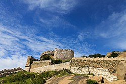
BHONGIR FORT.jpg
Yadadri Bhuvanagiri in Telangana (India).svg
Location in Telangana
Yadadri Bhuvanagiri
Yadadri Bhuvanagiri district
Coordinates(Bhuvanagiri): 17°30'36"N, 78°53'24"E
CountryFlag of India.svg  India
State Telangana
Headquarters Bhuvanagiri
Mandalas 16
Government
   District collector T, Vinay Krishna Reddy, IAS
   Add.District Collector Sri D Srinivas Reddy
   Additional Collector Local Bodies Sri Deepak Tiwari IAS
   Deputy Commissioner Of Police Sri Narayana Reddy
   Administrative Officer Sri M.Nageshwara Chary
Area
  Total3,091.48 km2 (1,193.63 sq mi)
Population
 (2011)
  Total770,833
  Density250/km2 (650/sq mi)
Time zone UTC+05:30 (IST)
Vehicle registration TG–30 [1]
Nominal GDP ( 2022-23 ) 246.11 billion (US$2.9 billion) [2]
Per capita Income ( 2022-23 )267,605 (US$3,200)
Website yadadri.telangana.gov.in

Yadadri Bhuvanagiri District, [3] is a district in the Indian state of Telangana. [4] The administrative headquarters is located at Bhuvanagiri Town. [5] [6] [7] The district shares boundaries with Suryapet, Nalgonda, Jangaon, Siddipet, Medchal-Malkajgiri and Rangareddy districts. It was carved out of Nalgonda district on 11 October 2016 during a large reorganization of the districts of Telangana. [8]

Contents

Geography

The district is spread over an area of 3,091.48 square kilometres (1,193.63 sq mi). [9]

Demographics

Religion in Yadadri Bhuvanagiri district (2011) [10]
Hinduism
94.81%
Islam
3.69%
Christianity
0.96%
Other or not stated
0.54%

As of 2011 Census of India, Yadadri Bhuvanagiri district has a population of 770,833. Yadadri Bhuvanagiri has a sex ratio of 974 females per 1000 males and a literacy rate of 65.67%. 79,962 (10.37%) were under 6 years of age. 123,165 (15.98%) lived in urban areas. Scheduled Castes and Scheduled Tribes made up 136,916 (17.76%) and 43,774 (5.68%) of the population respectively. [11]

Languages of Yadadri Bhuvanagiri district (2011) [12]

   Telugu (90.54%)
   Lambadi (5.00%)
   Urdu (3.42%)
  Others (1.04%)

At the time of the 2011 census, 90.54% of the population spoke Telugu, 5.00% Lambadi and 3.42% Urdu as their first language. [12]

Yadagiriguta

Administrative divisions

The district has two revenue divisions of Bhuvanagiri and Choutuppal. It is sub-divided into 16 mandals. [6] Smt. Pamela Satpathy, IAS is the present collector of the district. [13]

Mandals

S.No.Bhuvanagiri revenue divisionChoutuppal revenue division
1 Bhuvanagiri Choutuppal
2 Alair B. Pochampally
3 Atmakur (M) Ramannapet
4Addaguduru Samsthan Narayanapur
5 Bibinagar Valigonda
6 Bommalaramaram
7 Gundala
8 Motakondur
9 Mothkur
10 Rajapet
11 Turkapally
12 Yadagirigutta

See also

Related Research Articles

<span class="mw-page-title-main">Nalgonda district</span> District of Telangana in India

Nalgonda district is a district in the Telangana state of India. Nalgonda district has the highest number of mandals in the state with 31 mandals. The district shares boundaries with Suryapet, Rangareddy, Yadadri and Nagarkurnool districts and with the state boundary of Andhra Pradesh. In terms of area, Nalgonda is the largest district with an area of 7222.78 km2 in the state.

<span class="mw-page-title-main">Ranga Reddy district</span> District of Telangana in India

Ranga Reddy district is a district in the Indian state of Telangana. The district headquarters is located at Kongara Kalan Village, Ibrahimpatnam Mandal,. The district was named after the former deputy chief minister of the United Andhra Pradesh, K. V. Ranga Reddy. The district shares boundaries with Nalgonda, Yadadri Bhuvanagiri, Hyderabad, Medchal–Malkajgiri, Nagarkurnool, Mahabubnagar, Sangareddy and Vikarabad districts.

<span class="mw-page-title-main">Hanamkonda district</span> District of Telangana in India

Hanamkonda district, is a district in the Indian state of Telangana. The district headquarters are located at Hanamakonda. The district borders the districts of Jangaon, Karimnagar, Warangal, Bhupalpally and Siddipet.

<span class="mw-page-title-main">Bhongir</span> Settlement in India

Bhongir, officially known as Bhuvanagiri, is a city and a district headquarters of the Yadadri Bhuvanagiri district and part of the Hyderabad Metropolitan Region of the Indian state of Telangana.

<span class="mw-page-title-main">Choutuppal</span> Census town in Telangana, India

Choutuppal is a census town in Yadadri Bhuvanagiri district of the Indian state of Telangana. It is located in Choutuppal mandal of Choutuppal division. Its part of Hyderabad Metropolitan Development Authority. 49 km from Hyderabad.

Bibinagar is a Mandal in Yadadri Bhuvanagiri district of the Indian state of Telangana. It is located in Bibinagar mandal of Bhongir revenue division. It is famous for All India Institute of Medical Sciences, Bibinagar. 39 km from Hyderabad.

Motakondur is a village in Yadadri Bhuvanagiri district of the Indian state of Telangana. It is located in Motakondur mandal of Bhongir revenue division.

<span class="mw-page-title-main">Atmakur (M), Yadadri Bhuvanagiri district</span> Mandal in Telangana, India

Atmakur(M) is a Mandal in Yadadri Bhuvanagiri district of the Indian state of Telangana. It is located in Bhongir revenue division.

<span class="mw-page-title-main">Alair</span> Town in Telangana, India

Alair is a town in Yadadri Bhuvanagiri district of the Indian state of Telangana. It is a municipality and one of the constituencies in the Yadadri Bhuvanagiri district. It is located in Alair mandal of Bhongir revenue division. Alair is known for its Kulpakji Jain temple, and also known as the birthplace of Renukacharya, one of the five acharyas who came in the Kali Yuga to teach and preach Vīraśaivism.

<span class="mw-page-title-main">Mancherial district</span> District in Telangana, India

Mancherial district is a district located in the northern region of the Indian state of Telangana. The district comprises 18 mandals and two revenue divisions – Mancherial and Bellampalli. The district headquarters is located at Mancherial town. It is surrounded by Komaram Bheem, Nirmal, Jagtial, Peddapalli and Bhupalpally districts of Telangana and with Maharashtra state.

<span class="mw-page-title-main">Nirmal district</span> District of Telangana in India

Nirmal district is a district located in the northern region of the Indian state of Telangana. The district headquarters is located in the town of Nirmal. It borders the Telangana districts of Adilabad, Nizamabad, Mancherial, Asifabad, Jagtial districts as well as Nanded district of the state Maharashtra.

<span class="mw-page-title-main">Kamareddy district</span> District in Telangana, India

Kamareddy district is a district located in the western region of the Indian state of Telangana. The district shares boundaries with Medak, Nizamabad, Sangareddy, Siddipet and Rajanna Sircilla districts and with the state boundary of Maharashtra and Karnataka.

<span class="mw-page-title-main">Siddipet district</span> District of Telangana in India

Siddipet district is a district in the Indian state of Telangana. Its headquarters is Siddipet. This district contains a part of the Hyderabad Metropolitan Region(Markook Mulugu Wargal) The district shares boundaries with Jangaon, Sircilla, Karimnagar, Kamareddy, Hanamkonda, Yadadri, Medhchal and Medak districts.

<span class="mw-page-title-main">Warangal district</span> District of Telangana in India

Warangal district, formerly Warangal Rural district, is a district in the Indian state of Telangana. The district shares boundaries with Mahabubabad, Jangaon, Hanamkonda, Mulugu and Bhupalpally districts.

<span class="mw-page-title-main">Suryapet district</span> District of Telangana in India

Suryapet district is a district in the Indian state of Telangana. The city of Suryapet is the district headquarters. The district has three revenue divisions Suryapet, Kodad and Huzurnagar. It is sub-divided into 23 mandals. The district shares boundaries with Nalgonda, Khammam, Yadadri, Jangaon and Mahabubabad districts and with Andhra Pradesh state.

<span class="mw-page-title-main">Nagarkurnool district</span> District of Telangana in India

Nagarkurnool district is a district in the southern region of the Indian state of Telangana. The town of Nagarkurnool is the district headquarters. It was part of the Mahbubnagar district prior to re-organisation of districts in the state. The district shares boundaries with Nalgonda, Rangareddy, Mahabubnagar, Wanaparthy districts and with the state boundary of Andhra Pradesh with Nandyal, Palnadu and Prakasam Districts.

<span class="mw-page-title-main">Rajanna Sircilla district</span> District of Telangana in India

Rajanna Sircilla district is a district in the Indian state of Telangana. Sircilla is the district headquarters. The district shares boundaries with Karimnagar, Siddipet, Jagtial, Kamareddy, and Nizamabad districts.

<span class="mw-page-title-main">Jangaon district</span> District of Telangana in India

Janagama district is a district in the middle of the Indian state of Telangana. It was a part of the erstwhile Warangal district prior to the re-organisation of districts in the state. The district shares boundaries with Suryapet, Yadadri, Warangal, Hanamkonda, Siddipet and Mahabubabad districts.

<span class="mw-page-title-main">Divi's Laboratories</span> Indian pharmaceutical company

Divi's Laboratories Limited is an Indian multinational pharmaceutical company and producer of active pharmaceutical ingredients (APIs) and intermediates, headquartered in Hyderabad. The company manufactures and custom synthesizes generic APIs, intermediates. The company also manufactures and supplies nutraceutical ingredients through its subsidiary, Divi's Nutraceuticals. Divi's Laboratories is India's fourth largest publicly listed pharmaceutical company by market capitalization.

References

  1. "Telangana New Districts Names 2016 Pdf TS 31 Districts List". Timesalert.com. 11 October 2016. Retrieved 11 October 2016.
  2. https://www.telangana.gov.in/wp-content/uploads/2024/07/Telangana-Socio-Economic-Outlook-2024.pdf
  3. "About District | Yadadri Bhuvanagiri District, Govt of Telangana | India".
  4. "Names of 6 new districts changed". The Hindu. 22 October 2016. Retrieved 4 November 2016.
  5. "District Profile". Official website of Yadadri district. Retrieved 27 October 2016.
  6. 1 2 "Revenue divisions and mandals in Yadadri district" (PDF). The official website of Yadadri Bhuvanagiri district. Revenue Department, Telangana. 11 October 2016. p. 3. Retrieved 8 May 2019.
  7. "District Map" (PDF). The official website of Yadadri Bhuvanagiri district. Retrieved 8 May 2019.
  8. "New districts". Andhra Jyothy.com. 8 October 2016. Retrieved 8 October 2016.
  9. "New districts". Andhra Jyothy.com. 8 October 2016. Retrieved 8 October 2016.
  10. "Population by Religion - Andhra Pradesh". Census of India . Registrar General and Census Commissioner of India. 2011.
  11. "Know your district Plan your district - Yadadri Bhuvanagiri" (PDF). trac.telangana.gov.in. Telangana State Remote Sensing Applications Centre.
  12. 1 2 "Table C-16 Population by Mother Tongue: Andhra Pradesh". Census of India . Registrar General and Census Commissioner of India.
  13. "K Chandrasekhar Rao appoints collectors for new districts". Deccan Chronicle. 11 October 2016. Retrieved 13 October 2016.

17°30′36″N78°53′24″E / 17.51000°N 78.89000°E / 17.51000; 78.89000