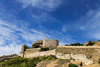
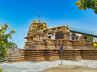
Kodad is a town in Suryapet district of the Indian state of Telangana. It is a municipality and the mandal headquarters of Kodad mandal in Kodad revenue division. It lies on the National Highway 65 between Hyderabad and Vijayawada. It is 44 km away from the district headquarters Suryapet

Nalgonda district is a district in the Telangana state of India. Nalgonda district has the highest number of mandals in the state with 31 mandals. The district shares boundaries with Suryapet, Rangareddy, Yadadri and Nagarkurnool districts and with the state boundary of Andhra Pradesh.

Ranga Reddy district is a district in the Indian state of Telangana. The district headquarters is located at Kongara Kalan Village, Ibrahimpatnam Mandal,. The district was named after the former deputy chief minister of the United Andhra Pradesh, K. V. Ranga Reddy. The district shares boundaries with Nalgonda, Yadadri Bhuvanagiri, Hyderabad, Medchal–Malkajgiri, Nagarkurnool, Mahabubnagar, Sangareddy and Vikarabad districts.

Bhongir, officially known as Bhuvanagiri, is a city and a district headquarters of the Yadadri Bhuvanagiri district and part of the Hyderabad Metropolitan Region of the Indian state of Telangana.

Jadcherla is a census town in Mahbubnagar district of the Indian state of Telangana. It is located in Jadcherla mandal in Mahbubnagar revenue division. In 2011, it was upgraded from village to a census town, along with 11 other villages. It is a historical town and is known for its cultural heritage. Recently Jadcherla has been made a Municipality.
Dilawarpur is a village and mandal headquarters in Nirmal district of the India.state of Telangana.It is located about 232 kilometres north of the state capital Hyderabad, 90 kilometres from Nizamabad and 15 kilometres from the district headquarters Nirmal.[1]
Bibinagar is a Mandal in Yadadri Bhuvanagiri district of the Indian state of Telangana. It is located in Bibinagar mandal of Bhongir revenue division. It is famous for All India Institute of Medical Sciences, Bibinagar. 39 km from Hyderabad.
Chevella is a town, mandal and suburb of Hyderabad in Ranga Reddy district of the Indian state of Telangana. It is the headquarters of surrounding villages with many government establishments like Judicial court, Revenue Division Office, Acp office under Cyberabad Metropolitan Police. It is also an educational hub with many schools, junior colleges, engineering colleges, business schools etc. There are many hospitals located along with a medical college, the Dr. Patnam Reddy Institute of Medical Sciences. It has become a part of Hyderabad Metropolitan Development Authority.
Yadagirigutta is a census town in Alair Assembly constituency of Yadadri Bhuvanagiri district of the Indian state of Telangana. It is a temple town as the famous Lakshmi Narasimha Temple is situated here. It is located at a distance of 16 km from the district headquarters Bhuvanagiri which is a part of Hyderabad Metropolitan Region and 55 km from Uppal, a major suburb of Hyderabad. The proposed Hyderabad Regional Ring Road passes through Yadagirigutta.
Samsthan Narayanapur is a Mandal in Bhuvanagiri district of Telangana State, India. Narayanapur Mandal Headquarters is Narayanapur town. It belongs to Telangana region. It is located 39 km towards west from District headquarters Bhongir.

Alair is a town in Yadadri Bhuvanagiri district of the Indian state of Telangana. It is a municipality and one of the constituencies in the Yadadri Bhuvanagiri district. It is located in Alair mandal of Bhongir revenue division. Alair is known for its Kulpakji Jain temple, and also known as the birthplace of Renukacharya, one of the five acharyas who came in the Kali Yuga to teach and preach Vīraśaivism.
Koyalgudem is a village in Choutuppal mandal, Yadadri Bhuvanagiri district in Telangana, India. This village popular for its 100% cotton and silk handloom (Ikat) manufacturing and exports. This village is separated from Ellambavi, a new gram panchayath was formed in 2018.
Nandanam is a village in Yadadri Bhuvanagiri district of Telangana, India. It falls under Bhongir mandal. It is located on Bhongir-Nalgonda road, 8 km (5.0 mi) southeast of the district headquarters Bhongir. It is situated 55 km (34 mi) from Hyderabad. Its population is 2449 as per 2011 census. Hyderabad is the nearest city. The village is 20 km (12 mi) from AIIMS Institute and Yadadri Temple city and 3 km (1.9 mi) from Raavi Narayan Reddy railway station.
Thukkapur is a village in Yadadri Bhuvanagiri district of Telangana, India. It falls under Bhongir mandal.
Ananthagiri is a thesildar in Kodad revenue division in the Suryapet district of Telangana, South India. Ananthagiri is also called has Hanumantha-Giri and later on people spell it has ananthagiri. Because, all say that there are more than 100 Lord Hanuman vigrahas around and nearby villages. The language spoken here is Telugu. It was the biggest Gram panchayat in Ananthagiri Mandal. It is a Village with great natural resources and high population density. NH-65 is the nearest highway which passes through the nearest town Kodad which is located at a distance of 7 km from Kodad.

Siddipet district is a district located in the northern region of the Indian state of Telangana. Its headquarters is Siddipet. This district contains a part of the Hyderabad Metropolitan Region(Markook Mulugu Wargal) The district shares boundaries with Jangaon, Sircilla, Karimnagar, Kamareddy, Hanamkonda, Yadadri, Medhchal and Medak districts.

Yadadri Bhuvanagiri District, is a district in the Indian state of Telangana. The administrative headquarters is located at Bhuvanagiri Town. The district shares boundaries with Suryapet, Nalgonda, Jangaon, Siddipet, Medchal-Malkajgiri and Rangareddy districts. It was carved out of Nalgonda district on 11 October 2016 during a large reorganization of the districts of Telangana.

Suryapet district is a district in the Indian state of Telangana. The city of Suryapet is the district headquarters. The district has three revenue divisions Suryapet, Kodad and Huzurnagar. It is sub-divided into 23 mandals. The district shares boundaries with Nalgonda, Khammam, Yadadri, Jangaon and Mahabubabad districts and with Andhra Pradesh state.

Jangaon district is a district in the Indian state of Telangana. It was a part of the erstwhile Warangal district prior to the re-organisation of districts in the state. The district shares boundaries with Suryapet, Yadadri, Warangal, Hanamkonda, Siddipet and Mahabubabad districts.
Jangaon Mandal is an administrative division or Sub District in Jangaon district in the Indian state of Telangana.


