Bhadrachalam is a census town in Bhadradri Kothagudem district in the Indian state of Telangana. It is an important Hindu pilgrimage town with the Bhadrachalam Temple of Lord Rama, situated on the banks of Godavari river. It is located 312 kilometres (194 mi) east of state capital, Hyderabad,115 kilometres (71 mi) from Khammam,178 kilometres (111 mi) from Suryapet,180 kilometres (112 mi) from Warangal,187 kilometres (116 mi) from Vijayawada,220 kilometres (137 mi) and 350 kilometres (217 mi) from Visakhapatnam.

Miryalaguda is a city in Nalgonda district of the Indian state of Telangana. In 2015, the Government of India placed Miryalaguda under the Atal Mission for Rejuvenation and Urban Transformation scheme. It is located about 44 kilometres (27 mi) from the district headquarters Nalgonda, 142 kilometres (88 mi) from the state capital Hyderabad.

Nalgonda is a city and municipality in the Indian state of Telangana. It is the headquarters of the Nalgonda district, as well as the headquarters of the Nalgonda mandal in the Nalgonda revenue division. It is located about 90 kilometres (56 mi) from the state capital Hyderabad.
Nakrekal is a census town in Nalgonda district of the Indian state of Telangana. It is located in Nakrekal mandal in Nalgonda division..It is located about 26km from Suryapet and 29km from Nalgonda.

Hanumakonda district, is a district located in the northern region of the Indian state of Telangana. The district headquarters are located at Hanumakonda. The district borders the districts of Jangaon, Karimnagar, Warangal, Bhupalpally and Siddipet.

Nagarjuna Sagar Dam is a masonry dam across the Krishna River at Nagarjuna Sagar which straddles the border between Palnadu district in Andhra Pradesh and Nalgonda district in Telangana. The dam provides irrigation water to the districts of Palnadu, Guntur, Nalgonda, Prakasam, Khammam, Krishna, and parts of West Godavari. It is also a source of electricity generation for the national grid.

Bhongir, officially known as Bhuvanagiri, is a city and a district headquarters of the Yadadri Bhuvanagiri district and part of the Hyderabad Metropolitan Region of the Indian state of Telangana.

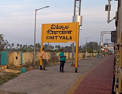
Choutuppal is a census town in Yadadri Bhuvanagiri district of the Indian state of Telangana. It is located in Choutuppal mandal of Choutuppal division. Its part of Hyderabad Metropolitan Development Authority. 49 km from Hyderabad.
Jangaon (Janagama) is a city and the district headquarters of Jangaon district in the Indian state of Telangana. It is also the mandal and divisional headquarters of Jangaon Mandal and Jangaon revenue division respectively. It is about 85 kilometres (53 mi) from the state capital Hyderabad. It lies on the National Highway 163
Chandur is a census town and Municipality and it is a Mandal Headquarters of Chandur Mandal in Nalgonda district & in the state of Telangana, India. It is located in Chandur mandal of Nalgonda division Postal code or Pin code: 508255. A beautiful and peaceful town. There are various legends about the etymology of the name one of the folklore says Chandi uuru as there is a famous Chandi maata temple of which the deity resembles to the goddess Durga of Vijayawada and is said to be commenced at the same time of the famous temple.
Thipparthy is a village in the Nalgonda district in Telangana. It is located in Thipparthy mandal of Nalgonda division. Gunda Sathyanarayana served as sarpanch for 15 years.
Yadagirigutta is a census town in Alair Assembly constituency of Yadadri Bhuvanagiri district of the Indian state of Telangana. It is a temple town as the famous Lakshmi Narasimha Temple is situated here. It is located at a distance of 16 km from the district headquarters Bhuvanagiri which is a part of Hyderabad Metropolitan Region and 55 km from Uppal, a major suburb of Hyderabad. The proposed Hyderabad Regional Ring Road passes through Yadagirigutta.

The Roman Catholic Diocese of Nalgonda is a diocese located in the city of Nalgonda in the Ecclesiastical province of Hyderabad in India.

Gutha Sukender Reddy is an Indian BRS politician who is the 2nd and current Chairman of the Telangana Legislative Council since 14 March 2022. He was elected as MLC in 2019 & 2021 respectively.
Valigonda is a census town in Yadadri Bhuvanagiri district of the Indian state of Telangana. It is located in Valigonda mandal of Bhongir division. It is located on the banks of Musi River. 20 Kms from Bhongir.

Ramannapeta is a village in Yadadri Bhuvanagiri district of the Indian state of Telangana. It is located in Ramannapeta mandal of Bhongir division.
Samsthan Narayanapur is a Mandal in Bhuvanagiri district of Telangana State, India. Narayanapur Mandal Headquarters is Narayanapur town. It belongs to Telangana region. It is located 39 km towards west from District headquarters Bhongir.
'Mungode,' 'Munugodu' or 'Munugode' is a village located in Munugode Mandal in Nalgonda Division of Nalgonda district of Telangana state, India. It is 21 Kilometers westward from Nalgonda town. Munugode village has a population of 10141, of which 5294 are males, while 4847 are females, as per Population Census 2011.
Jajireddigudem is a village in Suryapet district of the Indian state of Telangana. It is located in Jajireddygudem mandal of Suryapet division..It is about 30 km from the district headquarters Suryapet.

Alair is a town in Yadadri Bhuvanagiri district of the Indian state of Telangana. It is a municipality and one of the constituencies in the Yadadri Bhuvanagiri district. It is located in Alair mandal of Bhongir revenue division. Alair is known for its Kulpakji Jain temple, and also known as the birthplace of Renukacharya, one of the five acharyas who came in the Kali Yuga to teach and preach Vīraśaivism.