
The Arctic Archipelago, also known as the Canadian Arctic Archipelago, is a group of islands north of the Canadian mainland.
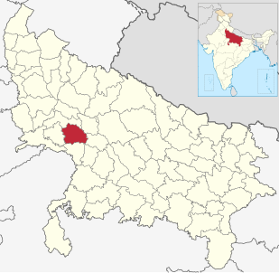
Mainpuri district is one of the districts in Agra division of Uttar Pradesh state of India. Mainpuri town is the district headquarters. It consists of six tehsils, namely Mainpuri, Bhongaon, Karhal, Kishni kurawali and Ghiror.

Nalgonda district is a district in the Telangana state of India. It has a population of 3,483,648, of which 13.32% is urban as of 2011. The district shares boundaries with Suryapet, Rangareddy, Yadadri, and Nagarkurnool districts, and with the state boundary of Andhra Pradesh.
Troitsk is the name of several inhabited localities in Russia.

Bhongir is a town and District Headquarter of Yadadri Bhuvanagiri district of the Indian state of Telangana. It comes under Hyderabad Metropolitan Development Authority, located on National Highway 163.

Bibinagar is a census town in Yadadri Bhuvanagiri district of the Indian state of Telangana. It is located in Bibinagar mandal.

Koh Kong District is a district (srok) of Koh Kong Province, in south-western Cambodia. The southern parts of Koh Kong district is part of Botum Sakor National Park since 1993. It comprise roughly one-third of the district.

Sri Lakshmi Narasimha Temple also known as Yadadri and Yadagirigutta temple, is a Hindu temple situated on a hillock in Yadagirigutta of Yadadri Bhuvanagiri district of the Indian state of Telangana. The temple is an abode of Narasimha, an incarnation of Lord Vishnu. It is located 62 km from Hyderabad about 120 kilometres (75 mi) from Suryapet and 88 kilometres (55 mi) from Nalgonda.

Marki is a village in the administrative district of Gmina Grabowo, within Kolno County, Podlaskie Voivodeship, in north-eastern Poland. It lies approximately 19 kilometres (12 mi) north-east of Kolno and 79 km (49 mi) north-west of the regional capital Białystok.
Hidaybu District is one of two districts of the Socotra Governorate, Yemen. It occupies the eastern part of the main island of Socotra archipelago. It is named after its capital and the principal town of the archipelago, the town of Hidaybu (Hadibu). As of 2003, the district had a population of 34,011 people.
Valigonda is a census town in Yadadri Bhuvanagiri district of the Indian state of Telangana. It is located in Valigonda mandal of Bhongir division. It is located on the banks of Musi River.
Ramannapeta is a village in Yadadri Bhuvanagiri district of the Indian state of Telangana. It is located in Ramannapeta mandal of Bhongir division.

Aler is a City in Yadadri Bhuvanagiri district of the Indian state of Telangana. It is located in Aler mandal of Bhongir division.
Saraspur is an area located in Ahmedabad, India.
Kurinjipadi taluk is a taluk of Cuddalore district of the Indian state of Tamil Nadu. The headquarters of the taluk is the town of Kurinjipadi. Abiyam pettai is the biggest village in this taluk
Nalgonda revenue division is an administrative division in the Nalgonda district of the Indian state of Telangana. It is one of the 3 revenue divisions in the district which consists of 11 mandals under its administration. Nalgonda is the divisional headquarters of the division. The revenue division got modified on 11 October 2011, based on the re-organisation of the districts in the state.
Khammam revenue division is an administrative division in the Khammam district of the Indian state of Telangana. It is one of the 2 revenue divisions in the district which consists of 14 mandals under its administration. Khammam is the divisional headquarters of the division.
Kotamarthy is a village in Addagudur Mandal, Yadadri District, Telangana State, India. The pin code is 508277

Yadadri-Bhuvanagiri district is a district in the Indian state of Telangana. The administrative headquarters is located at Bhongir. It was a part of the Nalgonda district before the re-organisation of districts in the state. .The district shares boundaries with Suryapet, Nalgonda, Jangaon, Siddipet, Medchal, Rangareddy districts.
Bhongir revenue division is an administrative division in the Yadadri Bhuvanagiri district of the Indian state of Telangana. It is one of the 2 revenue divisions in the district which consists of 11 mandals under its administration. Bhongir is the divisional headquarters of the division. The revenue division got modified on 11 October 2011, based on the re-organisation of the districts in the state.


