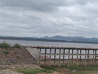
Karimnagar is a city and District Headquarters in the Indian state of Telangana. Karimnagar is a major urban agglomeration and fifth largest City in the state. It is governed by Municipal corporation and is the headquarters of the Karimnagar district It is situated on the banks of Manair River, which is a tributary of the Godavari River.It is the fourth largest and fastest growing urban settlement in the state, according to 2011 census. It has registered a population growth rate of 45.46% and 38.87% respectively over the past two decades between 1991 and 2011, which is highest growth rate among major cities of Telangana. It serves as a major educational and health hub for the northern districts of Telangana. It is a major business center and widely known for Granite and Agro-based industries.It is also called as "City of Granites"

Jagtial is a city and the district headquarters Jagitial district of Telangana, India. It has an average elevation of 293 metres (961 ft). It is located about 190 kilometres (118 mi) north of the state capital Hyderabad.

Karimnagar district is one of the 33 districts of the Indian state of Telangana. Karimnagar city is its administrative headquarters. The district shares boundaries with Peddapalli, Jagityal, Sircilla, Siddipet, Jangaon, Warangal urban and Jayashankar Bhupalapally districts.

Nizamabad district is a district located in the north-western region in the Indian state of Telangana. The city of Nizamabad is the district headquarters.

Dharmapuri is a village and the mandal headquarters of Dharmapuri mandal in Jagtial district of Telangana, India.

Korutla municipality is one of the major town and revenue division located in the Jagtial district in the Indian state of Telangana. It is a historical city ruled by Jain Kings and second largest town in Jagtial district. It is the headquarters of Koratla constituency. The population of this town crossed nearly 1 lakh in 2020. It is located about 23 kilometres (14 mi) from the district headquarters Jagtial. It's 205 kms. far from Hyderabad, 69 Kms. far from Karimnagar and 76 Kms. far from Nizamabad.

Gollapally is a village located in Gollapalle mandal of Jagtial district in Telangana, India. Before the reorganisation of districts in Telangana, Gollapally was part of Karimnagar district.

Sarangapur is a village Sarangapur mandal in Jagtial district of the Indian state of Telangana. Before reorganisation of districts in Telanaga in 2016, Sarangapur mandal was a part of Karimnagar district.
Metpally is a town in Metpally mandal of Jagtial district in the Indian state of Telangana.It is located in its own Metpally Revenue Division, it is a part of the Koratla constituency.[2] Metpally is 222.4 km away from Hyderabad and by NH 63 passing by metpally connect to NH 44 at armoor.To the north the godavri river about 18 km and kakatiya main canal from SRSP is flowing by metpally.

Kathlapur is a mandal in Jagtial district in the state of Telangana in India.

Kodimial is a village in Kodimial mandal of Jagtial district in the state of Telangana in India.

Metpally is a town and Revenue Division in Jagtial district of the Indian state of Telangana with the population hitting 1 lakh in 2020. It is located 222 km away from state capital Hyderabad, 67km from Nizamabad, 80km from Karimnagar and 33km far away from District Headquarter Jagtial.

Pegadapally is a village in Pegadapally mandal of Jagtial district in the state of Indian state of Telangana.

Bathikepelly is a village located in Pegadapally mandal, in the Jagtial district of Telangana state. Prior to the formation of Telangana, the village was part of Karimnagar district in Andhra Pradesh.

Mallapur is a mandal in the Jagtial district of the Indian state of Telangana.

Poodur or Pudur is a village in Kodimial mandal, Jagtial district, Telangana, India.
Jagtial Assembly constituency is a constituency of Telangana Legislative Assembly, India. It is one among 3 constituencies in Jagtial district. It is part of Nizamabad Lok Sabha constituency

Mancherial district is a district located in the northern region of the Indian state of Telangana. It is surrounded by Komaram Bheem, Nirmal, Jagtial, Peddapalli and Bhupalpally districts of Telangana and with Maharashtra state.

Jagitial district is a district located in the northern region of the Indian state of Telangana.It was a part of the Karimnagar district before re-organisation of districts in the state.

Peddapalli district is a district located in the northern region of the Indian state of Telangana. Its Administrative Headquarters is at Peddapalli and it is one of the fastest developing district in Telangana. Largest and Biggest city in Peddapalli District is Ramagundam. The District Shares Boundaries with Mancherial, Karimnagar, Jagtial and Jayashankar Bhupalpally Districts.


