Karimnagar is a Smart city and District Headquarters in the Indian state of Telangana. Karimnagar is a major urban agglomeration and fifth largest City in the state. It is governed by Municipal corporation and is the headquarters of the Karimnagar district It is situated on the banks of Manair River, which is a tributary of the Godavari River.It is the fourth largest and fastest growing urban settlement in the state, according to 2011 census. It has registered a population growth rate of 45.46% and 38.87% respectively over the past two decades between 1991 and 2011, which is highest growth rate among major cities of Telangana. It serves as a major educational and health hub for the northern districts of Telangana. It is a major business center and widely known for Granite and Agro-based industries.It is also called as "City of Granites"

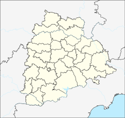
Karimnagar district is one of the 33 districts of the Indian state of Telangana. Karimnagar city is its administrative headquarters. The district shares boundaries with Peddapalli, Jagityal, Sircilla, Siddipet, Jangaon, Warangal urban and Jayashankar Bhupalapally districts.

Koratla municipality is a town located in the Jagtial district in the Indian state of Telangana. It is a second largest city in Jagtial district.It is the headquarters of Koratla constituency. Koratla,Metpally,Ibrahimpatnam,mallapur are the four mandals come under the koratla constitution.
Mancherial is a Municipality in the Mancherial district of the Indian state of Telangana.It is both the district and administrative headquarters of Mancherial mandal in the Mancherial revenue division. It is located on the north banks of the Godavari River..It is located about 244 kilometres (152 mi) from the state capital, Hyderabad, 84 kilometres (52 mi) from Karimnagar and 155 kilometres (96 mi) from Adilabad.
Gollapally is a village located in Gollapalle mandal of Jagtial district in Telangana, India. Before the reorganisation of districts in Telangana, Gollapally was part of Karimnagar district.

Bommanahal is a village in Anantapur district of the Indian state of Andhra Pradesh. It is the headquarters of Bommanahal mandal in Kalyandurg revenue division.
Velgatoor is a Town and mandal headquarter of Velgatoor mandal in Jagtial district in the state of Telangana in India.
Nandagiri is the name of several places in India. It is a village in Telangana, a suburb of Hyderabad.
Bathikepelly is a village located in Pegadapally mandal, in the Jagtial district of Telangana state.
Mallapur is a mandal in the Jagtial district of the Indian state of Telangana.

Kollur mandal is one of the 57 mandals in Guntur district of the Indian state of Andhra Pradesh. It is under the administration of Tenali revenue division and the headquarters are located at Kollur.

Nizampatnam mandal is one of the 57 mandals in Guntur district of the state of Andhra Pradesh, India. It is under the administration of Tenali Revenue Division and the headquarters are located at Nizampatnam. The mandal is bounded by Repalle, Nagaram, Pittalavanipalem and Karlapalem mandals. The mandals lies on the shore of Bay of Bengal and a portion of the mandal lies on the banks of Krishna River.

Nagayalanka mandal is one of the 50 mandals in Krishna district of the Indian state of Andhra Pradesh. It is under the administration of Machilipatnam revenue division and has its headquarters at Nagayalanka. The mandal is bounded by Avanigadda and Koduru mandals. It lies at the mouths of Krishna River where it empties into Bay of Bengal.
Kamalapuram mandal is one of the 50 mandals in Kadapa district of the Indian state of Andhra Pradesh. It is under the administration of Kadapa revenue division and the headquarters are located at Kamalapuram. The mandal is bounded by Yerraguntla, Proddutur, Chapad, Khajipet, Vallur, Pendlimarri and Veerapunayunipalle mandals.
Poodur or Pudur is a village in Kodimial mandal, Jagtial district, Telangana, India.
Obulapuram is a village in Ellanthakunta Mandal in the Karimnagar District of Telangana State, India. It is located 29 km west from the district headquarters of Karimnagar. 8 km from Ellanthakunta.
Pegadapalli or Pegadapalle is a village in Jaipur Mandal in Mancherial District of the Indian state of Telangana. It belongs to the Telangana region.

Challapalli mandal is one of the 50 mandals in the Krishna district of the Indian state of Andhra Pradesh. The headquarters of this mandal are located in Challapalli.