
Bhadrachalam is a census town in Bhadradri Kothagudem district in the Indian state of Telangana. It is an important Hindu pilgrimage town with the Bhadrachalam Temple of Lord Rama, situated on the banks of Godavari river. It is located 312 kilometres (194 mi) east of state capital, Hyderabad,115 kilometres (71 mi) from Khammam,178 kilometres (111 mi) from Suryapet,180 kilometres (112 mi) from Warangal,187 kilometres (116 mi) from Vijayawada,220 kilometres (137 mi) and 350 kilometres (217 mi) from Visakhapatnam.

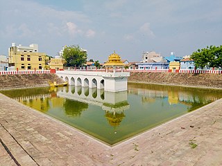
Nizamabad, also known as Induru, is a city in the Indian state of Telangana. It is governed by municipal corporation and is the headquarters of the Nizamabad district. Although previously part of Hyderabad State and then Andhra Pradesh state, Nizamabad became a part of the newly formed state of Telangana by the Andhra Pradesh Reorganisation Act, 2014. It is located about 186 kilometres (116 mi) north of the state capital, Hyderabad.

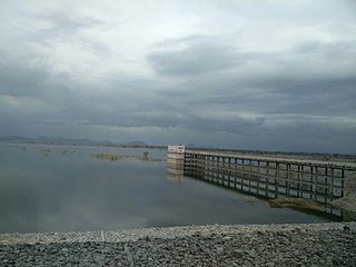
Nizamabad district is a district located in the north-western region of the Indian state of Telangana. The city of Nizamabad is the district headquarters. The district share boundaries with Jagtial, Sircilla, Nirmal, Kamareddy districts and with Nanded district of the state boundary of Maharashtra.

Suryapet is a city in the Indian state of Telangana. It is a municipality and the headquarters of its eponymous district. The Government of India announced Suryapet to be developed under the Atal Mission for Rejuvenation and Urban Transformation (AMRUT) scheme. Suryapet has been awarded the "Cleanest city" in South India by the Ministry of Urban development in Swachh Survekshan 2017. It is also known as "Gateway of Telangana". It is located about 134 kilometres (83 mi) east of the state capital, Hyderabad and also it is located about 138 kilometres (86 mi) West of Vijayawada.

Bodhan town in Nizamabad district of the Indian state Telangana. Bodhan is primarily known for the Nizam Sugar Factory founded by the Nizam of Hyderabad, and some historical places such as The Jalal Bukhari Dargah at Ranjalbase, The Chakreshwara Shiva Temple, The Renuka Temple, Bheemuni Gutta at Rakasipet and prominent other historical places, such as the Pandu Teertha, Chakra Teertha and many other temples and shrines.

Bhongir, officially known as Bhuvanagiri, is a city and a district headquarters of the Yadadri Bhuvanagiri district and part of the Hyderabad Metropolitan Region of the Indian state of Telangana.

Bhainsa is a town in Nirmal district of the Indian state of Telangana. It is the headquarters of Bhainsa mandal and Bhainsa revenue division. It is bordered with Bhokar taluk, Nanded district, Maharashtra State on west and Nizamabad district on South. Bhainsa is located at 19.1000°N 77.9667°E. It has an average elevation of 363 meters (1194 feet).

Korutla municipality is the second largest town and revenue division in the Jagtial district in the Indian state of Telangana. It is a historical town ruled by Jain Kings and second largest town in Jagtial district. It is the headquarters of Koratla constituency. It is located about 23 kilometres (14 mi) from the district headquarters Jagtial, 235 kilometers from Hyderabad, 73 kilometers from Karimnagar and 76 kilometers from Nizamabad.
Mancherial is a city and headquarters of the Mancherial district of the Indian state of Telangana. It is both the district and administrative headquarters of Mancherial mandal in the Mancherial revenue division. It is located on the north banks of the Godavari River. It is located about 244 kilometres (152 mi) from the state capital, Hyderabad, 84 kilometres (52 mi) from Karimnagar, 138 kilometres (86 mi) from Nirmal and 155 kilometres (96 mi) from Adilabad.
Armoor is a city in Nizamabad district, in the state of Telangana in India. Armoor is situated on NH 63. In the past, it was called Navanathapuram since it has nine mountains around the city Armoor is a variation of it.

Navipet is a Mandal in Nizamabad district in the state of Telangana in India Navipet is top mandal in Nizamabad district Which has good market value for crops and small revenue business. Navipet lies on Nizamabad Bhainsa main road. Navipet is famous for weekly goats market.
Rudrur is a town and Mandal headquarter located in Nizamabad district of Telangana in the Banswada Assembly Constituency, India.

Ramayampet is a Municipality and a mandal in Medak District of Telangana State. Ramayampet was an Assembly Constituency in the former Andhra Pradesh State from 1952 to 2009 in Medak district in Indian state of Telangana. It is the 4th biggest town in Medak district and is 20 km form Medak and is 80 km (50 mi) from Hyderabad. Located on National Highway NH 44, The longest National Highway in India NH 44 in Ramayampet.
Nizamabad mandal is one of the 27 mandals within Nizamabad District in the Indian state of Telangana. It is located in the revenue division of Nizamabad, while the headquarters are located in the city of the same name. The mandal is bordered by those of Mosra, Chandur, Yedpalle, Navipet, Makloor, Gandhari, and Dichpalle.

Asifabad is a census town and the district headquarters of Kumuram Bheem district in the Indian state of Telangana. It is located in Asifabad mandal of Asifabad revenue division. It is situated on the banks of Peddavagu river. It is about 309 kilometres (192 mi) north of the state capital Hyderabad,86 kilometres (53 mi) from Ramagundam, 118 kilometres (73 mi) from Adilabad and 148 kilometres (92 mi) from Karimnagar.
Mancherial district is a district located in the northern region of the Indian state of Telangana. The district comprises 18 mandals and two revenue divisions – Mancherial and Bellampalli. The district headquarters is located at Mancherial town. It is surrounded by Komaram Bheem, Nirmal, Jagtial, Peddapalli and Bhupalpally districts of Telangana and with Maharashtra state.

Nirmal district is a district located in the northern region of the Indian state of Telangana. The district headquarters is located in the town of Nirmal. It borders the Telangana districts of Adilabad, Nizamabad, Mancherial, Asifabad, Jagtial districts as well as Nanded district of the state Maharashtra.

Kamareddy district is a district located in the northern region of the Indian state of Telangana. The district shares boundaries with Medak, Nizamabad, Sangareddy, Siddipet and Rajanna Sircilla districts and with the state boundary of Maharashtra and Karnataka.
Jagtial district is a district located in the northern region of the Indian state of Telangana. Its headquarters is Jagtial. The district shares boundaries with Nirmal, Mancherial, Karimnagar, Peddapalli, Sircilla and Nizamabad districts.

Rajanna Sircilla district is a district in the Indian state of Telangana. Sircilla is the district headquarters. The district shares boundaries with Karimnagar, Siddipet, Jagtial, Kamareddy, and Nizamabad districts.

