
The Three Gorges Dam is a hydroelectric gravity dam that spans the Yangtze River near Sandouping in Yiling District, Yichang, Hubei province, central China, downstream of the Three Gorges. The world's largest power station in terms of installed capacity (22,500 MW), the Three Gorges Dam generates 95±20 TWh of electricity per year on average, depending on the amount of precipitation in the river basin. After the extensive monsoon rainfalls of 2020, the dam's annual production reached nearly 112 TWh, breaking the previous world record of ~103 TWh set by Itaipu Dam in 2016.

Pumped-storage hydroelectricity (PSH), or pumped hydroelectric energy storage (PHES), is a type of hydroelectric energy storage used by electric power systems for load balancing. The method stores energy in the form of gravitational potential energy of water, pumped from a lower elevation reservoir to a higher elevation. Low-cost surplus off-peak electric power is typically used to run the pumps. During periods of high electrical demand, the stored water is released through turbines to produce electric power. Although the losses of the pumping process make the plant a net consumer of energy overall, the system increases revenue by selling more electricity during periods of peak demand, when electricity prices are highest. If the upper lake collects significant rainfall or is fed by a river then the plant may be a net energy producer in the manner of a traditional hydroelectric plant.

Lake Mead is a reservoir formed by the Hoover Dam on the Colorado River in the Southwestern United States. It is located in the states of Nevada and Arizona, 24 mi (39 km) east of Las Vegas. It is the largest reservoir in the US in terms of water capacity. Lake Mead provides water to the states of Arizona, California, and Nevada as well as some of Mexico, providing sustenance to nearly 20 million people and large areas of farmland.
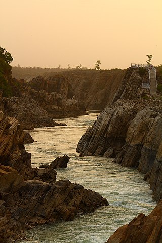
The Narmada River, previously also known as Narbada or anglicised as Nerbudda, is the 5th longest river in India and overall the longest west-flowing river in the country. It is also the largest flowing river in the state of Madhya Pradesh. This river flows through the states of Madhya Pradesh and Gujarat in India. It is also known as the "Lifeline of Madhya Pradesh and Gujarat" due to its huge contribution to the two states in many ways. The Narmada River rises from the Amarkantak Plateau in Anuppur district in Madhya Pradesh. It forms the traditional boundary between North and South India and flows westwards for 1,312 km (815.2 mi) before draining through the Gulf of Khambhat into the Arabian Sea, 30 km (18.6 mi) west of Bharuch city of Gujarat.

The Sardar Sarovar Dam is a concrete gravity dam built on the Narmada River near the town of Kevadiya, in Narmada District, in the Indian state of Gujarat. The dam was constructed to provide water and electricity to the Indian states of Gujarat, Madhya Pradesh, Maharashtra and Rajasthan.

The Taum Sauk pumped storage plant is a power station in the St. Francois mountain region of Missouri, United States about 90 miles (140 km) south of St. Louis near Lesterville, Missouri, in Reynolds County. It is operated by Ameren Missouri.

The Wainganga is a river in India originating in the Mahadeo Hills in Mundara in Gondwana region near the village Gopalganj in Seoni, Madhya Pradesh. It is a key tributary of the Godavari. The river flows south in a winding course through the states of Madhya Pradesh and Maharashtra, roughly 580 km (360 mi). After joining the Wardha River, the united stream, which is known as the Pranahita River, empties into the Godavari River at Kaleshwaram, Telangana.

The Godavari River has its catchment area in seven states of India: Maharashtra, Telangana, Chhattisgarh, Madhya Pradesh, Andhra Pradesh, Karnataka and Odisha. The number of dams constructed in Godavari basin is the highest among all the river basins in India. Nearly 350 major and medium dams and barrages had been constructed in the river basin by the year 2012.

Balaghat district is a district of Madhya Pradesh state in Central India.

Seoni District is a district of Madhya Pradesh state in central India. The town of Seoni is the district headquarters.

Seoni is a city and a municipality in Seoni district in the Indian state of Madhya Pradesh. This tribal household dominated district was formed in the year 1956.

Ghajini is a 2005 Indian Tamil-language action thriller film directed by A. R. Murugadoss and produced by Salem Chandrasekharan. The film stars Suriya and Asin in the lead with Pradeep Rawat as the main antagonist, along with Nayanthara and Riyaz Khan in the supporting roles. Harris Jayaraj composed the soundtrack and background music, while R. D. Rajasekhar and Anthony were the film's cinematographer and editor, respectively. In the film, Sanjay Ramaswamy (Suriya), once an eminent businessman, develops anterograde amnesia due to a head injury he got while attempting to save his fiancee Kalpana (Asin) from getting murdered by a gangster. After that, he sets out to avenge her murder with the aid of photographs from a Polaroid Instant camera and permanent tattoos on his body.
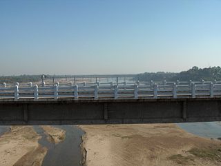
Originating from Pavagadh in the Panchmahal District of Gujarat, the Vishwamitri River flows mainly through the west of the city of Vadodara. The name of this river is said to have been derived from the name of the great saint Vishwamitra. Two other tributaries namely Dhadhar and Khanpur merge into it before it amalgamates with the Gulf of Khambhat. Human settlement dating back to 1000 B.C has been found on the bank of river Vishwamitri which ascertains the existence of Stone Age Era. Also in the beginning of the Christian era, a small township was developed on a mound on the banks of this river which later came to be known as Ankotakka while the mound is popular as Dhantekri. The Vishwamitri River was key to the settlement of Vadodara.
Narmada Bachao Andolan is an Indian social movement spearheaded by native tribals (adivasis), farmers, environmentalists and human rights activists against a number of large dam projects across the Narmada River, which flows through the states of Gujarat, Madhya Pradesh and Maharashtra. Sardar Sarovar Dam in Gujarat is one of the biggest dams on the river and was one of the first focal points of the movement. It is part of the Narmada Dam Project, whose main aim is to provide irrigation and electricity to people of the above states.

A dam failure or dam burst is a catastrophic type of structural failure characterized by the sudden, rapid, and uncontrolled release of impounded water or the likelihood of such an uncontrolled release. Between the years 2000 and 2009 more than 200 notable dam failures happened worldwide.

The Bear River is a tributary of the Feather River in the Sierra Nevada, winding through four California counties: Yuba, Sutter, Placer, and Nevada. About 73 miles (117 km) long, the river flows generally southwest through the Sierra then west through the Central Valley, draining a narrow, rugged watershed of 295 square miles (760 km2).

The Ukai Dam, constructed across the Tapti River, is the second largest reservoir in Gujarat after the Sardar Sarovar. It is also known as Vallabh Sagar. Constructed in 1972, the dam is meant for irrigation, power generation and flood control. Having a catchment area of about 62,255 km2 and a water spread of about 52,000 hectares, its capacity is almost the same as that of the Bhakra Nangal Dam. The site is located 94 km from Surat.

The 2020 Vidarbha Floods were a series of flooding events that occurred in the Vidarbha region of Indian State of Maharashtra in 2020. The floods affected the districts of Nagpur, Bhandara, Chandrapur, Gadchiroli and Gondia. Over 92,000 people were affected in the region.
