
The Bhagirathi Hooghly River or the 'Bhāgirathi-Hooghly', called the Ganga or the Kati-Ganga in the Puranas, rises close to Giria, which is north of Baharampur and Palashi, in Murshidabad. The main course of the Ganges then flows into Bangladesh as the Padma. A man-made canal called the Farakka Feeder Canal connects the Ganges to the Bhagirathi to bring the abundant waters of the Himalayan river to the narrow river that rises in West Bengal.

Jangipur is a city and a municipality in Murshidabad district in the state of West Bengal, India. It is the headquarters of the Jangipur subdivision. It is situated on the banks of the Bhagirathi. Jangipur is an old town having reference from the historical period of Moghul emperor Jahangir when an army camp was established here.

The Geography of West Bengal, a state in eastern India, is primarily defined by plains and plateaus, with the high peaks of the Himalayas in the north and the Bay of Bengal to the south.

Dhuliyan is a municipality town in the Jangipur subdivision of Murshidabad district in the state of West Bengal, India. This municipality was established in the year 1909 and comprises 19 wards. It is located between the Ganges and the Feeder canal.

Murshidabad district is a district of in the Indian state of West Bengal. Situated on the left bank of the river Ganges, the district is very fertile. Covering an area of 5,341 km2 (2,062 sq mi) and having a population 7.103 million, it is a densely populated district and the ninth most populous in India. Berhampore city is the headquarters of the district.
Mayurakshi River is a major river in Jharkhand and West Bengal, India, with a long history of devastating floods.
The Hinglo River is a tributary of the Ajay River in the Indian states of Jharkhand and West Bengal.
Suti I is a community development block that forms an administrative division in the Jangipur subdivision of Murshidabad district in the Indian state of West Bengal.

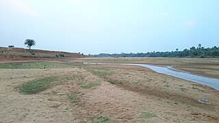
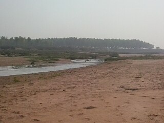
The Dwarka River is a tributary of Bhagirathi.

The Brahmani River is a tributary of the Dwarka River.
Khargram is a community development block that forms an administrative division in the Kandi subdivision of Murshidabad district in the Indian state of West Bengal.
Burwan is a community development block that forms an administrative division in the Kandi subdivision of Murshidabad district in the Indian state of West Bengal.
Raghunathganj I is a community development block that forms an administrative division in the Jangipur subdivision of Murshidabad district in the Indian state of West Bengal.
Nabagram is a community development block that forms an administrative division in the Lalbag subdivision of Murshidabad district in the Indian state of West Bengal.

Domkal is a community development block that forms an administrative division in the Domkol subdivision of Murshidabad district in the Indian state of West Bengal.
Raghunathganj II is a community development block that forms an administrative division in the Jangipur subdivision of Murshidabad district in the Indian state of West Bengal.
Suti II is a community development block that forms an administrative division in the Jangipur subdivision of Murshidabad district in the Indian state of West Bengal. Aurangabad is the census town of Suti II block.
Samserganj is a community development block that forms an administrative division in the Jangipur subdivision of Murshidabad district in the Indian state of West Bengal.
Farakka is a community development block that forms an administrative division in the Jangipur subdivision of Murshidabad district in the Indian state of West Bengal.

Following heavy rain in July and August 2017, the Indian state of West Bengal was affected by severe flooding. The floods were reported to have caused 50 deaths since 1 August and 8 deaths in the neighbouring state of Jharkhand.
