
The Geography of West Bengal, a state in eastern India, is primarily defined by plains and plateaus, with the high peaks of the Himalayas in the north and the Bay of Bengal to the south.
The Mayurakshi is a major river in Jharkhand and West Bengal, India, with a long history of devastating floods.
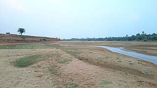
The Bakreshwar River is a tributary of the Mayurakshi River. It originates in Santhal Parganas division of Jharkhand. It then flows through Birbhum district and meets the Kopai River. The combined waters flow into the Mayurakshi River in Murshidabad district.

The Bansloi River is a tributary of the Bhagirathi.

Suti I is a community development block that forms an administrative division in the Jangipur subdivision of Murshidabad district in the Indian state of West Bengal.

The Brahmani River is a tributary of the Dwarka River.

Khargram is a community development block that forms an administrative division in the Kandi subdivision of Murshidabad district in the Indian state of West Bengal.

Burwan is a community development block that forms an administrative division in the Kandi subdivision of Murshidabad district in the Indian state of West Bengal.

Raghunathganj I is a community development block that forms an administrative division in the Jangipur subdivision of Murshidabad district in the Indian state of West Bengal.

Nabagram is a community development block that forms an administrative division in the Lalbag subdivision of Murshidabad district in the Indian state of West Bengal.

Jalangi is a village, with a police station, identified in 2011 census, in Jalangi CD Block in Domkol subdivision of Murshidabad district in the state of West Bengal, India. The village is situated along the bank of the Padma River.

Suti II is a community development block that forms an administrative division in the Jangipur subdivision of Murshidabad district in the Indian state of West Bengal. Aurangabad is the census town of Suti II block.

Samserganj is a community development block that forms an administrative division in the Jangipur subdivision of Murshidabad district in the Indian state of West Bengal.

Farakka is a community development block that forms an administrative division in the Jangipur subdivision of Murshidabad district in the Indian state of West Bengal.
Burwan is a village, with a police station, in the Burwan CD block in the Kandi subdivision of Murshidabad district in the state of West Bengal, India. It touches with Birbhum District and Near labpur and Miriti Village, where Ex president Mr Pranab mukharjee was Born.
Khargram is a village, with a police station, in the Khargram CD block in the Kandi subdivision of Murshidabad district in the state of West Bengal, India.

Kandi is a community development block that forms an administrative division in the Kandi subdivision of Murshidabad district in the Indian state of West Bengal.
Deucha is a village and a gram panchayat in Mohammad Bazar CD Block in Suri Sadar subdivision of Birbhum district in the Indian state of West Bengal.
Nagar is a village in the Khargram CD block in the Kandi subdivision of Murshidabad district in the state of West Bengal, India. It is located about 190 km from Kolkata, the state capital.
Sadikhanr Diar is a village in the Jalangi CD block in the Domkal subdivision of Murshidabad district in the state of West Bengal, India.


