| Auranga River | |
|---|---|
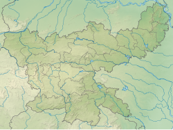 Location of the river mouth  Auranga River (Jharkhand) (India) | |
| Location | |
| Country | India |
| State | Jharkhand |
| Physical characteristics | |
| Source | |
| • location | Chulha Pani, Lohardaga Jharkhand |
| • coordinates | 23°36′52″N84°40′23″E / 23.61444°N 84.67306°E |
| • elevation | 921m |
| Mouth | North Koel River |
• location | Kechki |
• coordinates | 23°56′42″N84°08′28″E / 23.94500°N 84.14111°E |
• elevation | 247m |
| Length | 95 km (59 mi) |
| Basin features | |
| Tributaries | |
| • left | Lawapani waterfall |
| • right | Nunforwa waterfall, Tatapani hot water spring, jaram sukri |
The Auranga River originates at Chulha Pani on the border of Lohardega & Latehar district of Jharkhand. On its left River Damodar also originates from same point . River Auranga flows through the Richughutu, Latehar railway station and Palamu districts in the Indian state of Jharkhand. [1]