Panchghagh Falls | |
---|---|
Location | Khunti district, Jharkhand, India |
Coordinates | 22°56′41″N85°15′17″E / 22.94472°N 85.25472°E |
Number of drops | 5 |
Watercourse | Banai River |
Panchghagh Falls is a waterfall located in Khunti district in the Indian state of Jharkhand. [1]
Panchghagh Falls is located at 22°56′41″N85°15′17″E / 22.94472°N 85.25472°E .
In the adjacent map the area shown is “undulating and covered with hills, hillocks and jungles (jungles/ forests are shown as shaded area in the map). The soil of the area is rocky, sandy and red loam upland. There are paddy fields only in the depressions. It has a gentle slope adjacent to the streams.” [2] A major part of the district is in the 500–700 metres (1,600–2,300 ft) elevation range, with up to ± 200 m for some parts. [3] In 2011, it had a density of population of 210 persons per sq km. Khunti is an overwhelmingly rural district with 91.5% of the population living in rural areas. [4] Famous places in this area are Ulihatu, the birth place of Bhagwan Birsa Munda, and Dombari Buru, the central point of his activity. [5]
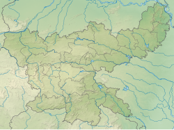
Note: The map alongside presents some of the notable locations in the district. All places marked in the map are linked in the larger full screen map.
In its bid to find its way through the hard and jagged terrain, the Banai River branches itself out in five different streams, generating ubiquitous singing rivulets through the cluster of rocks. Unlike Jonha and Hundru Falls, Panchghagh's water does not fall from great heights. Still, one can almost hear the roar of the water when one arrives near it, because all the five branched-out and swirling streams hit the rocks in a very turbulent manner. It's a treat to watch and hear. [6]
In spite of the presence of a large number of high waterfalls in the area, the Panchghagh Falls are a tourists preference for being viewed as the safest of all. The water falls from a lesser height, making it safe for tourists to enjoy in the rapid flow of water. Most of the people arrive here for picnic with family and friends.
Panchghagh Falls is 8 kilometres (5.0 mi) from Khunti on the road to chaibasa. It is 55 kilometres (34 mi) from Ranchi. Khunti is on NH 75 or Ranchi-Chaibasa Highway. [7] [8]
Khunti is the headquarter of Khunti district in the Indian state of Jharkhand. It is in South Chotanagpur division and one of the 24 districts in the Indian state of Jharkhand. The district of Khunti was carved out of Ranchi district on 12 September 2007. It is historically known as the centre of activity of the Birsa movement. As of 2011, it is the second least populous district of Jharkhand, after Lohardaga. The district is a part of the Red Corridor.
Arki block is a CD block that forms an administrative division in the Khunti Sadar subdivision of Khunti district, in the Indian state of Jharkhand.
Karra block is a CD block that forms an administrative division in the Khunti Sadar subdivision of Khunti district, in the Indian state of Jharkhand.
Bundu is a CD block that forms an administrative subdivision in Bundu subdivision of Ranchi district, Jharkhand, India.
Khunti block is a CD block that forms an administrative division in the Khunti Sadar subdivision of Khunti district, in the Indian state of Jharkhand.
Murhu block is a CD block that forms an administrative division in the Khunti Sadar subdivision of Khunti district, in the Indian state of Jharkhand.
Rania block is a CD block that forms an administrative division in the Khunti Sadar subdivision of Khunti district, in the Indian state of Jharkhand.
Torpa block is a CD block that forms an administrative division in the Khunti Sadar subdivision of Khunti district, in the Indian state of Jharkhand.
Kitahatu is a village in Murhu block, Khunti district, in the Indian state of Jharkhand.
Khunti district is one of the twenty-four districts in South Chotanagpur division of the Indian state of Jharkhand. The district of Khunti was carved out of Ranchi district on 12 September 2007. As of 2011, it is the second least populous district of Jharkhand, after Lohardaga. Khunti town is the headquarters of the district. It is historically known as the birthplace of Birsa Munda, and being the centre of activity of the Birsa movement.
Gobindpur is a village located in southern part of Karra block, Khunti district. It is 50 kilometres from Ranchi, the capital of Jharkhand state.
Torpa is a census town in the Torpa CD block in the Khunti Sadar subdivision of the Khunti district in the Indian state of Jharkhand.
Arki is a village in the Arki CD block in the Khunti Sadar subdivision of the Khunti district in the Indian state of Jharkhand.
Murhu is a village in the Murhu CD block in the Khunti Sadar subdivision of the Khunti district in the Indian state of Jharkhand.
Perwaghagh Falls is a waterfall with clear water flow on Chata River in the Fatka panchayat of Torpa block in Khunti district in the Indian state of Jharkhand.
Ulihatu is a village in the Arki CD block in the Khunti Sadar subdivision of the Khunti district in the Indian state of Jharkhand.
Karra is a village in the Karra CD block in the Khunti Sadar subdivision of the Khunti district in the Indian state of Jharkhand.
Rania is a village in the Rania CD block in the Khunti Sadar subdivision of the Khunti district in the Indian state of Jharkhand.
Birbanki is a village in the Arki CD block in the Khunti Sadar subdivision of the Khunti district in the Indian state of Jharkhand.
Maranghada is a village in the Khunti CD block in the Khunti Sadar subdivision of the Khunti district in the Indian state of Jharkhand.