Massanjore Dam

Last updated
Massanjore Dam
Massanjore Dam 40.jpg
India Jharkhand relief map.svg
Red pog.svg
Location in Jharkhand
India relief location map.jpg
Red pog.svg
Massanjore Dam (India)
Country India
Location Dumka District, Jharkhand
Coordinates 24°06′24″N87°18′30″E / 24.1068°N 87.3084°E / 24.1068; 87.3084
StatusFunctional
Opening date1955
Dam and spillways
Impounds Mayurakshi River
Height47.25 m (155.0 ft)
Length661.58 m (2,170.5 ft)
Reservoir
CreatesMassanjore Lake
Total capacity617 million cubic meters (21.79 tmcft)
Active capacity549.13 million cubic meters (19.39 tmcft)
Surface area67.4 square kilometres (16,650 acres)

Massanjore Dam is a hydropower generating dam over the Mayurakshi River located at Massanjore near Dumka in the state of Jharkhand, India. The Massanjore dam (also called Canada Dam), across the Mayurakshi, was commissioned in 1955. It was formally inaugurated by Lester B. Pearson, Foreign Minister of Canada. [1] The Mayurakshi River at the dam site has a catchment area of 1869 km2 [2]

Contents

Geography

Massanjore Dam
Invisible Square.svg
Mapscaleline.svg
15km
10miles
Red pog.svg
B
I
H
A
R
W
E
S
T
B
E
N
G
A
L
Mayurakshi River
Ajay River
Barakar River
Massanjore
Dam
D
Rasikpur
CT
Invisible Square.svg
Purana
Dumka
CT
Invisible Square.svg
Dudhani
CT
Invisible Square.svg
Karmatanr
CT
Invisible Square.svg
Mihijam
M
Invisible Square.svg
Jamtara
M
Invisible Square.svg
Basukinath
M
Invisible Square.svg
Dumka
M
Invisible Square.svg
Madhupur
M
Invisible Square.svg
Jasidih
M
Invisible Square.svg
Deoghar
M
Invisible Square.svg
Narayanpur
R
Invisible Square.svg
Nala
R
Invisible Square.svg
Kundahit
R
Invisible Square.svg
Fatehpur
R
Invisible Square.svg
Bindapathar
R
Invisible Square.svg
Basudih
R
Invisible Square.svg
Bagdahari
R
Invisible Square.svg
Tongra
RV
Invisible Square.svg
Taljhari
R
Invisible Square.svg
Shikaripara
R
Invisible Square.svg
Saraiyahat
R
Invisible Square.svg
Ranishwar
R
Invisible Square.svg
Ramgarh
R
Invisible Square.svg
Masalia
R
Invisible Square.svg
Maluti
R
Invisible Square.svg
Kathikund
R
Invisible Square.svg
Jarmundi
R
Invisible Square.svg
Jama
R
Invisible Square.svg
Hansdiha
R
Invisible Square.svg
Gopikandar
R
Invisible Square.svg
Sarwan
R
Invisible Square.svg
Sarath
R
Invisible Square.svg
Palojori
R
Invisible Square.svg
Mohanpur
R
Invisible Square.svg
Margomunda
R
Invisible Square.svg
Karon
R
Invisible Square.svg
Devipur
R
Invisible Square.svg
Sonaraithari
R
Invisible Square.svg
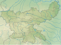
Cities, towns and locations in the Deoghar, Dumka and Jamtara districts in Santhal Pargana Division
M: Municipality, CT: census town, R: Rural/ Urban centre, D: Dam,
Owing to space constraints in the small map, the actual locations in a larger map may vary slightly

Location

Massanjore dam at 23°06′03″N87°19′31″E / 23.10083°N 87.32528°E / 23.10083; 87.32528 is about 36 kilometres (22 mi) upstream from Siuri in West Bengal and is about 34 kilometres (21 mi) from Dumka in Jharkhand.

Dam

It is 47.25 m high from its base and is 661.58 m long. The reservoir has an area of 67.4 square kilometres (16,650 acres) when full and has a storage capacity of 617,000,000 cubic metres (500,210 acre⋅ft). The length of the overflow section is 225.60 m and is controlled by 21 bays, each 9.144 m wide. The design discharge is 4.446 cumecs. The full reservoir level is 121.34 m and the flood level is 122.56 m. It cost Rs. 16.10 crore.

Canal

Mayurakshi Left Bank Canal- Length 20.54 kilometres (Lined Canal).

Mayurakshi Right Bank Canal-Yet to be constructed.

Finance

The dam was funded by the counterpart rupee fund created through supplies of wheat and other materials from Canada for use in India. Canada devoted those rupees to the further development of the Mayurakshi dam project. [3]

Flood reserve

Unfortunately, the Massanjore dam was not allowed to have a flood reserve. In 1956 the state government selectively took over flood control embankments till then maintained by the landlords or local bodies.

See also

Related Research Articles

<span class="mw-page-title-main">Dumka</span> City in Jharkhand, India

Dumka, the headquarters of the Dumka district and Santhal Pargana region, is a city in the state of Jharkhand, India. It was made the headquarters of the Santhal Pargana region, which was carved out of the Bhagalpur and Birbhum district after the Santal Hool of 1855. Dumka was carved out of the southern part of Bihar along with 18 other Districts on 15 November 2000 to form Jharkhand as 28th State of India. Dumka is a peaceful and green city and also sub-capital of Jharkhand. The nearest important cities are Rampurhat and Deoghar.

Mihijam is a town and a notified area in the Jamtara Sadar subdivision of the Jamtara district in the Indian state of Jharkhand.

<span class="mw-page-title-main">Mayurakshi River</span> Major river in Jharkhand and West Bengal, India

The Mayurakshi is a major river in Jharkhand and West Bengal, India, with a long history of devastating floods.

Ranishwar is a village in the Ranishwar CD block in the Dumka Sadar subdivision of the Dumka district in the Indian state of Jharkhand.

Palojori is a village in Palojori CD block in the Madhupur subdivision of the Deoghar district in the Indian state of Jharkhand.

Mohanpur is a village in Mohanpur CD block in the Deoghar subdivision of the Deoghar district in the Indian state of Jharkhand.

Jarmundi is a village in the Jarmundi CD block in the Dumka Sadar subdivision of Dumka district in the Indian state of Jharkhand.

Saraiyahat is a village in the Saraiyahat CD block in the Dumka Sadar subdivision of the Dumka district in the Indian state of Jharkhand.

Ramgarh is a village in the Ramgarh, Dumka CD block in the Dumka Sadar subdivision of the Dumka district in the Indian state of Jharkhand.

Gopikandar is a village in the Gopikandar CD block in the Dumka Sadar subdivision of the Dumka district in the Indian state of Jharkhand.

Kathikund is a village in the Kathikund CD block in the Dumka Sadar subdivision of the Dumka district in the Indian state of Jharkhand.

Shikaripara is a village in the Shikaripara CD block in the Dumka Sadar subdivision of the Dumka district in the Indian state of Jharkhand.

Jama is a village in the Jama community development block in the Dumka Sadar subdivision of the Dumka district in the Indian state of Jharkhand.

Masalia is a village in the Masalia, Dumka CD block in the Dumka Sadar subdivision of the Dumka district in the Indian state of Jharkhand.

Taljhari is a village in the Jarmundi CD block in the Dumka Sadar subdivision of the Dumka district in the Indian state of Jharkhand.

Tongra is a village in the Ranishwar CD block in the Dumka Sadar subdivision of the Dumka district in the Indian state of Jharkhand.

Rasikpur is a census town in Dumka CD block in Dumka subdivision of Dumka district in the Indian state of Jharkhand.

Purana Dumka is a census town in Dumka CD block in Dumka subdivision of Dumka district in the Indian state of Jharkhand.

Kundahit is a village in Kundhit CD block in the Jamtara Sadar subdivision of the Jamtara district in the Indian state of Jharkhand.

Bagdahari is a village in Kundhit CD block in the Jamtara Sadar subdivision of the Jamtara district in the Indian state of Jharkhand.

References

  1. "Canada Dam". This day that age. The Hindu 3 November 2005. Archived from the original on 17 February 2007. Retrieved 2017-05-06.{{cite web}}: CS1 maint: unfit URL (link)
  2. Mayurakshi Reservoir Project
  3. Cavell, Nik. "Canada and the Colombo Plan". Empire Club address. The Empire Club of Canada. Retrieved 2007-02-19.