Purana Dumka

Last updated

Purana Dumka
Purani Dumka
India Jharkhand location map.svg
Red pog.svg
Purana Dumka
Location in Jharkhand, India
India location map 3.png
Red pog.svg
Purana Dumka
Purana Dumka (India)
Coordinates: 24°15′23″N87°14′14″E / 24.256367°N 87.237278°E / 24.256367; 87.237278
CountryFlag of India.svg  India
State Jharkhand
District Dumka
Area
  Total1.15 km2 (0.44 sq mi)
Population
 (2011)
  Total10,034
  Density8,700/km2 (23,000/sq mi)
Languages (*For language details see Dumka (community development block)#Language and religion)
  Official Santali Hindi, Urdu
Time zone UTC+5:30 (IST)
PIN
814110
Telephone/ STD code06434
Lok Sabha constituency Dumka
Vidhan Sabha constituency Dumka
Website dumka.nic.in

Purana Dumka (also spelled as Purani Dumka) is a census town in Dumka CD block in Dumka subdivision of Dumka district in the Indian state of Jharkhand.

Contents

Geography

Purana Dumka
Cities, towns and locations in the Deoghar, Dumka and Jamtara districts in Santhal Pargana Division
M: Municipality, CT: census town, R: Rural/ Urban centre, D: Dam,
Owing to space constraints in the small map, the actual locations in a larger map may vary slightly

Location

Purana Dumka is located at 24°15′23″N87°14′14″E / 24.256367°N 87.237278°E / 24.256367; 87.237278 .

Overview

The map shows a large area, which is a plateau with low hills, except in the eastern portion where the Rajmahal hills intrude into this area and the Ramgarh hills are there. The south-western portion is just a rolling upland. The entire area is overwhelmingly rural with only small pockets of urbanisation. [1]

Note: The full screen map is interesting. All places marked on the map are linked in the full screen map and one can easily move on to another page of his/her choice. Enlarge the full screen map to see what else is there – one gets railway connections, many more road connections and so on.

Area

Purana Dumka has an area of 1.15 km2. [2]

Demographics

According to the 2011 Census of India, Purana Dumka had a total population of 10,034, of which 5,343 (53%) were males and 4,691 (47%) were females. Population in the age range 0–6 years was 1,387. The total number of literate persons in Purana Dumka was 8,647 (83.17% of the population over 6 years). [2]

Infrastructure

According to the District Census Handbook 2011, Dumka, Purani Dumka covered an area of 1.15 km2. Among the civic amenities, it had 50 km roads with both open and closed drains, the protected water supply involved uncovered well, hand pump. It had 1,591 domestic electric connections, 125 road light points. Among the medical facilities, it had 4 hospitals, 1 dispensary, 1 health centre, 1 family welfare centre, 2 maternity and child welfare centres, 2 maternity homes, 2 nursing home, 2 veterinary hospital, 1 medicine shop. Among the educational facilities it had 4 primary schools, 1 middle school. Two important items it produced were furniture, earthen pots. It had the branch offices of 1 nationalised bank, 1 agricultural credit society. [3]

Transport

Dumka railway station, on the Jasidih-Dumka-Rampurhat line, is located nearby. [4]

Related Research Articles

<span class="mw-page-title-main">Rampurhat</span> City in West Bengal, India

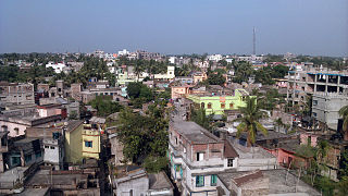
Rampurhat is a city and a municipality in Birbhum district in the Indian state of West Bengal. It is the headquarters of the Rampurhat subdivision. According to Census 2011 Rampurhat is the third most populous city in Birbhum district and 82nd most populous city in West Bengal. Rampurhat is a rapidly growing township It is near the West Bengal / Jharkhand border. Rampuhat is an important city of Birbhum district as it has dynamic connectivity with the other places of West Bengal and neighboring states via state highways, national highway and rail route. Rampurhat Junction is one of the busiest railway stations in eastern India.

<span class="mw-page-title-main">Basukinath</span> Town in Jharkhand, India

Basukinath is a town and notified area in the Dumka, Jharkhand, India.

Saraiyahat is a community development blocks that forms an administrative division in the Dumka Sadar subdivision of the Dumka district, Jharkhand state.

Jarmundi is a community development block that forms an administrative division in the Dumka Sadar subdivision of the Dumka district, Jharkhand state, India.

<span class="mw-page-title-main">Shikaripara</span> Community development block in Jharkhand, India

Shikaripara is a community development block in India that forms an administrative division in the Dumka Sadar subdivision of the Dumka district, Jharkhand state, India.

<span class="mw-page-title-main">Dumka (community development block)</span> Community development block in Jharkhand, India

Dumka is a community development block that forms an administrative division in the Dumka Sadar subdivision of the Dumka district, Jharkhand state, India.

Jama is a community development block that forms an administrative division in the Dumka Sadar subdivision of the Dumka district, Jharkhand state, India.

Mohanpur is a community development block that forms an administrative division in the Deoghar subdivision of the Deoghar district, Jharkhand state, India.

Chakmandala is a village in Rampurhat I CD Block in Rampurhat subdivision of Birbhum district in the Indian state of West Bengal

Ambhua is a census town in Murarai I CD block in Rampurhat subdivision of Birbhum district.

Bishnupur is a census town in Rampurhat II CD block in Rampurhat subdivision of Birbhum district.

Ranishwar is a village in the Ranishwar CD block in the Dumka Sadar subdivision of the Dumka district in the Indian state of Jharkhand.

Mohanpur is a village in Mohanpur CD block in the Deoghar subdivision of the Deoghar district in the Indian state of Jharkhand.

Jarmundi is a village in the Jarmundi CD block in the Dumka Sadar subdivision of Dumka district in the Indian state of Jharkhand.

Shikaripara is a village in the Shikaripara CD block in the Dumka Sadar subdivision of the Dumka district in the Indian state of Jharkhand.

Taljhari is a village in the Jarmundi CD block in the Dumka Sadar subdivision of the Dumka district in the Indian state of Jharkhand.

Rasikpur is a census town in Dumka CD block in Dumka subdivision of Dumka district in the Indian state of Jharkhand.

Dudhani is a census town in Dumka CD block in Dumka subdivision of Dumka district in the Indian state of Jharkhand.

Borio is a census town in the Borio CD block in the Sahibganj subdivision of the Sahibganj district in the Indian state of Jharkhand.

<span class="mw-page-title-main">Deoghar subdivision</span> Subdivision in Jharkhand, India

Deoghar subdivision is an administrative subdivision of the Deoghar district in the Santhal Pargana division in the state of Jharkhand, India.

References

  1. Roychoudhury, P.C. "Bihar District Gazetteers: Santhal Parganas". Chapter I: General. Secretariat Press, Patna, 1965. Retrieved 10 November 2020.
  2. 1 2 "District Census Handbook, Dumka, Series 21, Part XII B" (PDF). Page 25: District Primary Census Abstract, 2011 census. Directorate of Census Operations Jharkhand. Retrieved 8 November 2020.
  3. "District Census Handbook Dumka, Census of India 2011, Series 20, Part XII A" (PDF). 705-709. Directorate of census Operations, Jharkhand. Retrieved 8 November 2020.
  4. "Rampurhat-Jasidih Passenger". Time Table. IndiaRailInfo. Retrieved 8 November 2020.