Basudih | |
|---|---|
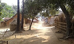
Village | |
 Basudih Location in Jamtara, Jharkhand  Basudih Basudih (India) | |
| Coordinates: 23°58′59″N87°06′09″E / 23.98298°N 87.10255°E | |
| Country | |
| State | Jharkhand |
| District | Jamtara |
| Established | 1990 |
| Founded by | Shree Brajamohan Maji |
| Area | |
• Total | 5 km2 (1.9 sq mi) |
| Elevation | 155 m (509 ft) |
| Population (2001) | |
• Total | 500 |
| • Density | 100/km2 (260/sq mi) |
| Languages (*For language details see Nala block#Language and religion) | |
| • Official | Hindi, Urdu |
| Time zone | UTC+5:30 (IST) |
| PIN | 815359 |
| Telephone code | 06428 |
| Vehicle registration | JH-21 |
| Sex ratio | 959 ♂/♀ |
| Website | welcometobasudih |
Basudih is a village in Nala block, Jamtara district, Jharkhand state, India has a Population (2001 Census) of 500 in about 50 families.