Rajrappa

Last updated
Rajrappa Falls
Maa Chhinnamasta Temple.jpg
Maa Chhinnamasta temple
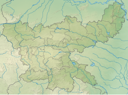
India Jharkhand relief map.svg
Red pog.svg
Rajrappa Falls
Rajrappa
Location Ramgarh district, Jharkhand, India
Coordinates 23°37′55″N85°42′40″E / 23.63194°N 85.71111°E / 23.63194; 85.71111
Elevation346 metres (1,135 ft)
Total height9.1 metres (30 ft)
WatercourseBhairavi River

Rajrappa is a waterfall and a pilgrimage centre in the Chitarpur CD block in the Ramgarh subdivision of the Ramgarh district in the Indian state of Jharkhand.
Contents

Geography

Invisible Square.svg
Mapscaleline.svg
8km
5miles
Red pog.svg
Bhairavi
River
Damodar
River
Bokaro
River
CCL Rajrappa Area
Invisible Square.svg
CCL Kuju Area
Invisible Square.svg
CCL
Hazaribagh Area
Invisible Square.svg
CCL Argada Area
Invisible Square.svg
CCL Barka
Sayal Area
Invisible Square.svg
Patratu
Super TPP
P
Invisible Square.svg
Rajrappa
T
Gola
R
Invisible Square.svg
Ghatotand
R
Invisible Square.svg
Dulmi
R
Invisible Square.svg
Bhurkunda
R
Invisible Square.svg
Bhadani Nagar
R
Invisible Square.svg
Ramgarh Cantonment
M
Invisible Square.svg
Topa
CTV
Invisible Square.svg
Taping
CT
Invisible Square.svg
Sirka
CT
Invisible Square.svg
Sewai
CT
Invisible Square.svg
Seota
CT
Invisible Square.svg
Saunda
CT
Invisible Square.svg
Sanri
CT
Invisible Square.svg
Patratu
CT
Invisible Square.svg
Orla
CT
Invisible Square.svg
Marar
CT
Invisible Square.svg
Mandu
CT
Invisible Square.svg
Lapanga
CT
Invisible Square.svg
Kuju
CT
Invisible Square.svg
Kedla
CT
Invisible Square.svg
Jainagar
CT
Invisible Square.svg
Hesla
CT
Invisible Square.svg
Chitarpur
CT
Invisible Square.svg
Bongabar
CT
Invisible Square.svg
Barughutu
CT
Invisible Square.svg
Ara
CT
Invisible Square.svg
Cities, towns and locations in Ramgarh district in North Chotanagpur Division
M: municipality, CT: census town, R: rural/ urban centre, T: tourist centre, P: power plant
Abbreviation used- TPP: thermal power project
Owing to space constraints in the small map, the actual locations in a larger map may vary slightly

Location

Rajrappa is located at 23°37′55″N85°42′40″E / 23.632°N 85.711°E / 23.632; 85.711 .

Rajrappa stands at the confluence of the Damodar and Bhairavi (locally called Bhera) rivers. [1]

Rajrappa is located off NH 23 connecting Ramgarh and Chas. It is 20 kilometres (12 mi) from Ramgarh, [2] 65 kilometres (40 mi) from Hazaribagh, [3] 70 kilometres (43 mi) from Ranchi and 68 kilometres (42 mi) from Bokaro Steel City. [1]

Note: The map alongside presents some of the notable locations in the district. All places marked in the map are linked in the larger full screen map.

Waterfalls

A view of Bhera river at its confluence with river Damodar Near Rajrappa falls Ramgarh Jharkhand India.jpg
A view of Bhera river at its confluence with river Damodar

The Bhera or Bhairavi joins the Damodar, falling from a height of 9.1 metres (30 ft). [1] [4]

Geographical significance

Rajrappa Falls has tremendous geographical significance. The Damodar valley at Rajrappa is a typical example of polycyclic valley or topographic discordance which is characterized by two storey valley. The Damodar developed its broad and flat valley of senile stage before the onset of Tertiary upliftment. The river was rejuvenated due to upliftment of landmass during the Paleogene and Neogene Periods (66 million to 1.8 million years ago) by the side effects of the Himalayan orogeny and thus the Damodar excavated its new deep and narrow valley of youthful stage within its broad and flat valley of senile stage. The Bhera river coming from over the Ranchi plateau makes a waterfall while joining the Damodar and thus presents an example of a hanging valley. The Damodar gorge near Rajrappa is a typical example of incised meander. [5]

Pilgrimage centre

Rajrappa is a Hindu pilgrimage centre attracting an estimated 2,500-3,000 persons daily. [3] The main attraction of the Chhinnamasta (also known as Chinnamastika) temple located here is the headless deity of goddess Chinnamasta which stands on the body of Kamdev and Rati in the lotus bed. The Chhinnamasta temple is very popular for its Tantrik style of architectural design. The temple is very old but has that essence of enchantment. [6] Apart from the main temple, there are ten temples of various gods and goddesses such as the Sun God and Lord Shiva. [2] Animal sacrifice is still practised in the temple. The sacrifice is offered on Tuesdays and Saturdays and during Kali puja. [7]

Rajrappa also is a pilgrim centre for the Santals and other tribals who come for immersion of the ashes of their loved ones in the Damodar. They come mostly during the month of December, in groups known as yatri. As per their mythology it is their final resting place. In their folk songs Rajrappa is referred to as "Thel Kopi Ghat" (Water Ghat) and they use oil after bathing. They come in significant numbers from the southern parts of Jharkhand state such as East and West Singhbhum and Saraikela districts.

In popular culture Chinnamasta is featured in the detective story of Bengali novel Feluda series "Chhinnamastar Abhishap" by the renowned filmmaker Satyajit Ray.

Civic administration

Police station

Rajrappa police station serves Chitarpur CD block. [8]

Economy

Coal mining

Invisible Square.svg
Mapscaleline.svg
5km
3miles
Red pog.svg
Bhera River
Damodar River
Maa Chhinamasta
Temple
H
Invisible Square.svg
Rajrappa
Waterfall
H
Chitarpur
CT
Invisible Square.svg
CCL Rajrappa Area Office
A
Invisible Square.svg
Rajrappa washery
W
Rajrappa colliery
O
Burakhap colliery
O
Karma colliery
O
Rajrappa
Collieries in the CCL Ramgarh Coalfield
U: Underground colliery, O: Open Cast colliery, M: Mixed colliery, W: Washery, S: Facility, A: Administrative headquarters, CT: census town, H: historical, religious, tourist centre
Owing to space constraints in the small map, the actual locations in a larger map may vary slightly

Rajrappa Area of Central Coalfields Limited (CCL), a subsidiary of Coal India Limited, is located in Ramgarh Coalfield. It is one of the biggest coal-fields in this region. It is widely known as the Rajrappa Project, which consist of the main quarry (a huge open cast mine), offices, colonies, recreation facilities, shopping complexes, a police out-post and public utility buildings. It is a complete township in itself. [7]

Education

See also

Related Research Articles

Bujurg Jamira is a town in the Patratu CD block in the Ramgarh subdivision of the Ramgarh district in the Indian state of Jharkhand.

Barughutu is a census town in the Mandu CD block in the Ramgarh subdivision of the Ramgarh district in the state of Jharkhand, India. Barughutu is adjacent to Ghatotand, where Tata Steel's West Bokaro Colliery is situated.

Kedla is a census town in the Mandu CD block in the Ramgarh subdivision of the Ramgarh district in the Indian state of Jharkhand.

Kuju is a census town in the Mandu CD block in the Ramgarh subdivision of the Ramgarh district in the Indian state of Jharkhand.

Orla is a census town in the Mandu CD block in the Ramgarh subdivision of the Ramgarh district in the Indian state of Jharkhand.

Ramgarh Coalfield are located in Ramgarh district in the Indian state of Jharkhand.

Bhurkunda is a town in the Patratu CD block in the Ramgarh subdivision of the Ramgarh district in Jharkhand, India.

Chitarpur is a census town in the Chitarpur CD block in the Ramgarh subdivision of the Ramgarh district in the Indian state of Jharkhand.

Kuju Area is one of the operational areas of the Central Coalfields Limited located mainly in the Ramgarh district in the state of Jharkhand, India.

Rajrappa Area is one of the operational areas of the Central Coalfields Limited located in the Ramgarh district in the state of Jharkhand, India.

Gola is a village in the Gola CD block in the Ramgarh subdivision of the Ramgarh district in the Indian state of Jharkhand.

Dulmi is a village in the Dulmi CD block in the Ramgarh subdivision of the Ramgarh district in the Indian state of Jharkhand.

Jainagar is a census town in the Patratu CD block in the Ramgarh subdivision of the Ramgarh district in the Indian state of Jharkhand.

<span class="mw-page-title-main">Hesla, Ramgarh</span> Census Town in Jharkhand, India

Hesla is a census town in the Patratu CD block in the Ramgarh subdivision of the Ramgarh district in the Indian state of Jharkhand.

Lapanga is a census town in the Patratu CD block in the Ramgarh subdivision of the Ramgarh district in the Indian state of Jharkhand.

Taping is a census town in the Mandu CD block in the Ramgarh subdivision of the Ramgarh district in the Indian state of Jharkhand.

Sanri is a census town in the Mandu CD block in the Ramgarh subdivision of the Ramgarh district in the Indian state of Jharkhand.

Bongabar is a census town in the Mandu CD block in the Ramgarh subdivision of the Ramgarh district in the Indian state of Jharkhand.

Seota is a census town in the Mandu CD block in the Ramgarh subdivision of the Ramgarh district in the Indian state of Jharkhand.

Marar is a census town in the Ramgarh CD block in the Ramgarh subdivision of the Ramgarh district in the Indian state of Jharkhand.

References

  1. 1 2 3 "Rajrappa Falls". india9. Retrieved 2010-04-20.
  2. 1 2 "Rajrappa temple". Ramgarh district administration. Retrieved 2010-04-20.
  3. 1 2 "Rajrappa". Hazaribagh district administration. Retrieved 2010-04-20.
  4. Dr. B.R. Kishore, Dr. Shiv Sharma (2008). India - A Travel Guide. Diamond Pocket Books (P) Ltd. p. 301. ISBN   9788128400674.
  5. Bukhari, A. Z. (2005). Encyclopedia of nature of geography By A.Z. Bukhari. ISBN   9788126124435 . Retrieved 2010-04-29.
  6. "Attractions at Rajrappa". mapsofindia. Archived from the original on 2011-06-22. Retrieved 2010-04-20.
  7. 1 2 "Next weekend you can be at ... Rajrappa". The Telegraph, 23 September 2009. Archived from the original on February 26, 2010. Retrieved 2009-09-23.
  8. "District Police Profile - Ramgarh". Jharkhand Police. Retrieved 6 February 2021.
External videos
Nuvola apps kaboodle.svg Rajrappa or Chhinnamasta temple
Nuvola apps kaboodle.svg Floods at Rajrappa