North Karanpura Coalfield

Last updated
North Karanpura Coalfield
Location
India Jharkhand location map.svg
Schlaegel und Eisen nach DIN 21800.svg
North Karanpura
Location in Jharkhand
State Jharkhand
Country India
Coordinates 23°43′41″N85°30′22″E / 23.72806°N 85.50611°E / 23.72806; 85.50611 Coordinates: 23°43′41″N85°30′22″E / 23.72806°N 85.50611°E / 23.72806; 85.50611
Owner
Company Central Coalfields Limited
Website http://ccl.gov.in/
Year of acquisition1975

North Karanpura Coalfield is located in Ranchi, Hazaribagh, Chatra and Latehar districts in the Indian state of Jharkhand.

Contents

Overview

In 1917, L.S.S.O’Malley described the coalfields in the upper reaches of the Damodar as follows: "Near the western boundary of Jharia field is that of Bokaro, covering" 220 square miles (570 km2), "with an estimated content of 1,500 million tons; close by… is the Ramgarh field (40 square miles), in which, however, coal is believed to be of inferior quality. A still larger field in the same district is that called Karanpura, which extends over" 544 square miles (1,410 km2) "and has an estimated capacity of 9,000 million tons." [1]

The Coalfield

There are large numbers of seams in the North Karanpura Coalfield, some with thicknesses over 72 feet. [2]

North Karnpura Coalfield covers an area of 1,230 square kilometres (470 sq mi) and has total coal reserves of 13,110.84 million tonnes. [3]

Collieries in the North Karanpura Coalfield except the North Karanpura Area
U: Underground colliery, O: Open Cast colliery, A: Administrative headquarters, CT: census town, R: rural/urban centre
Location of new mine sites are approximate
Owing to space constraints in the small map, the actual locations in a larger map may vary slightly
Collieries in the CCL North Karanpura Area (North Karanpura Coalfield)
U: Underground colliery, O: Open Cast colliery, W: Washery, A: Administrative headquarters, CT: census town
Owing to space constraints in the small map, the actual locations in a larger map may vary slightly

Reserves

Geological reserves in the North Karanpura Coalfield in million tonnes as on 1/4/2010: [4]

Type of CoalProvedIndicatedInferred
(exploration)
Total
Medium coking coal508.672799.84413.433,721.24
Non-coking coal8990.752,909.721,451.5313,352.00
Total9,499.425,708.861,864.9617,073.24

Projects

CCL Operational AreaProjects
North Karanpura Area Churi underground, Dakra Bukbuka opencast, K.D.H. opencast, Karkatta opencast, Rohini opencast, Purnadih opencast. [5]
Piparwar Area Piparwar opencast, Ray-Bachra underground, Ashoka opencast, Piparwar coal handling plant/ coal preparation plant. [6]
Magadh Sanghamitra Area Magadh open cast project, Sanghamitra open cast project. [7] [8]
Amrapali & Chandragupta Area Amrapali open cast project, Chandragupta open cast project. [9] [10]

Transport

In 1927, Bengal Nagpur Railway opened the 72-mile (116 km) Barkakana-Muri-Chandil line to traffic. In the same year the Central India Coalfields Railway opened the Gomoh-Barkakana line. It was extended to Daltonganj in 1929. Later these lines were amalgamated with East India Railway. [11] The 57 km long Hazaribagh-Barkakana section of the Koderma-Hazaribagh-Barkakana-Ranchi line was opened for passenger trains on 7 December 2016 by the railway minister Suresh Prabhu in the presence of chief minister Raghubar Das. [12]

Coal-bed methane

ONGC's preliminary assessment of coal-bed methane indicates that four Damodar Valley coalfields – Jharia, Bokaro, North Karanpura and Raniganj – to be the most prospective. [13]

See also

Related Research Articles

Barkakana is a census town in the Patratu CD block in the Ramgarh subdivision of the Ramgarh district in the state of Jharkhand, India.

Phusro is a nagar parishad in the Bermo subdivision of the Bokaro district in the Indian state of Jharkhand. It is situated about 35 kilometres (22 mi) from the district headquarters of Bokaro district. Damodar River passes through it.

<span class="mw-page-title-main">Ramgarh district</span> District of Jharkhand in India

Ramgarh district is one of the 24 districts in the Indian state of Jharkhand. It was also a military district during the British Regime, referred to then as Ramgarh district.

<span class="mw-page-title-main">Central Coalfields</span> Subsidiary of Coal India Limited

Central Coalfields Limited (CCL) is a subsidiary of Coal India Limited (CIL), an undertaking of the Government of India. CCL was established in 1956 as National Coal Development Corporation Limited and is a Category-I Mini Ratna company since October 2007. CCL manages the nationalized coal mines of the Coal Mines Authority, Central division. CCL is headquartered at Darbhanga House, Ranchi, Jharkhand.

South Karanpura Coalfield is located in Ramgarh district in the Indian state of Jharkhand.

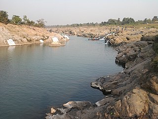
Ramgarh Coalfield are located in Ramgarh district in the Indian state of Jharkhand.

West Bokaro Coalfield is located mostly in Ramgarh district and partly in Hazaribagh district in the Indian state of Jharkhand.

East Bokaro Coalfield is located in Bokaro district in the Indian state of Jharkhand.

Bhurkunda is a town in the Patratu CD block in the Ramgarh subdivision of the Ramgarh district in Jharkhand, India.

Bachra is a census town in the Tandwa CD block in the Simaria subdivision of the Chatra district in the state of Jharkhand, India.

Bokaro and Kargali Area is one of the operational areas of the Central Coalfields Limited located mainly in the Bokaro district and partly in the Giridih district, both in the state of Jharkhand, India.

Hazaribagh Area is one of the operational areas of the Central Coalfields Limited located mainly in the Hazaribagh and Ramgarh districts in the state of Jharkhand, India.

Argada Area is one of the operational areas of the Central Coalfields Limited located in the Ramgarh and Hazaribagh districts in the state of Jharkhand, India.

Rajrappa Area is one of the operational areas of the Central Coalfields Limited located in the Ramgarh district in the state of Jharkhand, India.

North Karanpura Area is one of the operational areas of the Central Coalfields Limited located in the Ranchi district in the state of Jharkhand, India.

Piparwar Area is one of the operational areas of the Central Coalfields Limited located mainly in the Chatra district and marginally in the Ranchi district in the state of Jharkhand, India.

Tandwa is a village in the Tandwa CD block in the Simaria subdivision of the Chatra district in the Indian state of Jharkhand.

Piparwar is a village in the Tandwa CD block in the Simaria subdivision of the Chatra district in the Indian state of Jharkhand.

Amrapali & Chandragupta Area is one of the operational areas of the Central Coalfields Limited located in the Tandwa CD block of the Chatra district and the Keredari CD block in the Hazaribagh district in the state of Jharkhand, India.

<span class="mw-page-title-main">Mesra, Ranchi</span> Village in Jharkhand, India

Mesra is a village in the Kanke CD block in the Ranchi Sadar subdivision of the Ranchi district in the Indian state of Jharkhand.

References

  1. L.S.S. O’Malley, Bengal, Bihar and Orissa, Sikkim, p.87, Cambridge University Press, 1917 (paper back 2011) ISBN   978-1-107-60064-5
  2. "The Hazaribagh District" (PDF). Geology and Mineral Resources. Retrieved 2008-08-26.
  3. Prasoon Kumar Singh, Gurdeep Singh and Brajendra Kumar Tiwary. "Critical Evaluation of Geo-Environmental Scenario of Damodar River Basin, Inia" (PDF). Retrieved 2008-08-26.[ permanent dead link ]
  4. "Inventory of Geological Resource of India Coal" (PDF). CMPDI. Retrieved 27 December 2020.
  5. "Central Coalfields Limited". Areas – North Karanpura. CCL. Retrieved 27 December 2020.
  6. "Central Coalfields Limited". Areas – Piparwar. CCL. Retrieved 1 January 2021.
  7. "Environmental Statement 2015-16, Magadh Open Cast Project" (PDF). Central Coalfields Limited. Retrieved 15 January 2021.
  8. "Central Coalfields invites bids for operationalisation of Sanghamitra OCP". Projects Today, 6 July 2020. Retrieved 15 January 2021.
  9. "Pre-feasibility report of Amrapali OCO (12 MTPA)" (PDF). CCL. Retrieved 27 December 2020.
  10. "बहुप्रतीक्षित सीसीएल की चंद्रगुप्त कोल माइंस केरेडारी प्रखंड में खुलने की तैयारी में (Preparations on for opening of the much-awaited Chandragupta Coal Mines in Keredari Block)". in Hindi. livehindustan.com, 5 September 2020. Retrieved 15 January 2021.
  11. "Indian Railway History Timeline". Archived from the original on 2012-07-14. Retrieved 2008-08-26.
  12. "Hazaribagh-Barkakana railway line opened for traffic". Business Standard, 7 December 2016. Retrieved 16 January 2021.
  13. "Coal Bed Methane" (PDF). CBM Potential in India. Eastern Coalfields Limited. Retrieved 2008-08-26.