List of coalfields

Last updated

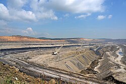
A coalfield is an area of certain uniform characteristics where coal is mined. The criteria for determining the approximate boundary of a coalfield are geographical and cultural, in addition to geological. A coalfield often groups the seams of coal, railroad companies, cultural groups, and watersheds and other geographical considerations. At one time the coalfield designation was an important category in business and industrial discussions. The terminology declined into unimportance as the 20th century progressed, and was probably only referred to by a few small railroads and history buffs by the 1980s. Renewed interest in industrial heritage and coal mining history has brought the old names of the coalfields before a larger audience.

Contents

Australia

New South Wales

Queensland

Victoria

Western Australia

Belgium

Canada

Coalfields of Germany, Belgium, the Netherlands and Northern France CoalDNLBF.png
Coalfields of Germany, Belgium, the Netherlands and Northern France

Chile

China

Colombia

Colombia has the largest coal reserves in Latin America and is a major exporter.

France

Germany

Great Britain

British.coalfields.19th.century.jpg

[1]

England

Scotland

Wales

India

Japan

Hokkaidō

Honshū

Kyūshū

New Zealand

The Netherlands

Pakistan

Poland

Russia

South Africa

Ukraine

United States

Coalfields in the West The American Museum journal (c1900-(1918)) (17972851040).jpg
Coalfields in the West

Alabama

Alaska

Arkansas

Colorado

Illinois

Indiana

Iowa

Kansas

Kentucky

Maryland

North Carolina

Ohio

Oklahoma

Oregon

Pennsylvania

Tennessee

Utah

Virginia

West Virginia

Wyoming

Venezuela

See also

Related Research Articles

<span class="mw-page-title-main">Newport Township, Pennsylvania</span> First Class Township in Pennsylvania, United States

Newport Township is a township in Luzerne County, Pennsylvania, United States. As of 2020, the population was 4,444. Newport is located on the outskirts of Nanticoke City.

<span class="mw-page-title-main">Coal Region</span> Pennsylvania region

The Coal Region is a region of Northeastern Pennsylvania. It is known for being home to the largest known deposits of anthracite coal in the world with an estimated reserve of seven billion short tons.

The History of coal mining goes back thousands of years, with early mines documented in ancient China, the Roman Empire and other early historical economies. It became important in the Industrial Revolution of the 19th and 20th centuries, when it was primarily used to power steam engines, heat buildings and generate electricity. Coal mining continues as an important economic activity today, but has begun to decline due to the strong contribution coal plays in global warming and environmental issues, which result in decreasing demand and in some geographies, peak coal.

<span class="mw-page-title-main">South Wales Coalfield</span> Region of Wales rich in coal deposits

The South Wales Coalfield extends across Pembrokeshire, Carmarthenshire, Swansea, Neath Port Talbot, Bridgend, Rhondda Cynon Taf, Merthyr Tydfil, Caerphilly, Blaenau Gwent and Torfaen. It is rich in coal deposits, especially in the South Wales Valleys.

<span class="mw-page-title-main">Geology of Wales</span>

The geology of Wales is complex and varied; its study has been of considerable historical significance in the development of geology as a science. All geological periods from the Cryogenian to the Jurassic are represented at outcrop, whilst younger sedimentary rocks occur beneath the seas immediately off the Welsh coast. The effects of two mountain-building episodes have left their mark in the faulting and folding of much of the Palaeozoic rock sequence. Superficial deposits and landforms created during the present Quaternary period by water and ice are also plentiful and contribute to a remarkably diverse landscape of mountains, hills and coastal plains.

<span class="mw-page-title-main">Geology of Pennsylvania</span>

The Geology of Pennsylvania consists of six distinct physiographic provinces, three of which are subdivided into different sections. Each province has its own economic advantages and geologic hazards and plays an important role in shaping everyday life in the state. From the southeast corner to the northwest corner of the state, they include: the Atlantic Plain Province, the Piedmont Province, the New England Province, the Ridge and Valley Province, the Appalachain Province, and the Central Lowlands Province.

<span class="mw-page-title-main">Llewellyn Formation</span>

The Llewellyn Formation is a mapped bedrock unit in eastern Pennsylvania. It was previously known as the "coal measures" and the post-Pottsville rocks. The formation is named for the community of Llewellyn in Schuylkill County.

Coal mining regions are significant resource extraction industries in many parts of the world. They provide a large amount of the fossil fuel energy in the world economy.

<span class="mw-page-title-main">History of coal mining in the United States</span>

The history of coal mining in the United States starts with the first commercial use in 1701, within the Manakin-Sabot area of Richmond, Virginia. Coal was the dominant power source in the late 1800s and early 1900s, and although in rapid decline it remains a significant source of energy in 2024.

<span class="mw-page-title-main">Bristol Coalfield</span> Coalfield in west England

The Bristol Coalfield is a geologically complex coalfield in the west of England. Comprising the coal-bearing rocks arranged around the Coalpit Heath Syncline and Kingsdown Anticline, it extends beneath the eastern parts of the city of Bristol and northwards through southern Gloucestershire. The coalfield is sometimes referred to together with the Somerset Coalfield, which lies to its south, as the Bristol and Somerset Coalfield. There are also two outlying coal-mining areas, the Severn Coalfield and the Nailsea Basin which are described below.

The Coal Measures Group is a lithostratigraphical term coined to refer to the coal-bearing succession of rock strata which occur in the United Kingdom within the Westphalian Stage of the Carboniferous Period. The succession was previously referred to as the 'Productive Coal Measures'. Other than in Northern Ireland the term is now obsolete in formal use and is replaced by the Pennine Coal Measures Group, Scottish Coal Measures Group and the South Wales Coal Measures Group for the three distinct depositional provinces of the British mainland.

Wardha Valley Coalfield is located mainly in Chandrapur district in the Vidarbha region of the Indian state of Maharashtra.

<span class="mw-page-title-main">Godavari Valley Coalfield</span> Mine in Telangana, India

Godavari Valley Coalfield is located in the districts of Adilabad, Karimnagar, Khammam and Warangal in the Indian state of Telangana. It is the only coalfield in South India. It lies in the basin of the Godavari River.

<span class="mw-page-title-main">Pisgah Mountain</span> Ridgeline in Pennsylvania

Pisgah Mountain, or Pisgah Ridge on older USGS maps, is a ridgeline running 12.5 miles (20.1 km) from Tamaqua to Jim Thorpe, Pennsylvania from the Little Schuylkill River water gap to the Lehigh River water gap.

<span class="mw-page-title-main">Solomon Creek</span> River of the Susquehanna River, Pennsylvania

Solomon Creek is a tributary of the Susquehanna River in Luzerne County, Pennsylvania, in the United States. It is approximately 8.8 miles (14.2 km) long and flows through Fairview Township, Hanover Township, and Wilkes-Barre. The creek is affected by acid mine drainage and has significant loads of iron, aluminum, and manganese. The creek's named tributaries are Spring Run, Sugar Notch Run, and Pine Creek. The Solomon Creek watershed is located in the Anthracite Valley section of the ridge-and-valley geographical province. Major rock formations in the watershed include the Mauch Chunk Formation, the Spechty Kopf Formation, and the Catskill Formation.

Little Black Creek is a tributary of Black Creek in Luzerne County, Pennsylvania, in the United States. It is approximately 2.2 miles (3.5 km) long and flows through Lattimer, Harleigh, and Hazle Township. The watershed of the creek is largely on coal mining land. It only has an intermittent flow and some of its waters drain into the Jeddo Tunnel instead of Black Creek. The creek is in the Eastern Middle Anthracite Field. There is at least one bridge crossing the creek.

<span class="mw-page-title-main">Nanticoke Creek</span> River in the United States of America

Nanticoke Creek is a tributary of the Susquehanna River in Luzerne County, Pennsylvania, in the United States. It is approximately 4.4 miles (7.1 km) long and flows through Hanover Township and Nanticoke. The watershed of the creek has an area of 7.57 square miles (19.6 km2). The creek has one named tributary, which is known as Espy Run. Nanticoke Creek impaired by pH and metals due to abandoned mine drainage. Abandoned mine drainage discharges in the creek's watershed include the Truesdale Mine Discharge and the Askam Borehole. The creek is located in the Northern Middle Anthracite Field and is in the Anthracite Valley Section of the ridge and valley physiographic province. The main rock formations in the watershed include the Mauch Chunk Formation, the Pottsville Group, and the Llewellyn Formation. The surficial geology consists of coal dumps, surface mining land, alluvium, Wisconsinan Outwash, Wisconsinan Till, urban land, and bedrock.

<span class="mw-page-title-main">Richmond Basin</span>

The Richmond Basin was one of the Eastern North America Rift Basins. It lies over Swift Creek Reservoir from Interstate 64 to the Appomattox River.

<span class="mw-page-title-main">Geology of North Korea</span>

The geology of North Korea has been studied by the Central Geological Survey of Mineral Resources, rare international research, and by inference from South Korea's geology.

References

Notes

  1. "BGS Report, single column layout" (PDF). Nora.nerc.ac.uk. Retrieved 26 January 2017.
  2. "A lithostratigraphical framework for the Carboniferous successions of southern Great Britain (onshore)" (PDF). Nora.nerc.ac.uk. Retrieved 26 January 2017.
  3. "Archived copy" (PDF). www.og.decc.gov.uk. Archived from the original (PDF) on 11 May 2015. Retrieved 14 January 2022.{{cite web}}: CS1 maint: archived copy as title (link)
  4. "UK COAL RESOURCE FOR NEW EXPLOITATION TECHNOLOGIES : Mining and New Technologies Summary Map" (PDF). Ukogl.org.uk. Retrieved 26 January 2017.
  5. E. G. POOLE (6 August 1971). "The Oxfordshire Coalfield". Nature. 232 (5310): 394–395. Bibcode:1971Natur.232..394P. doi:10.1038/232394a0. PMID   16063056 . Retrieved 26 January 2017.
  6. Kingsley G. Dunham And Einar G. Poole (21 February 1974). "The Oxfordshire Coalfield". Jgs.lyellcollection.org. Retrieved 26 January 2017.
  7. 1 2 3 4 5 6 "About SA coalfields". Keaton Energy. Archived from the original on 14 June 2009. Retrieved 15 January 2010.
  8. 1 2 "COAL". Pakistaneconomist.com. Retrieved 26 January 2017.
  9. "Pakistan Mineral Development Corporation". www.pmdc.gov.pk. Archived from the original on 26 August 2001. Retrieved 14 January 2022.
  10. "Coal Mining in Pakistan – Overview". Mbendi.co.za. 10 October 2016. Retrieved 26 January 2017.
  11. "Archived copy". www.pakistan.gov.pk. Archived from the original on 24 October 2007. Retrieved 14 January 2022.{{cite web}}: CS1 maint: archived copy as title (link)
  12. "USTDA Grant to Support Integrated Coal Mining, Power Generation Project in Pakistan - U.S. Embassy Islamabad Pakistan". islamabad.usembassy.gov. Archived from the original on 2 November 2007. Retrieved 14 January 2022.