Traeth Coch is a wide sandy bay and an area of outstanding natural beauty on the east coast of the island of Anglesey in Wales. The bay is also known in English as Red Wharf Bay and lies between the villages of Pentraeth and Benllech. It is also close to Castell Mawr Rock, thought to be the site of an Iron Age fort.

Crynant is a village and community in the Dulais Valley in Wales. It lies 7¾ miles north-east from the town of Neath in Neath Port Talbot, lying between the mountains of Mynydd Marchywel to the west, Hirfynydd to the east and Mynydd y Drum to the north.

The River Rhondda is a river in South Wales with two major tributaries, Rhondda Fawr and Rhondda Fach.

The Isle of Anglesey County Council is the governing body for the county of Anglesey, one of the unitary authority areas of Wales. The council has 30 councillors who represent 11 multi-member electoral wards.

Malltraeth (origin: Mall is a small village in the southwest of Anglesey, in the community of Bodorgan. It is now at the end of a large bay, which used to extend much further inland, almost creating a second sea strait in the area. The population as of the 2011 census was only 255.
The geology of Wales is complex and varied; its study has been of considerable historical significance in the development of geology as a science. All geological periods from the Cryogenian to the Jurassic are represented at outcrop, whilst younger sedimentary rocks occur beneath the seas immediately off the Welsh coast. The effects of two mountain-building episodes have left their mark in the faulting and folding of much of the Palaeozoic rock sequence. Superficial deposits and landforms created during the present Quaternary period by water and ice are also plentiful and contribute to a remarkably diverse landscape of mountains, hills and coastal plains.
Gaerwen is a village on the island of Anglesey in the community of Llanfihangel Ysgeifiog. It is located in the south of the island 4 miles (6.4 km) west of Llanfairpwllgwyngyll and 4 miles (6.4 km) southeast of Llangefni. The A5 runs through the village, and the A55 runs just a few hundred metres north. According to the 2011 Census Gaerwen is now listed by the Office for National Statistics as Llanfihangel Ysgeifiog. The population of the community is 1,551. Gaerwen and Pentre Berw, Llangaffo are trio villages.

Afon Cefni is one of the major rivers on the island of Anglesey, Wales. It is 16.9 kilometres (11 mi) long. The river starts at the Llyn Cefni in the centre of the island and then runs south through the county town of Llangefni. Just north of the A55 the river turns and flows south-west. It passes through the flatlands of the Malltraeth Marshes, where the river course was altered in 1824, creating a canal-like straight stretch. This part of the river and the surrounding marshes, part of which is a RSPB reserve, are frequented by a variety of wetland birds which in their turn are preyed on by falcons, hawks and harriers. A cycle trail follows the straightened course of the river as it flows through the marshes.

Mining in Wales provided a significant source of income to the economy of Wales throughout the nineteenth century and early twentieth century. It was key to the Industrial Revolution.
Pentre Berw is a small village located on the island of Anglesey in north Wales. It lies about 2 miles (3.2 km) south of the county town of Llangefni, and next to Gaerwen.

Bodorgan is a hamlet and a surrounding community area on the Isle of Anglesey, Wales, United Kingdom. According to the United Kingdom Census 2001, there are 1,503 residents in the electoral ward, 72.7% of them being able to speak Welsh. This increased to 1,704 at the 2011 Census but only 67.72% of this increased population were Welsh speakers.

The A4080 is a British A road which is located on the Island of Anglesey, Wales. It follows a very roundabout route from the A5 road at Llanfairpwllgwyngyll via Newborough and Rhosneigr back to the A55 and the A5 about 9 miles south of Holyhead. In all the road is about 17 miles long.

Anglesey, an island off the north-west coast of Wales, forms a principal area and historic county. It includes Holy Island across the narrow Cymyran Strait, and also some islets and skerries. Anglesey island, at 260 square miles (673 km2), is the largest in Wales, the seventh largest in the British Isles, largest in the Irish Sea and second most populous there after the Isle of Man. The area run by Isle of Anglesey County Council measures 276 square miles (715 km2), with a 2011 census population of 69,751, including 13,659 on Holy Island. The Menai Strait between Anglesey and mainland Wales is spanned by the Menai Suspension Bridge, designed by Thomas Telford in 1826, and the Britannia Bridge, built in 1850 and replaced in 1980. The largest town is Holyhead on Holy Island, whose port handles over 2 million passengers a year to and from Ireland. The next largest is Llangefni, the county council seat. From 1974 to 1996 Anglesey was part of Gwynedd. Most inhabitants are habitual Welsh speakers. The name Ynys Môn is used for the UK Parliament and Senedd constituencies. The island postcodes are LL58–LL78.

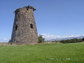
Malltraeth Marsh is a large marsh area in Anglesey, North Wales, north-east of Malltraeth village, along the flatlands of Trefdraeth Bodorgan, Llangristiolus and south of Cefn Cwmwd.Rhostrehwfa. It was reclaimed from estuarine marshes after the construction of the Malltraeth Cob (dyke), a 1 mile (1.6 km) long embankment, and the subsequent canalisation in 1824 of the Afon Cefni.
This is a list of place-names in countries outside of Wales which are named after places in Wales, or derived from the Welsh language, or are known to be named after a Welsh person.

St Michael's Church, Llanfihangel Ysgeifiog, is a former parish church in Anglesey, Wales, which is now closed and in ruins. The structure dates from the 15th century and a chapel was added to the north side in the 17th century. A replacement church was built elsewhere in the parish in 1847, and the old church was closed, partly demolished and abandoned. Some restoration work has taken place in the 21st century and some occasional services have been held.

Llanfihangel Ysgeifiog is a community and former ecclesiastical parish in Anglesey, Wales, east of Llangefni.
The natural resources of Wales have contributed substantially to the economic wealth of the United Kingdom from pre-Roman times to the present. Wales has a complex and varied geology with a wealth of natural minerals. Although Wales has been strongly associated with the coal industry, it has also been the world's leading supplier of slate and of copper at different times. The country lies along the western side of Great Britain and is buffeted by the prevailing South-Westerly trade winds which bring year round rain and wind but also maintain an equable temperate climate. The combination of climate and physical geography and geology have given rise to many different types of landscape and biomes rich in species variety
The geology of Anglesey, the largest (714 km2) island in Wales is some of the most complex in the country. Anglesey has relatively low relief, the 'grain' of which runs northeast-southwest, i.e. ridge and valley features extend in that direction reflecting not only the trend of the late Precambrian and Palaeozoic age bedrock geology but also the direction in which glacial ice traversed and scoured the island during the last ice age. It was realised in the 1980s that the island is composed of multiple terranes, recognition of which is key to understanding its Precambrian and lower Palaeozoic evolution. The interpretation of the island's geological complexity has been debated amongst geologists for decades and recent research continues in that vein.
