
The Geography of West Bengal, a state in eastern India, is primarily defined by plains and plateaus, with the high peaks of the Himalayas in the north and the Bay of Bengal to the south.

Gosaba is a village and a gram panchayat within the jurisdiction of the Gosaba police station in the Gosaba CD block in the Canning subdivision of the South 24 Parganas district in the Indian state of West Bengal.
Basanti is a census town and a gram panchayat within the jurisdiction of the Basanti police station in the Basanti CD block in the Canning subdivision of the South 24 Parganas district in the Indian state of West Bengal.
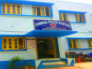
Canning is a town of the South 24 Parganas district in the Indian state of West Bengal. It is situated on the western banks of the Matla River. It is the headquarters of the Canning subdivision.

Matla River forms a wide estuary in and around the Sundarbans in South 24 Parganas district in the Indian state of West Bengal.
Thakuran River is a tidal estuarine river that forms a wide estuary in and around the Sundarbans in South 24 Parganas district in the Indian state of West Bengal.
Muri Ganga River is a distributary of the Hooghly in South 24 Parganas district in the Indian state of West Bengal.
Saptamukhi River is a tidal estuarine river in and around the Sundarbans in South 24 Parganas district in the Indian state of West Bengal.
Gosaba River is a tidal estuarine river in and around the Sundarbans in South 24 Parganas district in the Indian state of West Bengal.
Hariabhanga River (also spelt Haribhanga) is a tidal estuarine river in and around the Sundarbans in North 24 Parganas district in the Indian state of West Bengal, bordering on Satkhira District of Bangladesh.
Gaur Daha is a census town within the jurisdiction of the Canning police station in the Canning I CD block in the Canning subdivision of the South 24 Parganas district in the Indian state of West Bengal.
Jharkhali is a village and a gram panchayat within the jurisdiction of the Basanti police station in the Basanti CD block in the Canning subdivision of the South 24 Parganas district in the Indian state of West Bengal.
Kalaria is a census town within the jurisdiction of the Canning police station in the Canning I CD block in the Canning subdivision of the South 24 Parganas district in the Indian state of West Bengal.
Rajapur is a census town within the jurisdiction of the Canning police station in the Canning I CD block in the Canning subdivision of the South 24 Parganas district in the Indian state of West Bengal.
Bayarsing is a census town within the jurisdiction of the Canning police station in the Canning I CD block in the Canning subdivision of the South 24 Parganas district in the Indian state of West Bengal.
Matla is a census town and a gram panchayat within the jurisdiction of the Canning police station in the Canning I CD block in the Canning subdivision of the South 24 Parganas district in the Indian state of West Bengal.
Dighirpar is a census town and a gram panchayat within the jurisdiction of the Canning police station in the Canning I CD block in the Canning subdivision of the South 24 Parganas district in the Indian state of West Bengal.
Tengra Khali is a village within the jurisdiction of the Canning police station in the Canning I CD block in the Canning subdivision of the South 24 Parganas district in the Indian state of West Bengal.
Pathankhali is a village and a gram panchayat within the jurisdiction of the Gosaba police station in the Gosaba CD block in the Canning subdivision of the South 24 Parganas district in the Indian state of West Bengal.
Mather Dighi is a village and a gram panchayat within the jurisdiction of the Jibantala police station in the Canning II CD block in the Canning subdivision of the South 24 Parganas district in the Indian state of West Bengal.
