Related Research Articles

Kushtia District is a district in the Khulna administrative division of western Bangladesh. Kushtia is the second largest municipality in Bangladesh and the eleventh largest city in the country. Kushtia has existed as a separate district since the partition of India. Prior to that, Kushtia was name of a subdivision of Nadia district. Kushtia is the birthplace of many historical figures including Mir Mosharraf Hossain (1847–1912), Bagha Jatin (1879–1915) and Lalon (1774–1890). Nobel laureate poet Rabindranath Tagore lived his early life at Shelaidaha, a village in the district.

Manikganj is a district in central Bangladesh and part of the Dhaka Division. It was established in 1845, it was a subdivision of Faridpur District until, in 1953, it was transferred to Dhaka District for administrative purposes. In 1984, Manikganj was declared a full district.
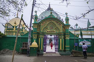
Sirajganj District is a district in the North Bengal region of Bangladesh, located in the Rajshahi Division. It is the 25th largest district by area and 9th largest district by population in Bangladesh. It is known as the gateway to North Bengal.

Baral river is one of the offshoots of the Ganges, starts its journey at Charghat Upazila of Rajshahi District of Bangladesh. The Baral, flowing through Natore and Pabna, meets with the Gumani River at the east of Bhangura and finally meets with the Hurasagar River after joining with the Karatoya south of Shahjadpur Upazila. The river is approximately 147 kilometres (91 mi) long, and 120 metres (410 ft) wide and 6 metres (20 ft) deep on average. The river receives water from the Ganges only in the monsoon season. But it maintains its flow throughout the year with local runoff water and water from Chalan Beel. Its drainage area is about 230 square kilometres (89 sq mi). Some important places located on the banks of the Baral are: Charghat, Baraigram, Bagatipara, Gurudaspur, Chatmohar, Bhangura and Bera upazilas of Bangladesh. The Baral Bridge is located on this river at Bhangura Upazila.

Raozan Upazila is an upazila of Chattogram District, in Chattogram Division, Bangladesh. It was established in August,1947.

Noakhali Sadar is an upazila of Noakhali District in the Division of Chittagong, Bangladesh. Noakhali Thana was established in 1861 and was converted into an upazila in 1984. The upazila takes its name from the district and the Bengali word sadar (headquarters). It is the subdistrict where the district headquarters, Noakhali town, is located. The town is situated on the western bank of the Noakhali Canal, from which it takes its name. The Noakhali Canal was dug in 1660 to control flooding of the river Dakatia. The name Noakhali means "New canal", derived from the Bengali words noa (new) and khal (canal).
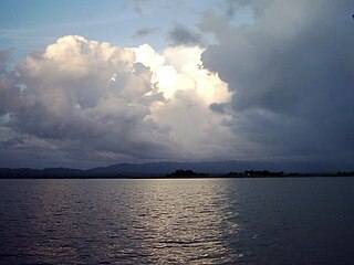
Kaptai is an upazila of Rangamati District in the Division of Chittagong, Bangladesh. The name of the Kaptai was derived from the Tripuri word "Kaptetoima". It is said that in the past, the river was wild and full of tropical flora and fauna. Large quantities and several varieties of canes could be found along the river bank that flows from the south, upper ridge. The river reaches its estuary at the Kainsa Khyong.

Tungipara is an upazila of Gopalganj District in Dhaka Division, Bangladesh. It is the birthplace of Sheikh Mujibur Rahman, the founder of independent Bangladesh. In 1995, it was carved out of Gopalganj Sadar Upazila to become an upazila.

Narail Sadar is an upazila of Narail District in the Division of Khulna, Bangladesh. Narail Thana was established in 1861 and was converted into an upazila in 1984. The upazila takes its name from the district and the Bengali word sadar (headquarters). It is the subdistrict where the district headquarters, Narail town, is located.

Bogra Sadar Upazila officially Bogura Sadar Upazila is an upazila of Bogra District in the Division of Rajshahi, Bangladesh. Bogra Thana was established in 1821 and was converted into an upazila in 1983. The upazila takes its name from the district and the Bengali word sadar (headquarters). It is the subdistrict where the district headquarters, Bogra town, is located.
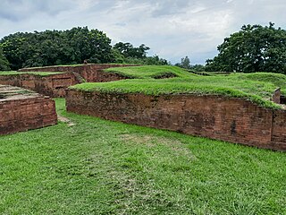
Shibganj Upazila is an upazila of Bogra District in the Division of Rajshahi, Bangladesh. The upazila was created in 1983. It is named after its administrative center, the town of Shibganj.

Belkuchi is an upazila, or sub-district of Sirajganj District, located in Rajshahi Division, Bangladesh.
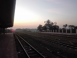
Kamarkhanda is an upazila, or sub-district of Sirajganj District, located in Rajshahi Division, Bangladesh.
Kazipur is an upazila, or sub-district of Sirajganj District, located in Rajshahi Division, Bangladesh.

Sirajganj Sadar is an upazila, or sub-district of Sirajganj District, located in Rajshahi Division, Bangladesh.

Tarash is an upazila, or sub-district of Sirajganj District, located in Rajshahi Division, Bangladesh.

The Bangshi is an important river in central Bangladesh. It originates in Jamalpur, from the course of the old Brahmaputra and flows past the Madhupur tract. It flows through Tangail and meets the Tongi in Ghazipur. It passes near Jatiyo Smriti Soudho in Savar and falls into the Dhaleshwari. About 238 kilometres (148 mi) long, it is not navigable for most of the year except when swelled by the monsoon rains. Louhajang River is a tributary of the Bangshi. Dhamrai on the banks of the Bangshi is famous for its muslin weaving.

The Bhairab is a river in south-western Bangladesh, a distributary of the Ganges. It passes through Khulna, dividing the city into two parts. Bhairab River originates from Tengamari border of Meherpur District and passes through Jessore city. The river is approximately 160 kilometres (100 mi) long and 91 metres (300 ft) wide. Its average depth is 1.2 to 1.5 metres and with minimal water flow, it has plenty of silt.

The divisions of Bangladesh are further divided into districts or zilas. The headquarters of a district is called the district seat. There are 64 districts in Bangladesh. The districts are further subdivided into 495 subdistricts or upazilas.
The Haringhata River is located in Bangladesh. It is one of the large coastal rivers of the Ganges-Padma system south of the confluence of the Bhola and the Baleshwar, and sets part of the boundary between Bagerhat District and Barguna District before emptying into the Bay of Bengal. The Haringhata flows between Sarankhola Upazila in Bagerhat district, and Patharghata Upazila of Barguna district.
References
- ↑ Ishaq, Muhammad, ed. (1978). Bangladesh District Gazetteers: Sylhet, Volume 8; Volume 10. Bangladesh Government Press.
- ↑ Kamrul Islam (2012). "Sirajganj Sadar Upazila". In Sirajul Islam and Ahmed A. Jamal (ed.). Banglapedia: National Encyclopedia of Bangladesh (Second ed.). Asiatic Society of Bangladesh. The river is unlabelled on the map
- ↑ O'Malley, Lewis Sydney Steward (1923). Pabna. Bengal Secretariat Book Depot. p. 13.
- ↑ Monayem Khan (2012). "Raiganj Upazila". In Sirajul Islam and Ahmed A. Jamal (ed.). Banglapedia: National Encyclopedia of Bangladesh (Second ed.). Asiatic Society of Bangladesh.