Jim Corbett National Park is a national park in India located in the Nainital district of Uttarakhand state. The first national park in India, it was established in 1936 during the British Raj and named Hailey National Park after William Malcolm Hailey, a governor of the United Provinces in which it was then located. In 1956, nearly a decade after India's independence, it was renamed Corbett National Park after the hunter and naturalist Jim Corbett, who had played a leading role in its establishment and had died the year before. The park was the first to come under the Project Tiger initiative.

The Satpura Range is a range of hills in central India. The range rises in eastern Gujarat running east through the border of Maharashtra and Madhya Pradesh and ends in Chhattisgarh. The range parallels the Vindhya Range to the north, and these two east–west ranges divide Indian Subcontinent into the Indo-Gangetic plain of northern India and the Deccan Plateau of the south. The Narmada River originates from north-eastern end of Satpura in Amarkantak, and runs in the depression between the Satpura and Vindhya ranges, draining the northern slope of the Satpura range, running west towards the Arabian Sea. The Tapti River originates in the eastern-central part of Satpura, crossing the range in the center and running west at the range's southern slopes before meeting the Arabian Sea at Surat, draining the central and southern slopes of the range. Multai, the place of Tapi river origin is located about 465 kilometer far, south-westerly to Amarkantak, separated across by the hill range. The Godavari River and its tributaries drain the Deccan plateau, which lies south of the range, and the Mahanadi River drains the easternmost portion of the range. The Godavari and Mahanadi rivers flow into the Bay of Bengal. At its eastern end, the Satpura range meets the hills of the Chotanagpur Plateau. The Satpura Range is a horst mountain and is flanked by Narmada Graben in the north and much smaller but parallel Tapi Graben in the south.
Netarhat is a hill station in Latehar district in the Indian state of Jharkhand. It is also referred to as the "Queen of Chotanagpur", and is a hill station. The town is also famous for Netarhat Residential School, set up in 1954.
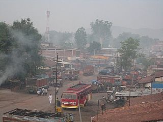
Latehar is a town which is a headquarter of Latehar district of Jharkhand state, it is known for its natural environment, forest, forest products and mineral deposits. Latehar remained a part of Palamau District as a sub division since 1924. It was elevated from sub divisional status to a district on 4 April 2001, vide Jharkhand Government Notification No 946 dated 04.04.2001. Latehar is located on the north–west corner of Jharkhand in the Palamau Commissionary. It is surrounded by Ranchi, Lohardaga, Gumla, Palamu and Chatra district apart from Chhattisgarh state and district headquarters is situated at 84.51198 East Longitude and 23.741988 North Latitude.

Bandhavgarh National Park is a national park of India, located in the Umaria district of Madhya Pradesh. Bandhavgarh, with an area of 105 square kilometres (41 sq mi), was declared a national park in 1968 and then became Tiger Reserve in 1993. The current core area is spread over 716 square kilometres (276 sq mi).
Satpura Tiger Reserve (STR) also known as Satpura National Park is located in the Narmadapuram District of Madhya Pradesh in India. Its name is derived from the Satpura range. It covers an area of 524 km2 (202 sq mi). Satpura National Park, along with the adjoining Bori and Pachmarhi wildlife sanctuaries, provides 2,200 km2 (850 sq mi) of unique central Indian highland ecosystem. It was set up in 1981.

Jaldapara National Park is a national park situated at the foothills of the Eastern Himalayas in Alipurduar District of northern West Bengal, India, and on the banks of the Torsa River. Jaldapara is situated at an altitude of 61 m and is spread across 216.51 km2 (83.59 sq mi) of vast grassland with patches of riverine forests. It was declared a sanctuary in 1941 for protection of its great variety of flora and fauna.
Kanha Tiger Reserve, also known as Kanha–Kisli National Park, is one of the tiger reserves of India and the largest national park of the state of Madhya Pradesh. The present-day Kanha area is divided into two protected areas, Hallon and Banjar, of 250 and 300 km2, respectively. Kanha National Park was created on 1 June 1955 and was designated a tiger reserve in 1973. Today, it encompasses an area of 940 km2 (360 sq mi) in the two districts Mandla and Balaghat.
Anaimalai Tiger Reserve, earlier known as Indira Gandhi Wildlife Sanctuary and National Park and as Anaimalai Wildlife Sanctuary, is a protected area in the Anaimalai Hills of Pollachi and Valparai taluks of Coimbatore District and Udumalaipettai taluk in Tiruppur District, Tamil Nadu, India. The Tamil Nadu Environment and Forests Department by a notification dated 27 June 2007, declared an extent of 958.59 km2 that encompassed the erstwhile IGWLS&NP or Anaimalai Wildlife Sanctuary, as Anaimalai Tiger Reserve under the Wildlife Protection Act, 1972. According to the National Tiger Conservation Authority, the Reserve presently includes a core area of 958.59 km2 and buffer/peripheral area of 521.28 km2 forming a total area of 1479.87 km2.

Kali Tiger Reserve is a protected area and tiger reserve. It is located in Uttara Kannada district, in Karnataka, India. The park is a habitat of Bengal tigers, black panthers and Indian elephants, amongst other distinctive fauna. The Kali River flows through the tiger reserve and is the lifeline of the ecosystem and hence the name. The tiger reserve is spread over an area of 1300 square kilometres.

Simlipal is a tiger reserve in the Mayurbhanj district in the Indian state of Odisha covering 2,750 km2 (1,060 sq mi). It is part of the Mayurbhanj Elephant Reserve, which includes three protected areas—Similipal Tiger Reserve, Hadgarh Wildlife Sanctuary with 191.06 km2 (73.77 sq mi) and Kuldiha Wildlife Sanctuary with 272.75 km2 (105.31 sq mi). Simlipal National Park derives its name from the abundance of red silk cotton trees growing in the area.

Nameri National Park is a national park in the foothills of the eastern Himalayas in the Sonitpur District of Assam, India, about 35 km from Tezpur. Nameri is about 9 km from Chariduar, the nearest village.

Koyna Wildlife Sanctuary is a wildlife sanctuary and natural World Heritage Site, which is located in Satara district of the Indian state of Maharashtra. Further, this wildlife sanctuary is designated as an Important Bird area. The sanctuary is nested in the Western Ghats, covering an area of around 423.55 km2 (163.53 sq mi), and elevations ranging from 600 to 1,100 m. It was notified in 1985 as a wildlife sanctuary situated in Maharashtra. It forms the northern portion of the Sahyadri Tiger Reserve, with Chandoli National Park forming the southern part of the reserve.

Namdapha National Park is a 1,985 km2 (766 sq mi) large protected area in Arunachal Pradesh of Northeast India. The park was established in 1983. With more than 1,000 floral and about 1,400 faunal species, it is a biodiversity hotspot in the Eastern Himalayas. The national park harbours the northernmost lowland evergreen rainforests in the world at 27°N latitude. It also harbours extensive dipterocarp forests, comprising the northwestern parts of the Mizoram-Manipur-Kachin rain forests ecoregion.
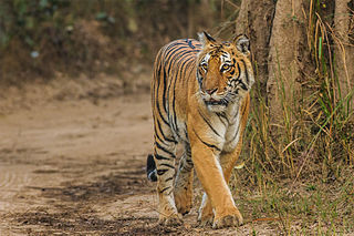
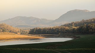
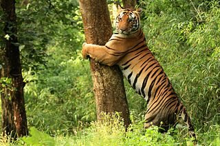
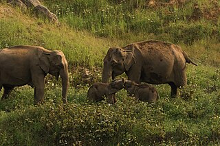
The Palamau Tiger Reserve is one of the nine original tiger reserves in Jharkhand, India and the only one in this state. It forms part of Betla National Park and Palamau Wildlife Sanctuary. As of 2022, the reserve is reported to be largely under Naxal control.

Dandeli Wildlife Sanctuary is located at 15°30′23″N74°23′30″E in Uttara Kannada District of Karnataka state in India. The sanctuary covers an area of 866.41 km2 (334.52 sq mi).
Someshwara Wildlife Sanctuary is a protected wildlife sanctuary in the Western Ghats of Karnataka state in India. It is named after the presiding deity "Lord Someshwara" of the famed Someshwara temple located within the sanctuary. The sanctuary lies in Udupi & Shivamogga districts of Karnataka, below Agumbe. The sanctuary houses Sitanadi nature camp run by Karnataka Forest Department. Udupi to Agumbe road passes through this wildlife sanctuary. The nearest town is Hebri which is connected by bus service to Udupi, Mangaluru and Bengaluru on a daily basis.
Bor Tiger Reserve is a wildlife sanctuary which was declared as a tiger reserve in July 2014. It is located near Hingani in Wardha District in the Indian state of Maharashtra. It is a home to a variety of wild animals. The reserve covers an area of 138.12 km2 (53.33 sq mi). which includes the drainage basin of the Bor Dam.
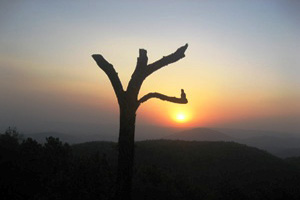
Tourism in Jharkhand refers to tourism in the Indian state of Jharkhand. Jharkhand is known for its waterfalls, hills and holy places.

Raimona National Park is located in extreme western part of Assam, India. It is spread across Gossaigaon and Kokrajhar subdivisions of Kokrajhar district of Bodoland Territorial Region.