Pandu | |
|---|---|
Block | |
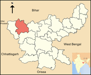
 Pandu Location in jharkhand, India | |
| Coordinates: 24°19′N83°58′E / 24.32°N 83.96°E Coordinates: 24°19′N83°58′E / 24.32°N 83.96°E | |
| Country | |
| State | Jharkhand |
| District | Palamu |
| Block | Pandu |
| Government | |
| • MLA | Ramachandra Chandravansi Bharatiya Janata Party |
| Population (2001) | |
| • Total | 74,464 |
| Languages | |
| • Official | Magahi, Hindi |
| Time zone | UTC+5:30 (IST) |
| PIN | 822124 |
| Website | palamu |
Pandu block is one of the administrative blocks of Palamu district, Jharkhand state, India. According to census (2001), the block has a population of 74,464. The block has 71 villages. It is named for Pandu.
Palamau is one of the twenty-four districts of jharkhand state, India. It was formed in 1892. The administrative headquarter of the district is Medininagar, situated on the Koel River.

Jharkhand is a state in eastern India, carved out of the southern part of Bihar on 15 November 2000. The state shares its border with the states of Bihar to the north, Uttar Pradesh to the northwest, Chhattisgarh to the west, Odisha to the south and West Bengal to the east. It has an area of 79,710 km2 (30,778 sq mi). It is the 15th largest state by area, and the 14th largest by population. Hindi is the official language of the state. The city of Ranchi is its capital and Dumka its sub capital. The state is known for its waterfalls, hills and holy places; Baidyanath Dham, Parasnath and Rajrappa are major religious sites.

India is a country in South Asia. It is the seventh-largest country by area, the second-most populous country, and the most populous democracy in the world. Bounded by the Indian Ocean on the south, the Arabian Sea on the southwest, and the Bay of Bengal on the southeast, it shares land borders with Pakistan to the west; China, Nepal, and Bhutan to the north; and Bangladesh and Myanmar to the east. In the Indian Ocean, India is in the vicinity of Sri Lanka and the Maldives; its Andaman and Nicobar Islands share a maritime border with Thailand and Indonesia.
It is reach of natural and Religious resources.
Major festivals includes Dussehra, Muharram, Dipawali, Holi, Id etc.
Major tourist Attractions :
- Vaishnav Math, Dhachabar
- Bakash Baba Place
- Devi Dham, Hisra
- Shiv Temple Hisra/Musikhap [on Hill]
- Tisibar Dham
- Khaira baba [religious place for both Hindu/Muslim on Spectacular mount Khaira, part of Kaimur Range]

Kaimur Range is the eastern portion of the Vindhya Range, about 483 kilometres (300 mi) long, extending from around Katangi in Jabalpur district of Madhya Pradesh to around Sasaram in Rohtas district of Bihar. It passes through the Rewa and Mirzapur divisions. The range never rises more than a few hundred metres above the surrounding plains and has a maximum width of around 80 km.
| Name of Panchayat | No of Village | Population |
|---|---|---|
| Lumba Satbahini | 6 | 5238 |
| Lahar Banjari | 3 | 5598 |
| Murma Kala | 3 | 5415 |
| Murma Khurd | 4 | 4569 |
| Tisibar Kala | 5 | 5055 |
| Dala Kala | 7 | 4783 |
| Fuliya | 11 | 4376 |
| Kutmu | 1 | 5994 |
| Pandu | 4 | 5834 |
| Mahugawan | 6 | 5513 |
| Sildili | 7 | 5349 |
| Musikhap | 5 | 5191 |
| Kajru Kala | 3 | 5304 |
| Ratnag | 6 | 6269 |
Now one more Block, Untari Road has been created from Pandu Block.
There is one Government Hospital, and many Registered Pvt Clinics.
One Branch of Vananchal Gramin bank is taking care of financial needs for the People of this reason.
There exists following facilities in Block Headquarter Pandu:
- BSNL Telephone exchange (Burnt by Maoists several years ago)
- Post Office
- Police Station
- Kalyan High School(Govt)
- Kasturba Gandhi Girls High School (Govt Residential)
- Priyadarshini Indira Gandhi Girls High School (Govt. Aided)
- Government Middle School
- Girls Middle School(Govt.)
- Gyan Jyoti Public School
- SS Public School
- Gyan Niketan Public School
- Saraswati Shishu Mandir(school)
- One PYKKA center is functiong under able leadership of Ktidashree Sanjay Pandey
Pandu is well connected throu Bus from Garhwa, Daltonganj and Rehla.
Nearest Railway station is Untari Road - 12 km, Garwa Road - 15 km, Garhwa - 22 km, DaltonGanj 30 km (Ariel distance)
Nearest Airport is - Ranchi - 180 km, Patna - 187 km, Varanasi- 150 km