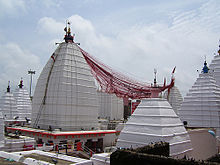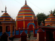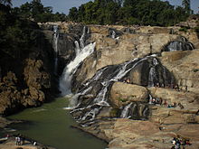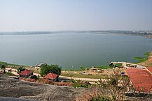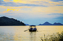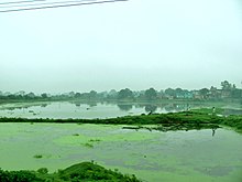
Jharkhand is a state in eastern India. The state shares its border with the states of West Bengal to the east, Chhattisgarh to the west, Uttar Pradesh to the northwest, Bihar to the north and Odisha to the south. It is the 15th largest state by area, and the 14th largest by population. Hindi is the official language of the state. The city of Ranchi is its capital and Dumka its sub-capital. The state is known for its waterfalls, hills and holy places; Baidyanath Dham, Parasnath, Dewri and Rajrappa are major religious sites. Jharkhand is primarily rural, with about 24% of its population living in cities as of 2011.

The Chota Nagpur Plateau is a plateau in eastern India, which covers much of Jharkhand state as well as adjacent parts of Chhattisgarh, Odisha, West Bengal and Bihar. The Indo-Gangetic plain lies to the north and east of the plateau, and the basin of the Mahanadi river lies to the south. The total area of the Chota Nagpur Plateau is approximately 65,000 square kilometres (25,000 sq mi).

Rajrappa is a waterfall and a pilgrimage centre in the Chitarpur CD block in the Ramgarh subdivision of the Ramgarh district in the Indian state of Jharkhand.
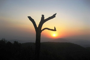
Netarhat is a hill station in Latehar district in the Indian state of Jharkhand. It is also referred to as the "Queen of Chotanagpur", and is a hill station. The hill station is the among the highest points of the Chhotanagpur plateau. The natural beauty of the place is simply splendid. Netarhat is especially known for its stunning views of sunrise and sunset and is popularly known as the Queen of Chhotanagpur. Netarhat comes under the tag of lesser known tourist places. Being lesser known works wonders for its visitors, the most beautiful part about Netarhat is its rawness, there is a beauty in its austerity, in just standing at a height and looking at the far spread lush jungles.
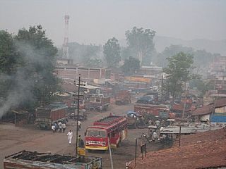
Latehar is a town in the Latehar district of Jharkhand, India. It is known for its natural environment, forest, forest products and mineral deposits. Latehar remained a part of Palamau District as a sub division since 1924. It was elevated from sub divisional status to a district on 4 April 2001, vide Jharkhand Government Notification No 946 dated 04.04.2001. Latehar is located on the north–west corner of Jharkhand in the Palamau Commissionary. It is surrounded by Ranchi, Lohardaga, Gumla, Palamu and Chatra district apart from Chhattisgarh state and district headquarters is situated at 84.51198 East Longitude and 23.741988 North Latitude. It is a predominantly tribal district with almost 45.54% of the population belonging to the scheduled tribes. More than 66% of total population comprises SCs and STs. The total area of the district is 3,622.50 km2 and one of the block headquarters is more than 200 km away from the district headquarters.

Gumla district is one of the twenty-four districts of Jharkhand state, India, and Gumla town is the administrative headquarters of this district.

Latehar district is one of the 24 districts of Jharkhand state in eastern India, and Latehar town is the administrative headquarters of this district. This district is part of Palamu division.

Giridih district is one of the twenty-four districts of Jharkhand state, India, and Giridih is the administrative headquarters of this district. As of 2011 it is the third most populous district of Jharkhand, after Ranchi and Dhanbad.
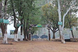
Betla National Park is a national park located in the Latehar and Palamu district of Jharkhand, India. It is spread over an area of 226.32 km2 (87.38 sq mi) and is a part of the Palamu Tiger Reserve. It was declared a national park in 1986. The park hosts a wide variety of wildlife.

Ramgarh Cantonment, usually referred to as Ramgarh Cantt or just Ramgarh is a cantonment town, belonging to the Ramgarh district of the Indian state of Jharkhand. Historically, a subdivision of the larger Hazaribag district, Ramgarh was finally elevated to a district status on 12 September 2007 largely to ease administrative hardships.
Sadni Falls is a waterfall located about 3 kilometres (1.9 mi) from Rajadera village in Gumla district in the Indian state of Jharkhand.
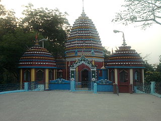
Ramgarh district is one of the 24 districts in the Indian state of Jharkhand. It was also a military district during the British Regime, referred to then as Ramgarh district. It is the part of State Capital Region (SCR).
The Burha River flows through the Latehar district of Palamu division in the Indian state of Jharkhand.
Padma is a village in the Padma CD block in the Barhi subdivision of the Hazaribagh district in the Indian state of Jharkhand.
Jharkhand Rajya Gramin Bank (JRGB) is a Regional Rural Bank (RRB). The bank was established on 1 April 2019 with the amalgamation of the erstwhile Vananchal Gramin Bank and erstwhile Jharkhand Gramin Bank under the provisions of RRB Act 1976. It is under the ownership of Ministry of Finance, Government of India. This bank is sponsored by State Bank of India & is jointly Owned by the Government of India, Government of Jharkhand and State Bank of India.

Navratangarh (Doisagarh) was one of the capitals of the Nagvanshi dynasty, who ruled parts of what is now the state of Jharkhand, India. It is located in Sisai block of Gumla district. It is said that king Durjan Shah shifted his capital from Khukhragarh to Navratangarh. He constructed the fort between 1636 and 1639. The palace was a five-storeyed structure with its "water-gate" and garh-khai (moat) arrangement. It has a kiaclmy (court), a treasury house and a prison-cell with its underground dungeon. It was declared national heritage in 2009.
Serangdag is a village/ Bauxite mining centre in the Ghaghra CD block in the Gumla subdivision of the Gumla district in the Indian state of Jharkhand.
