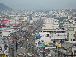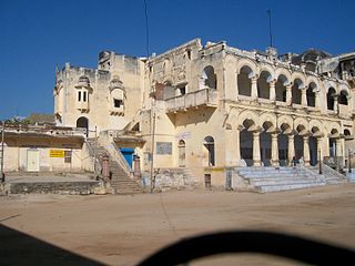
Dharmasagar is a Town and a mandal in Hanamkonda district in Telangana, India. Dharmasagar is well connected with towns like Kazipet, and Hanamakonda by road. It is 14.4 km far from its District Main Town Warangal and 122 km far from its State Capital Hyderabad.

Gajuwaka is a major residential area of Visakhapatnam City, India. The neighborhood of Visakhapatnam is considered the biggest shopping district in Andhra Pradesh by revenue. Though conceived as a residential locality, it is now one of the principal shopping districts of the city. Gajuwaka area of Visakhapatnam has the Highest per capita income in Andhra Pradesh.

Bhilwara District is a district of the state of Rajasthan in western India. The town of Bhilwara is the district headquarters.

Bhongir, also referred as Bhuvanagiri, is a town and headquarters of Yadadri Bhuvanagiri district of the Indian state of Telangana. Falling under Hyderabad Metropolitan Development Authority, the town is located on National Highway 163 & National Highway 161AA (India), about 47 km from state capital Hyderabad Central Point

Gajapathinagaram is a census town in Vizianagaram district of the Indian state of Andhra Pradesh. It is located in Gajapathinagaram mandal of Vizianagaram revenue division. It is located on National Highway 26 between Vizianagaram and Ramabhadrapuram.

Kothavalasa is a Suburb in Visakhapatnam city but present in Vizianagaram district of the Indian state of Andhra Pradesh. It is located in Kothavalasa mandal of Vizianagaram revenue division. It is located 30 km from the city of Visakhapatanam

Baireddipalle is a village in Palamaner Taluk and Chittoor district of the Indian state of Andhra Pradesh. It is the mandal headquarters of Baireddipalle mandal.

Kursath, also spelled Kursat, is a town and nagar panchayat in Unnao district in the Indian state of Uttar Pradesh. It is watered by the Sai river, which flows about 1.5 km to the north, and the Bangarmau-Hasanganj road passes about 4 km to the south of the town. The soil here is mostly loam and clay, with a small amount of sand. The main crops are wheat, barley, bejhar, juwar, bajra, paddy, maize, and sugarcane. Irrigation is provided mainly by canal.

Shyampur I is a community development block that forms an administrative division in Uluberia subdivision of Howrah district in the Indian state of West Bengal.

Bagnan I is a community development block that forms an administrative division in Uluberia subdivision of Howrah district in the Indian state of West Bengal.

Namkhana is a community development block that forms an administrative division in Kakdwip subdivision of South 24 Parganas district in West Bengal state of India.

Ponugupadu is a village in Phirangipuram Mandal, Guntur district, Andhra Pradesh, India. The village is 12 km from Narasaraopet and 3 km from Sathuluru Railway Station.

Karankote is a village 13 km away from Tandur. Sarpanch - Medipally Veena. It is a major Gram panchayat in the Tandur Mandal, Vikarabad district. A Cement Corporation of India factory is located in this village. Karankote is famous for its Limestone mines.

Uluberia I is a community development block that forms an administrative division in Uluberia subdivision of Howrah district in the Indian state of West Bengal.

Radhamohanpur is a village in Debra Community Development Block in West Medinipur District of West Bengal, India. It is located in the Burdwan Division, 28 km towards East from District headquarters Midnapore. Bengali is the Local Language. Radhamohanpur village is surrounded by Pingla Block towards South, Panskura-I Block towards East, Kharagpur-II Block towards west, Keshpur Block towards North. Radhamohanpur Railway Station lies along the Kharagpur- Howrah Railway line.

Bheduasole is a medium-sized Gram Panchayat and village in Indpur Block in Bankura District of the Indian state of West Bengal. It is located in Burdwan Division. It is located 23 km towards west from District headquarters Bankura and 187 km from State capital Kolkata.

Pinakadimi is a village in West Godavari district of the Indian state of Andhra Pradesh. It is located in Pedavegi mandal of Eluru revenue division. It is located at a distance of 7 km from district headquarters Eluru city.

Ganapavaram mandal is one of the 48 mandals in West Godavari district of the Indian state of Andhra Pradesh. It is under the administration of Eluru revenue division and the headquarters are located at Ganapavaram. Ganapavaram Mandal is bounded by Nidamarru Mandal towards west, Pentapadu Mandal towards North, Undi Mandal towards South, Unguturu Mandal towards North. Tadepalligudem, Bhimavaram, Tanuku, Eluru are the nearby Cities to Ganapavaram. It is located 55 km from Eluru and 22 km from Bhimavaram.

Biccavolu mandal is one of the 65 mandals in East Godavari district of the Indian state of Andhra Pradesh. It is under the administration of Rajahmundry revenue division and the headquarters are located at Biccavolu village. Biccavolu Mandal is bounded by Rayavaram Mandal towards South, Pedapudi Mandal towards East, Anaparthy Mandal towards west, Ramachandrapuram Mandal towards north. It is located ata distance of 41 kilometres from Rajahhmundry.
Kolkur is a village in Sadasivpet Mandal, formerly in Medak district of Telangana State, India. As part of Telangana Districts' re-organisation, Kolkur village in Sadasivpet Mandal was reorganised from Medak District to Sangareddy district. It is located 15 km towards the west of the District headquarters Sangareddi and 8 km from Sadasivapet municipality.
Kolkur village of Medak has a substantial population of Schedule Caste. Schedule Caste (SC) constitutes 27.81% while Schedule Tribe (ST) were 1.84% of total population in Kolkur village. In Kolkur village out of the total population, 1105 are engaged in work activities. 98.28% of workers describe their work as Main Work while 1.72% are involved in Marginal activity providing a livelihood for less than 6 months. Of 1105 workers engaged in Main Work, 209 were cultivators while 676 were agricultural labourers.
High-Density State


