
Kothagudem is a City in Telangana. It serves as the headquarters of the Bhadradri Kothagudem district of the Indian state of Telangana. It was a portion of large Zamindari estate known as Husanabad Shankaragiri or Palvancha Zamindari in the Nizam's Dominion. Estate name was given by Captain Glasfurd. The Zamindar of Bhadrachalam was Zamindar of Palvancha also.
Kodad is a town in Suryapet district of the Indian state of Telangana. It is a municipality and the mandal headquarters of Kodad mandal in Kodad revenue division. It lies on the National Highway 65 between Hyderabad and Vijayawada. It is 44 km away from the district headquarters Suryapet

Karimnagar district is one of the 33 districts of the Indian state of Telangana. Karimnagar city is its administrative headquarters. The district shares boundaries with Peddapalli, Jagityal, Sircilla, Siddipet, Jangaon, Hanamkonda district and Jayashankar Bhupalapally districts.

Hanumakonda district, is a district located in the northern region of the Indian state of Telangana. The district headquarters are located at Hanumakonda. The district borders the districts of Jangaon, Karimnagar, Warangal, Bhupalpally and Siddipet.
Mahadevpur is a village in Mahadevpur mandal in Jayashankar Bhupalpally district of Telangana, India.
Jangaon is a town and the district headquarters of Jangaon district in the Indian state of Telangana. It is also the mandal and divisional headquarters of Jangaon Mandal and Jangaon revenue division respectively. It is about 85 kilometres (53 mi) from the state capital Hyderabad. It lies on the National Highway 163
Nirmal is a town and the district headquarters of Nirmal district in the Indian state of Telangana. It is famed for its toys made out of wood.
Kataram is a village in Kataram mandal of Jayashankar Bhupalpally district in the state of Telangana in India.
Malharrao is a mandal in Jayashankar Bhupalpally district of the Telangana state in India.
Kamalapur Town or sometimes Kamalapuram is a Mandal of Hanumakonda district in the state of Telangana in India.It is located nearer to town Warangal the city of kakatiyas.It is close to Kakatiya university.
Chityala is a village and a mandal in Jayashankar Bhupalpally district in the state of Telangana in India.

Eturnagaram is a village and a mandal in Mulugu district in the state of Telangana in India.

Narsampet is a town in Warangal district of the Indian state of Telangana. Narsampet is a Mandal in Warangal Rural District of Telangana State, India. Headquarters of Narsampet Revenue Division is in Narsampet Town. As part of Telangana Districts re-organisation, Narsampet Mandal re-organised from Warangal District to Warangal Rural district. The town is 36 km east of District Headquarter Warangal.
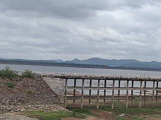
Mulugu is a town in Mulugu district, Telangana. It is the headquarters of the district, which was formed in 2019 after Jayashankar Bhupalpally district was split. Prior to the reorganization of districts that created Jayashankar Bhupalpally district, Mulugu was a part of the Warangal district. It lies on National Highway 163.
Peerzadiguda is a satellite city of Hyderabad and municipal corporation located in Medchal-Malkajgiri district in the state of Telangana, India.
Parkal is a town in Hanumakonda district of the Indian state of Telangana.
Maha Mutharam is a village and a mandal in Jayashankar Bhupalpally district in the state of Telangana in India.
Mancherial district is a district located in the northern region of the Indian state of Telangana. The district comprises 18 mandals and two revenue divisions – Mancherial and Bellampalli. The district headquarters is located at Mancherial town. It is surrounded by Komaram Bheem, Nirmal, Jagtial, Peddapalli and Bhupalpally districts of Telangana and with Maharashtra state.
Mahabubabad district is a district in the Indian state of Telangana. The district was carved out from the erstwhile Warangal district following the re-organisation of districts in the state in October 2016. The district shares boundaries with Suryapet, Khammam, Bhadradri, Warangal, Mulugu and Jangaon districts.
Jayashankar Bhupalpally district is a district in the Indian state of Telangana. The district headquarters are located at Bhupalpally. It was a part of the erstwhile Warangal district and Karimnagar district prior to the re-organisation of districts in the state. The district share boundaries with Karimnagar, Mancherial, Peddapalli, Hanamkonda, Warangal, and Mulugu districts and with the state boundary of Maharashtra and Chhattisgarh.