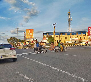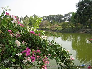
Medak is a town in Medak district of the Indian state of Telangana. It is a municipality and the headquarters of Medak mandal in Medak revenue division. And There is a river named srujan which is big in length.
Alapakkam is a census town in Chengalpattu district in the state of Tamil Nadu, India. The Alapakkam Census Town has population of 9,404 of which 4,702 are males while 4,702 are females as per report released by Census India 2011.

Bannur is a municipality in Mysore district in the state of Karnataka, India.
Bharatganj is a Nagar Panchayat city in district of Prayagraj, Uttar Pradesh.

Choutuppal is a census town in Yadadri Bhuvanagiri district of the Indian state of Telangana. It is located in Choutuppal mandal of Choutuppal division. Its part of Hyderabad Metropolitan Development Authority. 49 km from Hyderabad.
Dhampur is a city and a municipal board in Bijnor district in the state of Uttar Pradesh, India. It is located at 29.51°N 78.50°E, and lies in Northern India.
Govindgarh is a census town in Jaipur district in the Indian state of Rajasthan.
Mhowgaon is a Nagar Panchayat under Sub Division Dr. Ambedkar Nagar (Mhow) in Indore district in the Indian state of Madhya Pradesh. The total geographical area of Mhowgaon nagar panchayat is 13.5 km2 and it is the smallest city by area in the sub district. The population density of the city is 2309 persons per km2. Mhowgaon is divided into 15 wards for which elections are held every 5 years. Among them, Mhowgaon Ward No. 2 is the most populous ward with a population of 3440 and Mhowgaon Ward No. 15 is the least populous ward with a population of 957. Mhowgaon Nagar Panchayat has total administration over 6,373 houses to which it supplies basic amenities like water and sewerage. It is also authorized to build roads within Nagar Panchayat limits and impose taxes on properties coming under its jurisdiction.
Nallur (Nalloor) is a panchayat town in Kanniyakumari district in the Indian state of Tamil Nadu.
Palda is a census town in Indore district in the Indian state of Madhya Pradesh.

Palvancha is a town in Bhadradri district of the Indian state of Telangana. It is located in Palvancha mandal of Kothagudem revenue division.
Sendarapatti, also known as Senthalai, is a panchayat town in Salem district in the Indian state of Tamil Nadu.
Sewalkhas is a town and a Nagar Panchayat in Meerut district in the Indian state of Uttar Pradesh.

Sompeta is a census town in Srikakulam district of the Indian state of Andhra Pradesh. It is the mandal headquarters of Sompeta mandal in Tekkali revenue division.
Thondi is a Panchayat Town located in the Ramanathapuram district of the southern Indian state of Tamil Nadu.
Patti is a town and a Nagar Panchayat in Pratapgarh district in the Indian state of Uttar Pradesh.
Kodamthuruth is a village in Alappuzha district in the Indian state of Kerala. It is a panchayat, which comes under the Aroor Assembly constituency.

Pudussery West is a census town in the Palakkad district, state of Kerala, India. Pudussery West comes under the administration of the Pudusseri gram panchayat.
Rudrur is a town and Mandal headquarter located in Nizamabad district of Telangana in the Banswada Assembly Constituency, India.

Dadra is one of the two talukas in Dadra and Nagar Haveli district, India. It is an enclave lying a few kilometres north west of Nagar Haveli and is surrounded by Gujarat.


