Nedumangad is a town and municipality in Thiruvananthapuram metropolitan area of Thiruvananthapuram district in the Indian state of Kerala, and is the headquarters of Nedumangad tehsil and Nedumangad Revenue Division (RDO). It is a suburb of the extended metropolitan region of Thiruvananthapuram city. It is located around 16 km to the north-east of Thiruvananthapuram city on the Thiruvananthapuram – Shenkottah (State Highway 2). It is an important commercial center in the district. It is a growing commercial and educational hub and all important government institutions are situated in the town. Nedumangadu Market is important in South Kerala.

Balussery is a town located about 25 km northeast of Kozhikode city and lies on the side of State Highway 34. It is one of the 12 block Panchayats in Kozhikode district. Balussery is the Northeast side entry of Calicut city.
V. Pudur is a panchayat town in Thoothukudi district in the Indian state of Tamil Nadu.
Koodali is a census town and grama panchayat in Thalassery taluk of Kannur district in Kerala state, India. Koodali is located 15.5 km (9.6 mi) east of Kannur city on Kannur-Mattanur road.

Edakkara is a town located in Malappuram district of the Indian state of Kerala. It is an emerging commercial hub, and one of the busiest towns in Nilambur Taluk.
Pangode is an Indian village and a Grama Panchayat located in the Trivandrum district in the state of Kerala. The village is known for its participation in the Indian Independence Movement, through the Kallara-Pangode Struggle. It is situated in the foothills of Western Ghats.

Cherupuzha is a town in Kannur district, Kerala, India. It is the headquarters of the Cherupuzha Panchayat which is a special grade panchayat in Kerala.
Neraluru is a village in Anekal taluk, Bangalore urban district, India. It is around 28 kilometers from Bangalore and 10 kilometers from Hosur, Tamil Nadu. The nearest mofussil towns are Attibele and Chandapura, both of which are within a 5 kilometer radius of Neralur. Electronics City, one of India's largest Information Technology parks, is around 10 kilometres from the village. A few of the villages which share its boundaries with Neraluru are - Guddahatti, Balagaranahalli, Lakshmisagara, Old Chandapura, Thirumagondanahalli, Bandapura, Yadavanahalli and Bendaganahalli. Kannada is the most widely spoken language in the village. With the advent of migrant laborers, and as a consequence of private townships springing up in unbridled abundance, people from all over the country can be found in varying proportions, which has made the language demographics getting diversified, thereby showcasing our multi cultural and multi ethnic heterogeneity.
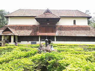
Vettikkavala is a village located in the Kollam district in the state of Kerala, India. One point of interest within the village is a Shiva-Vishnu temple which hosts a special deity called Vathukkal Njali Kunju. An annual celebration of Pongala is held at the temple. The village is also well known for temple arts and a palace constructed by Sree Moolam Thirunal.

Purathur is a beautiful sandy coastal village and a Grama Panchayat in Tirur Taluk, Malappuram district in the state of Kerala, India. Bharathappuzha river and Tirur River merges together in Purathur and join with the Arabian Sea at Padinjarekara Azhimukham, which is also the southernmost tip of Purathur Gram panchayat. Opposite to Padinjarekara Azhimukham is Ponnani port. The village is located at the southernmost tip of Tirur Taluk and is bordered by historically important Ponnani port in Ponnani Municipality of Ponnani taluk to south.
Vellarada is a border village situated in Thiruvananthapuram district in the state of Kerala, India. It is 42 km from Thiruvananthapuram. It is the southernmost part of Kerala state, sharing its border with Tamil Nadu. Vellarada is said to be the threshold to the high-range areas of the eastern part of Thiruvananthapuram district. The southernmost point of Western Ghats in Kerala is near Vellarada.

is a Grama Panchayat & village in Thrissur district in the state of Kerala, India.

Thamarassery, formerly known as Thazhmalachery, is one of the taluks and a major hill town in the Kozhikode district of Kerala, India, 30 km north-east of Kozhikode (Calicut) city and 29 km east of Koyilandy. It lies on the Calicut - Wayanad - Mysore route.
Velayuthampalayam is a town located in Karur District in the Indian state of Tamil Nadu. It comes under the jurisdiction of Pugalur municipality. This town is situated on the footsteps of Pugali Malai Arunattan Malai, which houses Lord Murugan. The river Cauvery is 3 kilometers away from the town. It is very close to TNPL Kagithapuram. The adjacent places are TNPL Kagithapuram, Thottakuritchi and Karappalayam.
Thirumalapuram is a Village Panchayat in Chityal mandal of Hanamkonda district, Telangana state, India. Thirumalapuram is also called Thirumalapur. The ancient name for Thirumalapur is Bokkalapadu.

Palackattumala is a village in Kottayam District of Kerala, India with a population of around 1500. An oblong tableland located on a small rolling hill, north of Illickal Junction in Pala – Vaikom road. The nearest town is Palai.
Patrame is a small, rural panchayat village on the left (east) bank of the Netravati River in Karnataka, India. Administratively, it is under Belthangady taluk, Dakshina Kannada district, Karnataka. Patrame is the only village in its gram panchayat. The village of Patrame is 26 km from its taluk headquarters Belthangady, and 8 km by road from Dharmasthala.

Mukhathala is a small town and block panchayat in Kollam district of Kerala, India. The area is known for the famous Murari Temple which holds a unique position in the cultural history of Travancore.

Chapparapadavu is a Grama panchayat in Kannur district in the Indian state of Kerala. Chapparapadavu Panchayat have administration over the villages of Kooveri, Thimiri and Vellad.
Kulei is a traditional Indian village belongs to Angul district of Odisha. Kulei is the 6th most populous village in Samal Barrage sub district of Angul district. The area of the village is 3 km2, making it the 17th largest village in the subdistrict. The population density of Kulei is 516 people per km2. 0.54 km2, (19%) of which is covered with forest.

