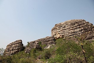
Jagtial is a city and the district headquarters of jagtial district of Telangana, India. It has an average elevation of 293 metres (961 ft). It is located about 190 kilometres (118 mi) north of the state capital Hyderabad.

Karimnagar district is one of the 33 districts of the Indian state of Telangana. Karimnagar city is its administrative headquarters. The district shares boundaries with Peddapalli, Jagityal, Sircilla, Siddipet, Jangaon, Hanamkonda district and Jayashankar Bhupalapally districts.
Bavojigudem is a village located 13 km from Maripeda, the Mandal headquarters, in Jayashankar Bhupalpally district, Andhra Pradesh, India. The neighbouring villages are Venkampadu, Neelukurti, and Giripuram. Previously this village was under the control of the neighbouring village panchayat, Neelukurthi. 15 years ago, the village has got a separate panchayat. The name of the sarpanch is Smt Baby Rani. The prominent people of the village are Sri K Karunakar reddy, M Kesava rao, D Hanumanthu. Recently village tank is repaired and 2 crops are assured in this village.
Mahadevpur is a village in Mahadevpur mandal in Jayashankar Bhupalpally district of Telangana, India.
Rajendranagar is a mandal in Ranga Reddy district of the Indian state of Telangana. and it is also Rajendranagar revenue division. Rajendranagar is being developed as an IT hub.
Kataram is a village in Kataram mandal of Jayashankar Bhupalpally district in the state of Telangana in India.
Mogullapalle is a village and a mandal in Jayashankar Bhupalpally district in the Indian state of Telangana.
Chityala is a village and a mandal in Jayashankar Bhupalpally district in the state of Telangana in India.

Ghanpuram is a village and a mandal in Mulugu district in the state of Telangana in India.
Govindaraopet is a village and a mandal in Mulugu District in the state of Telangana in India. It is located approximately 70 km (43 mi) distance from Hanamkonda along National Highway-163 which connects Hyderabad in Telangana and Bhopalapatnam in Chhattisgarh. And it is 200 km (120 mi) distance from its state capital Hyderabad.

Mulugu district is a district in the Indian state of Telangana. Its headquarters is the town of Mulugu. Mulugu district is the least populated district with 2,94,671 in the state. Mulugu district has the fewest mandals in the state with nine mandals. It currently borders Warangal, Mahabubabad, Jayashankar and Bhadradri districts and with the state of Chhattisgarh.
Regonda is a mandal and a mandal in Jayashankar Bhupalpally district in the state of Telangana, India. It has buildings from the period of the Kakatiya dynasty.
Dwarakapet is a village panchayat in Chityala mandal in Jayashankar Bhupalpally district in the state of Telangana in India.
Ankushapur is a village panchayat in Tekumatla mandal in Jayashankar Bhupalpally district in the state of Telangana in India. Located 72 km from Warangal city, The population of this village is approximately 1000. This village panchayat is a combination of two villages named as Ankushapur and Somanpalli. Ankushapur village does not have a bus route or train route. People get buses from Tekumatla which is 1 km away. from Ankushapur. From Tekumatla people has bus facility to Parkal, Warangal and Jammikunta. in this village there is no post office, roads, or mobile tower and there is also no water plant. This village has two temples one is Hanuman temple located in center of the village and another one is Baddi Pochamma temple located on the outskirts of the village. and there is a government primary school in this village. Earlier Literacy percentage of this village was very low, but now the literacy percentage is very good.
Pangidipalle is a village panchayat in Chityal mandal in Jayashankar Bhupalpally district in the state of Andhra Pradesh in India.
Tekumatla is a village and mandal in Jayashankar Bhupalpally district of the Indian state of Telangana.
Devarampally is a village and panchayat in Jayashankar Bhupalpally district, Telangana, India. It falls under Kataram mandal.
Maha Mutharam is a village and a mandal in Jayashankar Bhupalpally district in the state of Telangana in India.
Ashireddipally is a village panchayat in Chityal mandal in Jayashankar Bhupalpally district in the state of Telangana in India.

Jayashankar Bhupalpally district is a district in the Indian state of Telangana. The district headquarters are located at Bhupalpally. It was a part of the erstwhile Warangal district and Karimnagar district prior to the re-organisation of districts in the state. The district share boundaries with Karimnagar, Mancherial, Peddapalli, Hanamkonda, Warangal, and Mulugu districts and with the state boundary of Maharashtra and Chhattisgarh.


