
Gadchiroli district is an administrative district in Maharashtra, India. The city of Gadchiroli is the administrative headquarters of the district.

Karimnagar district is one of the 33 districts of the Indian state of Telangana. Karimnagar city is its administrative headquarters. The district shares boundaries with Peddapalli, Jagityal, Sircilla, Siddipet, Jangaon, Hanamkonda district and Jayashankar Bhupalapally districts.

Hanamkonda district or Hanumakonda district, is a district located in the northern region of the Indian state of Telangana. The district headquarters are located at Hanamkonda. The district borders the districts of Jangaon, Karimnagar, Warangal, Bhupalpally and Siddipet.
Kaleshwaram is a village in Mahadevpur Mandal in Jayashankar Bhupalpally district in the Indian state of Telangana. This name refers more broadly to the state of Telangana & Kaleshwaram Temple.
Tadvai is a village and mandal headquarters in Jayashankar district, Telangana, India. Recently it changed its name into "Sammakka Saralamma Tadvai".
Kataram is a village in Kataram mandal of Jayashankar Bhupalpally district in the state of Telangana in India.
Malharrao is a mandal in Jayashankar Bhupalpally district of the Telangana state in India.
Mogullapalle is a village and a mandal in Jayashankar Bhupalpally district in the Indian state of Telangana.
Chityala is a village and a mandal in Jayashankar Bhupalpally district in the state of Telangana in India.

Ghanpur is a village and a mandal in Mulugu district in the state of Telangana in India.
Mangapet is a village and mandal in Mulugu district of Telangana.
Govindaraopet is a village and a mandal in Mulugu District in the state of Telangana in India. It is located approximately 70 km distance from Hanamkonda along National Highway-163 which connects Hyderabad in Telangana and Bhopalapatnam in Chhattisgarh. And it is 200 km distance from its State capital Hyderabad.
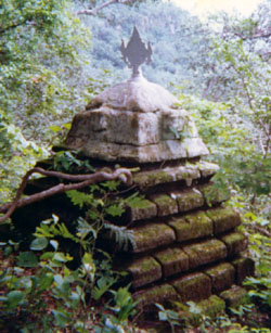
Regonda is a mandal and a mandal in Jayashankar Bhupalpally district in the state of Telangana, India. It has buildings from the period of the Kakatiya dynasty.
Tekumatla is a village and mandal in Jayashankar Bhupalpally district of the Indian state of Telangana.
Wazed, Wazedu or Wazeed is a mandal in Jayashankar Bhupalpally district of Telangana. Previously, Wazedu belonged to Nugur Taluka of East Godavari District.
Maha Mutharam is a village and a mandal in Jayashankar Bhupalpally district in the state of Telangana in India.
Mancherial district is a district located in the northern region of the Indian state of Telangana. The district comprises 18 mandals and two revenue divisions – Mancherial and Bellampalli. The district headquarters is located at Mancherial town. It is surrounded by Komaram Bheem, Nirmal, Jagtial, Peddapalli and Bhupalpally districts of Telangana and with Maharashtra state.
Jayashankar Bhupalpally district is a district in the Indian state of Telangana. The district headquarters are located at Bhupalpally. It was a part of the erstwhile Warangal district and Karimnagar district prior to the re-organisation of districts in the state. The district share boundaries with Karimnagar, Mancherial, Peddapalli, Hanamkonda, Warangal, and Mulugu districts and with the state boundary of Maharashtra and Chhattisgarh.

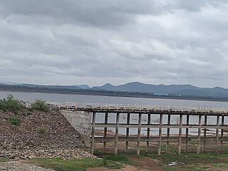
The Lakshmi Barrage, also known as the Medigadda Barrage is the starting point of the proposed Kaleshwaram Project which envisages construction of three barrages between Yellampally & Medigadda. Its objective is to utilize Godavari water for drinking and irrigation. The Barrage/Project site is located at Medigadda Village, Mahadevpur Mandal, Jayashankar Bhupalpally district in Telangana State, India.
The Saraswati Barrage, also known as the Annaram Barrage is an irrigation project on Godavari River located at Annaram Village, Mahadevpur Mandal, Jayashankar Bhupalpally district in Telangana State, India.

