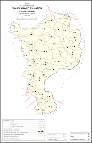
Raebareli district is a district of Uttar Pradesh state in northern India. The city of Raebareli is the district headquarters. This district is a part of Lucknow Division in Uttar Pradesh state. The total area of Raebareli district is 3,371 Sq. km.

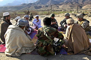
Guldara District is located in the northwestern part of Kabul Province, Afghanistan. It has a population of 25,213 people, including new returnees. Around 70% are Tajiks and 30% Pashtuns.

Alingar District is located approximately 27 km from Mehtarlam, the provincial capital of Laghman Province and borders with Alishing and Dawlat Shah districts to the West, Nuristan Province to the North, Kunar and Nangarhar provinces to the East and Qarghayi and Mihtarlam districts to the South.It has about 60 villages located in four main valleys. The population is 85,600 (2006) - 70% of them Pashtun, 20% Pashai and 5% Tajik. The district center is the village of Shahi, located on 34.8347°N 70.3603°E at 915 m altitude. in the valley of the Alingar River, which crosses the district and is the main source of irrigation. The security situation is reported to be relatively stable, although there are some private disputes. The district is reported free of mines.
Kurli is a village in Sindhudurg District, the south-easternmost district of Konkan Division, Maharashtra, India. Kurli is located 7.9 km from its Taluk Main Town Vaibhavwadi. Kurli is 33.6 km from its District main city, Oras. It is 307 km from its State Main City Mumbai. This is a culturally and historically important village. Kurli consists of wadis like Temb Wadi, Khadakwadi, Bajarpeth. Also it is famous because of the newly made Kurli Dam.
Koligudda is a village in the Raybag Taluk of the Belgaum district in Karnataka, India. It is situated 123 kilometers northeast of Belgaum, between the Athani-Gokak road.
Lokur is a village in Kagwad tehsil, Belgaum district, in the state of Karnataka, India. According to Census 2011 information the location code or village code of Lokur village is 597287. It is 32 kilometres (20 mi) from the sub-district headquarters at Athni and 122 kilometres (76 mi) from the district headquarters at Belgaum. As per 2009 stats, Mangasuli is the gram panchayat of Lokur village.

Bhagipur is a village in Unchahar block of Raebareli district, Uttar Pradesh, India. It is located 34 km from Raebareli, the district headquarters. As of 2011, it has a population of 446 people, in 89 households.

Bela Bhela, also called Uttarpara, is a village in Rahi block of Rae Bareli district, Uttar Pradesh, India. It is located 9 km from Rae Bareli, the district headquarters, east of the road to Dalmau. It lies in a belt of stiff clay soil which is highly productive agriculturally and is interspersed with wetlands and patches of barren usar soil. Bela Bhela is a large village consisting of many hamlets. As of 2011, Bela Bhela has a total population of 16,623 people, in 3,004 households. It has one primary school and one medical clinic.

Abdu Mau, also spelled Abdumau, is a village in Chhatoh block of Rae Bareli district, Uttar Pradesh, India. It is located 48 km from Raebareli, the district headquarters. As of 2011, the village has a population of 1,339 people, in 213 households. It has one primary school and no healthcare facilities. It belongs to the nyaya panchayat of Paraiya Namaksar.

Paraiya Namaksar is a village in Chhatoh block of Rae Bareli district, Uttar Pradesh, India. It is located 14 km from Jais, the nearest large town. As of 2011, Paraiya Namaksar has a population of 4,506 people, in 820 households. It has four primary schools and one primary health sub centre. It hosts a market twice per week, on Tuesdays and Saturdays. Grain, vegetables, and cloth are the main items traded. Paraiya Namaksar is also the headquarters of a nyaya panchayat which also covers 8 other villages.

Rokha is a large village in Dih block of Rae Bareli district, Uttar Pradesh, India. Historically the namesake of a pargana, Rokha is a predominantly agricultural village consisting of many hamlets. It is located 28 km from Raebareli, the district headquarters. The large village of Mau also borders Rokha to the north. Rokha is connected by road with Nasirabad and Jais to the northeast and Suchi to the southwest.

Gopalpur is a large village in Dih block of Rae Bareli district, Uttar Pradesh, India. It is located 29 km from Raebareli, the district headquarters. As of 2011, it has a population of 521 people, in 101 households. It has one primary school and no healthcare facilities, and does not host a weekly haat or a permanent market. Gopalpur belongs to the nyaya panchayat of Mau.

Ranjitpur is a village in Sareni block of Rae Bareli district, Uttar Pradesh, India. It is located 20 km from Lalganj, the tehsil headquarters. As of 2011, it has a population of 1,122 people, in 196 households. It has 2 primary schools and no healthcare facilities, and it hosts a regular market but not a weekly haat. It belongs to the nyaya panchayat of Rasulpur.

Miramau is a village in Khiron block of Rae Bareli district, Uttar Pradesh, India. It is located 14 km from Lalganj, the tehsil headquarters. As of 2011, it has a population of 1,057 people, in 228 households. It has 1 primary school, but has no formal healthcare facilities, weekly haat or permanent market. It belongs to the nyaya panchayat of Bhitargaon.

Nunera is a village in Khiron block of Rae Bareli district, Uttar Pradesh, India. It is located 18 km (11 mi) from Lalganj, the tehsil headquarters. As of 2011, it has a population of 1,717 people, in 302 households. It has two primary schools and no healthcare facilities and does not host a weekly haat or a permanent market. It belongs to the nyaya panchayat of Tikwamau.

Manpur is a village in Khiron block of Rae Bareli district, Uttar Pradesh, India. It is located 13 km from Lalganj, the tehsil headquarters. As of 2011, it has a population of 1,188 people, in 192 households. It has 1 primary school and no healthcare facilities and it does not host a weekly haat or a permanent market. It belongs to the nyaya panchayat of Semari.

Chak Nizam is a village in Rahi block of Rae Bareli district, Uttar Pradesh, India. It is located 8 km from Rae Bareli, the district headquarters. As of 2011, its population was 806 people, in 137 households. It has one primary school, no medical facilities and does not host a weekly haat or a permanent market. It belongs to the nyaya panchayat of Bhaon.

Raghunathpur is a village in Rahi block of Rae Bareli district, Uttar Pradesh, India. It is located 11 km from Rae Bareli, the district headquarters. As of 2011, it has a population of 1,217 people, in 207 households. The village has one primary school, no medical facilities and does not host a weekly haat or a permanent market. It belongs to the nyaya panchayat of Bhadokhar.

Chak Bhadokhar is a village in Rahi block of Rae Bareli district, Uttar Pradesh, India. It is located 11 km from Rae Bareli, the district headquarters. As of 2011, it has a population of 115 people, in 22 households. The village has no schools, medical facilities nor hosts any weekly haat or permanent market. It belongs to the nyaya panchayat of Bhadokhar.

Bakwara is a village in Rahi block of Rae Bareli district, Uttar Pradesh, India. It is located 15 km from Rae Bareli, the district headquarters. As of 2011, it has a population of 1,540 people, in 257 households. It has one primary school and no medical facilities. The village hosts a weekly haat but not a permanent market. It belongs to the nyaya panchayat of Rustampur.


