Related Research Articles

Mount Vesuvius is a somma–stratovolcano located on the Gulf of Naples in Campania, Italy, about 9 km (5.6 mi) east of Naples and a short distance from the shore. It is one of several volcanoes forming the Campanian volcanic arc. Vesuvius consists of a large cone partially encircled by the steep rim of a summit caldera, resulting from the collapse of an earlier, much higher structure.

The Turpan Depression or Turfan Depression, is a fault-bounded trough located around and south of the city-oasis of Turpan, in the Xinjiang Autonomous Region in far Western China, about 150 kilometres (93 mi) southeast of the regional capital Ürümqi. It includes Lake Ayding, −154 metres (−505 ft), the second or third lowest depression on Earth. By some measures, it is also the hottest and driest area in China during the summer.

Velankanni (Vēḷāṅkaṇṇi), is a Special Grade Panchayat Town in Nagapattinam district in the Indian state of Tamil Nadu. It lies on the Coromandel Coast of the Bay of Bengal, 350 km south of Chennai (Madras), 12 km south of Nagapattinam, and 33 km southeast of Thiruvarur.

Suryapet is a growing town in the Indian state of Telangana. It is a municipality and the headquarters of its eponymous district. The Government of India announced Suryapet to be developed under the Atal Mission for Rejuvenation and Urban Transformation (AMRUT) scheme. Suryapet has been awarded the "Cleanest city" in South India by the Ministry of Urban development in Swachh Survekshan 2017. It is also known as "Gateway of Telangana". It is located about 134 kilometres (83 mi) east of the state capital, Hyderabad and also it is located about 138 kilometres (86 mi) West of Vijayawada.

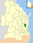
The Shire of Maroochy was a local government area about 100 kilometres (62 mi) north of Brisbane in the Sunshine Coast region of South East Queensland, Australia. The shire covered an area of 1,162.7 square kilometres (448.9 sq mi), and existed as a local government entity from 1890 until 2008, when it amalgamated with its neighbours to the north and south to form the Sunshine Coast Region.

Franchimont Castle is a medieval castle in the municipality of Theux, Liège Province, Wallonia, Belgium. It sits at the western end of a small hill 2 kilometres (1.2 mi) south of the village of Theux, a sub-municipality.
Pallipattu is a town in Tamil Nadu and a border town located between the Chittoor District of Andhra Pradesh and Tiruvallur District of Tamil Nadu. It is known for its fertile agricultural lands and the west-to-east flowing Kusasthalai river.
Warisaliganj is a Community Development block and a Municipal Council in Nawada district in the Indian state of Bihar.

The Shire of Kilcoy was a local government area in South East Queensland, Australia, about 95 kilometres (59 mi) northwest of Brisbane along the D'Aguilar Highway, not far from the Sunshine Coast. The shire covered an area of 1,445.2 square kilometres (558.0 sq mi), and existed from 1912 until its merger with the Shire of Esk to form the Somerset Region on 15 March 2008.

Dornala is a village in Prakasam district of the Indian state of Andhra Pradesh. It is the mandal headquarters of Dornala mandal in Markapur revenue division.
Karvetinagar or Karvetinagaram is a village in Chittoor district in the Indian state of Andhra Pradesh. It is the headquarters of Karvetinagar mandal. The town is known for the Venugopalaswamy Temple, that was constructed during the reign of the Venturing dynasty.

Oaky River, a perennial stream of the Macleay River catchment, is located in the Northern Tablelands district of New South Wales, Australia.

Sapta Badri constitutes a group of seven sacred Hindu temples, dedicated to god Vishnu, located in Garhwal Himalayas in the Indian state of Uttarakhand. The Badrinath temple, called the Badri Vishal is the primary temple among the seven shrines. The other six being Adi Badri, Bhavishya Badri, Yogadhayan Badri, Vriddha Badri, Ardha Badri and Dhyan Badri. The Panch Badri temple circuit consisted of only five temples, omitting Ardha Badri and usually Dhyan Badri. Rarely, Narasingh Badri, is included in the Sapta Badri or Panch Badri list.

Chopta is a small region of meadows and evergreen forest area, a part of Kedarnath wildlife sanctuary located in Uttarakhand state, India and a base for trekking to Tungnath, the third temple of Panch Kedar which lies 3.5 kilometres (2.2 mi) away. Located at a distance of 1.5 kilometres (0.93 mi) from Tungnath is Chandrashila, a summit rising to over 4,000 metres (13,000 ft).
Myingyi Kyun, also known as High Island, is a small island off the coast of Ayeyarwady Region, Burma.

Thirupadiripuliyur railway station is one of the two railway stations serving the town of Cuddalore, headquarters of the Cuddalore district in Tamil Nadu, India, the other one being Cuddalore Port Junction. It is located on the main line between Chennai Egmore and Tiruchirappalli Junction. It comes under the Tiruchirappalli railway division of the Southern Railway zone. This railway station was mentioned in Jayakanthan's novel.
Asifabad is a city and the district headquarters of Kumuram Bheem district in the Indian state of Telangana. It is located in Asifabad mandal of Asifabad revenue division. It is situated on the banks of Peddavagu river. It is about 309 kilometres (192 mi) north of the state capital Hyderabad,86 kilometres (53 mi) from Ramagundam, 118 kilometres (73 mi) from Adilabad and 148 kilometres (92 mi) from Karimnagar.
Bhattian is a village in the Phillaur tehsil of Jalandhar District of the Indian state of Punjab. It is located on 8 kilometres (5.0 mi) from the head postal office in Phillaur, 7.5 kilometres (4.7 mi) from Goraya, 50 kilometres (31 mi) from Jalandhar, and 117 kilometres (73 mi) from the state capital of Chandigarh. The village is administered by the Sarpanch, an elected representative.
Chak Des Raj is a village in Phillaur tehsil of Jalandhar District of Punjab State, India. It is located 5.5 kilometres (3.4 mi) away from postal head office Bara Pind. The village is 20 kilometres (12 mi) away from Phillaur, 36.7 kilometres (22.8 mi) from Jalandhar, and 127 kilometres (79 mi) from state capital Chandigarh. The village is administrated by a sarpanch who is an elected representative of village as per Panchayati raj (India).
Chhaula is a village in the Nakodar tehsil of Jalandhar District of the Indian state of Punjab. It is located on 32 kilometres (20 mi) from the postal office in Phillaur, 19.6 kilometres (12.2 mi) from Nakodar, 43.6 kilometres (27.1 mi) from Jalandhar, and 148 kilometres (92 mi) from the state capital of Chandigarh. The village is administered by the Sarpanch, an elected representative.
References
18°49′16″N79°09′07″E / 18.821°N 79.152°E