
The Borough of Tunbridge Wells is a local government district and borough in Kent, England. It takes its name from its main town, Royal Tunbridge Wells.
Roscoe Bay Provincial Park is a provincial park in British Columbia, Canada, comprising the southeast portion of West Redonda Island, facing Desolation Sound and Waddington Channel.

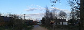
Plášťovce is a village and municipality in the Levice District in the Nitra Region of Slovakia.

Štitáre is a village and municipality in the Nitra District in western central Slovakia, in the Nitra Region.
Ciencisko is a village in the administrative district of Gmina Strzelno, within Mogilno County, Kuyavian-Pomeranian Voivodeship, in north-central Poland.
Saki is a village in the administrative district of Gmina Bielsk Podlaski, within Bielsk County, Podlaskie Voivodeship, in north-eastern Poland.

Garbów is a village in the administrative district of Gmina Bedlno, within Kutno County, Łódź Voivodeship, in central Poland. It lies approximately 6 kilometres (4 mi) south of Bedlno, 18 km (11 mi) south-east of Kutno, and 43 km (27 mi) north of the regional capital Łódź.
Wilczkowice Średnie is a village in the administrative district of Gmina Łęczyca, within Łęczyca County, Łódź Voivodeship, in central Poland. It lies approximately 3 kilometres (2 mi) west of Łęczyca and 36 km (22 mi) north-west of the regional capital Łódź.

Bənövşələr is a village in the Agdam District of Azerbaijan. The village forms part of the municipality of Əhmədağalı.
Papravənd is a village in the Agdam District of Azerbaijan.
Stadniki is a village in the administrative district of Gmina Dobczyce, within Myślenice County, Lesser Poland Voivodeship, in southern Poland. It lies approximately 5 kilometres (3 mi) east of Dobczyce, 18 km (11 mi) east of Myślenice, and 26 km (16 mi) south-east of the regional capital Kraków.
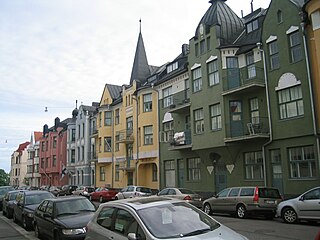
Ullanlinna is a city district of Helsinki, in Finland. The name Ullanlinna refers to the fortification line that was built at the southern edge of the area during the 18th century, as part of the town fortifications, which also included the fortress of Suomenlinna. The name Ulla refers to the Swedish Queen Ulrika Eleonora (1688–1741). During the 19th century the area was dominated by summer pavilions owned by the wealthy Helsinki middle-classes. The appearance of the area changed gradually at the end of the 19th century as the wooden houses were replaced with much higher stone buildings, designed in the prevailing Jugendstil architectural style synonymous with National Romanticism.
Stary Kiączyn is a village in the administrative district of Gmina Stawiszyn, within Kalisz County, Greater Poland Voivodeship, in west-central Poland. It lies approximately 3 kilometres (2 mi) north-east of Stawiszyn, 20 km (12 mi) north of Kalisz, and 98 km (61 mi) south-east of the regional capital Poznań.
Gamów is a village in the administrative district of Gmina Rudnik, within Racibórz County, Silesian Voivodeship, in southern Poland. It lies approximately 4 kilometres (2 mi) west of Rudnik, 10 km (6 mi) north-west of Racibórz, and 64 km (40 mi) west of the regional capital Katowice.
Zimne Zdroje is a village in the administrative district of Gmina Osieczna, within Starogard County, Pomeranian Voivodeship, in northern Poland. It lies approximately 7 kilometres (4 mi) north-west of Osieczna, 30 km (19 mi) south-west of Starogard Gdański, and 68 km (42 mi) south-west of the regional capital Gdańsk.

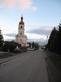
Bubovice is a municipality and village in Beroun District in the Central Bohemian Region of the Czech Republic.
Jonionių gyvenvietės is an archaeological site in Varėna district municipality, in Alytus County, in southeastern Lithuania.
'Kudipady', also called Pallataru-Kodipady or Kidippady, is a village in Puttur Taluk of Dakshina Kannada district, India. It is 6 km to the west of the larger town of Puttur and 4 km south of the town of Kabaka. Mangalore, the regions chief port city, is a further 48 km to the north-west. The local economy is primarily agricultural, with most farms growing Areca nut cocoa, pepper, coconut, and bananas.

Nakhon Sawan railway station is a railway station in Nong Pling Sub-district, Nakhon Sawan City, Nakhon Sawan. It is a Class 1 station and the main station in Nakhon Sawan Province. It is about 245 kilometres from Bangkok railway station. The railyard serves as a PTT Petroleum tanker car yard with a spur line to a gas refinery.

Swachhand is a mountain of the Garhwal Himalayas in Uttarakhand, India. Swachhand is 6,721 metres (22,051 ft) high. Its peak is the 46th highest located entirely within the Uttrakhand. Nanda Devi is the highest mountain in this category. Swachhand lies between the Satopanth 7,075 metres (23,212 ft) NNW and Janhukut 6,805 metres (22,326 ft) SSE. It's neighbour Janhukut peaks at 3.8 km SSE. It is located 8.9 km NW of Chaukhamba I 7,138 metres (23,419 ft) and 8.9 km NW lies Bhagirathi I 6,856 metres (22,493 ft).