![]() | This article may require copy editing for grammar, style, cohesion, tone, or spelling.(April 2025) |
Osmanabad district | |
---|---|
Dharashiv district | |
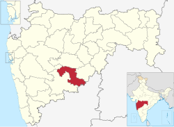
![]() Location in Maharashtra | |
Coordinates(Osmanabad): 17°21′N75°10′E / 17.35°N 75.16°E - 18°24′N76°24′E / 18.40°N 76.40°E | |
Country | ![]() |
State | Maharashtra |
Division | Aurangabad |
Headquarters | Osmanabad |
Tehsils | |
Government | |
• Body | Osmanabad Zilla Parishad |
• Guardian Minister | Tanaji Sawant (Cabinet Minister MH) |
• President Z. P. Osmanabad | Ranajagjitsinha Patil (BJP) |
• District Collector | Sachin Ombase (IAS) |
• CEO Z. P. Osmanabad | Rahul Gupta (IAS) |
• MPs | Omraje Nimbalkar (Osmanabad) |
Area | |
• Total | 7,569 km2 (2,922 sq mi) |
Population (2011) | |
• Total | 1,657,576 |
• Density | 220/km2 (570/sq mi) |
Demographics | |
• Literacy | 76.33% |
• Sex ratio | 920 |
Time zone | UTC+05:30 (IST) |
Major highways | National Highway 52, National Highway 65, National Highway 361 |
Average annual precipitation | 760.40 mm |
Website | dharashiv |
Osmanabad District (pronunciation: [usmaːnabaːd̪]) (Transliteration: Usmanabad Jil'hā), officially known as Dharashiv District, [1] is an administrative district in the Marathwada region in the Indian state of Maharashtra. The district headquarter is located at Osmanabad. The District of Osmanabad derives its name from the last ruler of Hyderabad, the 7th Nizam, Mir Osman Ali Khan, of which the region was a part till 1947. This region was earlier part of The Hyderabad State until Independence.This primarily rural district occupies an area of 7,569 km2 (2,922 sq mi) of which 241.4 km2 (93.2 sq mi) is urban and has a population of 1,657,576 of which 16.96% were urban (as of 2011). [2]
Osmanabad district lies in the southern part of state. It lies on the Deccan plateau, about 600 m above sea level. Parts of the sina, Manjira and Terna River flow through the district. The district is located on the south side of the Marathwada region between latitude 17.35 to 18.40 degrees north, and latitude 75.16 to 76.40 degrees east.
Osmanabad District is bordered by the Beed District to the north, Latur District to the east, Solapur District to the west, Ahmednagar district to the north-west and the Bidar and Kalaburagi districts of state of Karnataka to the south. Most of the district lies in the hilly areas of the Balaghat Range.
The rainy season starts from mid-June and continues till the end of September. The climate is humid in October and November and dry and cool from mid-November to January. From February to June the climate is dry and becomes increasingly hot. During summer the temperature of Osmanabad district is low compared to other districts of Marathwada region. The average annual rainfall in the district is 760.40 mm. Temperature Max.: 42.1 °C; Min.: 8 °C
Year | Pop. | ±% p.a. |
---|---|---|
1901 | 387,122 | — |
1911 | 460,516 | +1.75% |
1921 | 442,156 | −0.41% |
1931 | 492,845 | +1.09% |
1941 | 547,945 | +1.07% |
1951 | 603,273 | +0.97% |
1961 | 726,036 | +1.87% |
1971 | 928,227 | +2.49% |
1981 | 1,029,702 | +1.04% |
1991 | 1,276,327 | +2.17% |
2001 | 1,486,586 | +1.54% |
2011 | 1,657,576 | +1.09% |
source: [3] |
In the 2011 census Osmanabad district had a population of 1,657,576, [2] roughly equal to the nation of Guinea-Bissau [5] or the US state of Idaho. [6] This gave it a ranking of 298th among district of India (out of a total of 640). [2] The district had a population density of 219 inhabitants per square kilometre (570/sq mi). [2] Its population growth rate over the decade 2001-2011 was 11.69%. [2] Osmanabad had a sex ratio of 920 females for every 1000 males, [2] and a literacy rate of 76.33%. 16.96% of the population lives in urban areas. Scheduled Castes and Scheduled Tribes make up 16.00% and 2.17% of the population respectively. [2]
At the time of the 2011 Census of India, 85.42% of the population in the district spoke Marathi, 5.89% Hindi, 4.25% Urdu and 2.04% Lambadi as their first language. [7]
Before Independence of India, Osmanabad was under Princy State of Nizams, Later was the District of Gulbarga Division of Hyderabad State (1948–1956) in 1960 the Marathwada Region Merged into newly Created State Maharashtra. [8]
The Shivsena (SHS), Congress (IND), NCP, BJP and BSP are the major political parties in Osmanabad district. [9] [10]
Osmanabad's representation in the Indian Parliament (Lok Sabha) is via the Osmanabad constituency which also includes a piece of northern Solapur district (Barshi) and a piece of southern Latur district (Ausa). Current Member of parliament from Osmananbad loksabha constituency is Omprakash Raje Nimbalkar [11] Osmanabad constituency is formed by six Assembly constituencies i.e. Osmanabad, Omerga, Tuljapur, Paranda Boom, these four from Osmanabad district, Barshi from Solapur District, and Ausa from Latur District.
There are four constituencies for the Maharashtra Legislative Assembly (Vidhan Sabha): the Paranda constituency, Osmanabad constituency, Tuljapur constituency, and Umarga constituency. [12] [13]
Guardian Minister Osmanabad | |
---|---|
![]() Emblem of India | |
since 24 September 2022 | |
Style | The Honourable |
Appointer | Chief Minister of Maharashtra |
Term length | 5 years / No time limit |
Website | osmanabad |
Name | Term of office |
---|---|
Deepak Sawant | 31 October 2014 - 7 January 2019 |
Subhash Desai (additional charge) | 7 January 2019 - 16 June 2019 |
Jaydutt Kshirsagar | 16 June 2019 - 8 November 2019 |
Shankarrao Gadakh | 9 January 2020 - 29 June 2022 |
Tanaji Sawant | 24 September 2022 - Incumbent |
District Magistrate / Collector Osmanabad | |
---|---|
![]() Emblem of India | |
Incumbent since 6 January 2023Sachin Ombase (IAS) | |
Residence | At Osmanabad district |
Appointer | Government of Maharashtra |
Term length | No time limit |
Website | osmanabad |
Name | Term of office |
---|---|
Kaustubh Diwegaonkar | 2019 - 6 January 2023 |
Sachin Ombase (IAS) | 6 January 2023 - incumbent |
There are eight talukas (tahsils) in Osmanabad district. [14]
Paranda is a historical place known for the Paranda Fort.
Tuljapur is a major taluka town, about 45 km from Solapur, 25 km from Osmanabad town and 40 km from Hyderabad national Highway at Naldurga.
Tuljapur is best known for its Tulja Bhavani Mandir. It is said that Tulja Bhavani mata had offered sword to Shivaji (not verifiable) and his son Sambhaji re-built the temple. Omerga is a densely populated taluka in Osmanabad. The Tata Institute of Social Sciences, Mumbai also has a School of Rural Development (the "Rural Campus") at Tuljapur.
Kalamb is a major taluka, 55 km from district headquarter Osmanabad. Kalamb city is old city with river Manjara flowing nearby. Major APMC market is main attraction. The taluka is blessed by Yedeshwari Devi, whose temple located at Yermala, 25 km from kalamb.
A small portion of the Barshi light railway connecting Latur-Barshi-Kurduvadi passed through northern fringe of Osmanabad district until 2007. The rail track was converted to broad gauge and the track alignment was changed southwards to pass near Osmanabad town. The modified track from Latur to Osmanabad opened for traffic in September 2007. The modified rail track from Osmanabad to Kurduvadi junction became operational in October 2008 and connects Osmanabad to Pune and Mumbai by a shorter rail route than via Latur. North India also connected by this new track. Railway service is available for Nagpur to Kolhapur, Miraj to Parli, Pandharpur to Nizamabad, Pune to Hyderabad, Pune to Amarawati, Pune To Nizmabad via Osmanabad station. Tourism and Transport are developed. Osmanabad is well connected with Mumbai, Pune, Latur, Parbhani, Nanded, Amravati, Nagpur, Kolhapur, Miraj, Parli. Osmanabad station comes under Central Railway (CR) zone.
Below National Highways passes through the Osmanabad District. [15]
1. NH-52: Sangrur(Punjab)-Hisar(Haryana)-Kota(Rajasthan)-Indore(Madhya Pradesh)-Dhule-Aurangabad-Beed-Osmanabad-Tuljapur-Solapur-Vijayapura-Hubballi-Ankola(Karnataka)
(Villages from Osmanabad district on this NH are- Pargaon-Kunthalgiri Phata-Terkheda-Yermala-Yedshi-Osmanabad-Tuljapur-Tamalwadi)
2. NH-63: Barshi-Yedshi-Dhoki-Murud-Latur-Udgir-Deglur-Nizamabad(Telangana)-Sironcha(Maharashtra)-Jagdalpur(Chhattisgarh)-Kotpad(Odisha)-Borigumma
3. NH-65: Pune-Indapur-Solapur-Omerga-Hyderabad-Vijayawada-Machilipatnam(Andhra Pradesh)
(Villages from Osmanabad district on this NH are- Itkal-Anadur-Naldurg-Jalkot-Yenegur-Dalimb-Omerga-Turori)
4. NH-361: Tuljapur-Latur-Ahmedpur-Nanded-Yavatmal-Wardha-Butibori(Near Nagpur)
5. NH-548B: Mantha-Selu-Pathari-Sonpeth-Parali-Ambajogai-Latur-Ausa-Omerga-Yenegur-Murum-Alur-Akkalkot-Nagansur-Vijayapura-Athani-Chikhodi-Sankeshwar-Gotur(Karnataka)
6. NH-548C: Satara-Koregaon-Mhaswad-Malshiras-Akluj-Tembhurni-Barshi-Yermala-Kalamb-Kej-Majalgaon-Partur-Mantha-Lonar-Mehkar-Khamgaon-Shegaon-Akot-Anjangaon-Betul (Madhya Pradesh)
7. NH-652: Tuljapur-Naldurg-Hannur-Akkalkot
Osmanabad Airport located 10 Kilometres north of Osmanabad, does not have any commercial air traffic. Reliance Airport Developers, who won a bid in 2009 to run the airport on a 95-year lease, [16] [17] plan to use this airport for aviation training. [18] The nearest operational airports are Aurangabad Airport and Nanded Airport.
Guinea-Bissau 1,596,677 July 2011 est.
Idaho 1,567,582