Satara is a city located in the Satara District of Maharashtra state of India, near the confluence of the river Krishna and its tributary, the Venna. The city was established in the 16th century and was the seat of the Chhatrapati of the Maratha Kingdom, Shahu I.
Thottiyam is a Town and Taluk in Tiruchirappalli district in the Indian state of Tamil Nadu. Thamilselvi Thirugnanam is the current President of Thottiyam. It is situated 60 km north-west of Tiruchirapalli on Tiruchy-Namakkal State Highway (SH-25) and further it connects Namakkal-Salem-Bangalore National Highway. It is located near the Kaveri River, about 12 km north-west of Musiri. Koranganatha Temple located in the outskirts of the town is a historic temple built during the Chola period in the 10th century. There is a village near by this town called Thirunarayana puram which has the famous Vedanarayana perumal temple, Thirunarayanapuram.
Kudal is a census town in Sindhudurg district, Maharashtra, India. It is situated on River Karli in southwest Maharashtara. Kudal is the fourth largest town in Sindhudurg after Sawantwadi, Malvan and Kankavli. As of 2011, the population is 16,015. Kudal supports one MIDC area in the Konkan division. The Kudal railway station is located on the Konkan Railway route and connects the town with Mumbai metro situated in the Bombay, Baroda and Central India Railway of the north, and Mangalore on the south. It is a major stop for the Konkan Railway. The Deccan Odyssey train also stops in Kudal. National Highway 66 passes through Kudal. Apart from that, it also has two bus stations, a new one and old one. The old one is situated in market while the new one is just adjacent to the NH-66. Kudal is situated in centre of the Sindhudurg district and also considered one of the fastest-growing towns in the Konkan region. The Desai's were the original rulers of Kudal, who were tributaries of the Bijapur Sultanate, later the Marathas and then under the British.
Bhor is a town and a municipal council in Pune district in the state of Maharashtra, India.

Chiplun ( [t͡ʃipɭuːɳ]) is a city in Ratnagiri district in the state of Maharashtra, India. It is one of the financial and commercial hubs of Ratnagiri district, and the headquarters of Chiplun taluka. It is about 250 km south of Mumbai and 90 km North of Ratnagiri in the Konkan region of Maharashtra, on the Mumbai–Goa highway (NH-66). It has a long history and a strong cultural background. Recent decades have seen much industrial development in it and its and surrounding areas.
Daund is a city, municipal council, and headquarters of the Daund tehsil in the Pune district in the state of Maharashtra, India. The city of Daund is located on the Bhima River.

Koilwar or Koelwar is a nagar panchayat (town) and one of the 14 community development block in Bhojpur district in the Indian state of Bihar. As of 2011, the population of Koilwar town was 17,725, in 2,893 households. Koilwar lies on the Arrah-Patna highway (NH-922).
Poladpur is a census town in Raigad district in the Indian state of Maharashtra.

Rahimatpur is a city and a municipal council in Satara district in the Indian state of Maharashtra.

Sadri is a municipality in the Pali district of Rajasthan, India. It is considered the gateway to Marwar from Mewar. Sadri is one of the main places of worship for the Jain community. Ranakpur Temple and Shri Parshuram Mahadev Mandir are located in Sadri, which became a municipality in 1961. Bhadras is located 3 km from Sadri along the Suhai river.
Shirwal is a census town in Satara district in the Indian state of Maharashtra.
Parola is a city and a municipal council in Jalgaon district in the Indian state of Maharashtra. It is located on the Hajira (Surat)–Dhule–Kolkata national highway 6. The municipal council was established by the British government before the independence of India. This City is centuries old known for the two main features such as the Shree Balaji Temple and The Parola fort Also known as the native of Rani Laxmibai of Jhansi. City and Fort Build by Jahagirdar Sadashiv Rao Damodar Newalkar the great grandfather in law of Rani Lakshmibai Jhansi.
Degana is a town municipality and headquarter to Sub-Division and Tehsil located in Nagaur district of Rajasthan, India.
Koregaon is a census town and headquarters for the surrounding Koregaon Taluka in the Satara subdivision of Satara district in the Indian state of Maharashtra. It is situated on the NH-548C Satara-Baitul National Highway about 18 km east of Satara city, about 120 km from Pune and 267 km from Mumbai. The Koregaon railway station, situated on the Pune - Miraj line, is 2 kilometers outside the town. Koregaon Bus Station is conveniently located just a stone's throw away from the railway station.
Bagar, or Baggar, is a town and municipal council in the Jhunjhunu district of Rajasthan, a northwestern state in India. Known for its heritage havelis, it is located 12 kilometres (7.5 mi) from Jhunjhunu city on NH 8 towards Chirawa-Loharu.
Maan is not a city name. Dahiwadi taluka is called Maan taluka being it is situated on the Maan river. The subdivision Dahiwadi is in Satara district, Maharashtra, India. Dahiwadi is tehsil place of maan taluka.

Dhom Dam is an earthfill and gravity dam on Krishna River near Wai in state of Maharashtra in India.
Simalwara is a census town in Dungarpur district in the Indian state of Rajasthan. It is the administrative headquarters for Simalwara Tehsil.
National Highway 548C, commonly referred to as NH 548C is a national highway in India. It is a spur road of National Highway 48. NH-548C traverses the states of Madhya Pradesh and Maharashtra in India.
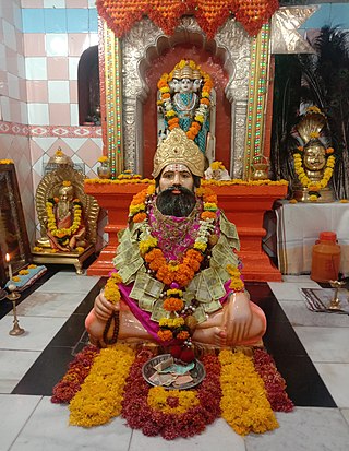
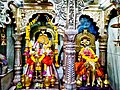
Pusegaon is a town in the Satara district of the state of Maharashtra in India. It is situated on the NH-548C Satara-Baitul National Highway. Pusegaon is known for the Shree Sevagiri Maharaj Temple & its annual Rathotsava fair.