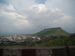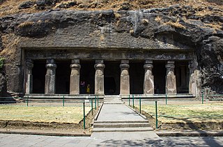
Satara is a city located in the Satara District of Maharashtra state of India, near the confluence of the river Krishna and its tributary, the Venna. The city was established in the 16th century and was the seat of the Chhatrapati of Maratha Empire, Shahu I. It is the headquarters of Satara Tehsil, as well as the Satara District. The city gets its name from the seven forts (Sat-Tara) which are around the city. The city is known as a Soldier's city as well as Pensioner's city.

Osmanabad District is an administrative district in the Marathwada region in the Indian state of Maharashtra. The district headquarter is located at Osmanabad. The District of Osmanabad derives its name from the last ruler of Hyderabad, the 7th Nizam, Mir Osman Ali Khan, of which the region was a part till 1947. This region was earlier part of The Hyderabad State until Independence.This primarily rural district occupies an area of 7,569 km2 (2,922 sq mi) of which 241.4 km2 (93.2 sq mi) is urban and has a population of 1,657,576 of which 16.96% were urban.
Wai is a town in Satara district of Maharashtra state in India. Located on the Krishna River, Wai was a prominent town during the Peshwa era. Two important Marathi Brahmin from ruling families had their origins here: Rani Lakshmibai of Jhansi and Gopikabai, wife of Nanasaheb Peshwa.

Raigad district, previously Colaba district, is a district in the Konkan division of Maharashtra, India.

Barshi is a city located in Barshi Sub district of Solapur District of Maharashtra State of Republic of India.
Chikhli is a city and a municipal council in Buldana district in Vidarbha Region of Maharashtra state, India. It is located on the Pune-Nagpur highway. It is situated at the westernmost border of Vidarbha region of Maharashtra and is 500 km from the state capital, Mumbai. Chikhli is situated on the border of the Marathwada Region and Vidarbha Regions of Maharashtra.
Dehu Road Cantt, is a military cantonment in the city of Pune, India which was established in October 1958. The Dehu Ordnance Depot and Dehu Ammunition Depot was setup in the 1940s.
Gadhinglaj ([ɡəɖᵊɦiŋɡləd͡z]) is a city in India in the Kolhapur district in the southwest corner of the state of Maharashtra, India. It is located on the banks of the river Hiranyakeshi. It is the Taluka (Tehsil) headquarters of Gadhinglaj Taluka and a subdivision headquarters of the Gadhinglaj Subdivision of the Kolhapur District. It is governed by a municipal council. The rapidly growing city is the third largest in the Kolhapur District, with population of more than 50,000. Places to visit like Samagad fort, temples and beautiful weather.

Karad is a city in Satara district of Indian state of Maharashtra and it is 320 km (180.19 miles) from Mumbai, 72 km From Sangli and 159 km from Pune. It lies at the confluence of Koyna River and the Krishna River known as the "Priti sangam". The two rivers originate at Mahabaleshwar, which is around 100 km from Karad. They diverge at their origin and travel about the same distance to meet again in Karad. The rivers meet exactly head-on, thus forming the letter "T" which is the only head-on confluence in the world. Hence Krishna and Koyna river's confluence is called Preeti Sangam, meaning Confluence of Love. Karad is well known for sugar production and is known as the sugar bowl of Maharashtra owing to the presence of many sugar factories in and around Karad. It is considered an important educational hub in Western Maharashtra due to the presence of many prestigious educational institutes. This place is also known as the resting place (Samadhi) of the first chief minister of Maharashtra Shri. Yashwantrao Chavan situated at the confluence of the Krishna and Koyana rivers.
Shirur is an administrative subdivision of the Pune district in the Indian state of Maharashtra. It is located on the eastern boundary of the district, on the banks of the Ghod River. The town is also called Ghodnadi to distinguish it from other locations that have the same name. Ghodnadi in Marathi Language means Ghod River.
Takali Dhokeshwar is a village in Ahmednagar District, Maharashtra, India. It is located at the intersection of the Mumbai - Vishakhapattanam highway and the Satara - Nashik road.
Tadawale Sammat Wagholi is a small town and gram panchayat in Koregaon taluka, Satara district, in the Indian province of Maharashtra.
Wagholi is a village in Koregaon takula of Satara district of Maharashtra, India. It plays an important role in the economic, social, cultural, and educational lives of people in Koregaon, and Satara Districts.

Padali is a census village in the Satara district, in the Indian state of Maharashtra. It is surrounded by a Mountains on its three sides. There is a big temple of Heljaidevi Mandir at Village. Agriculture is the main occupation in the village with more than 75% of the total area being used for agricultural activities.
Umarga (Omerga) Tehsil is a tehsil/ taluka/ subdistrict in Osmanabad district, Maharashtra on the Deccan Plateau of India. The town of Umarga is the administrative headquarters of the tehsil. There are 79 panchayat villages in Umarga Tehsil.
Shikrapur is a panchayat village in the state of Maharashtra, India. It is the largest village in the Shirur Taluka of Pune District in Maharashtra.
Banawadi is a census village of Satara district in the Indian state of Maharashtra. It is situated near to the Satara Phaltan state highway, about 21 km north of Satara, about 108 km from Pune and 220 km from Mumbai.
Malkapur is a town in Satara district in the southern part of Indian state of Maharashtra. It lies beside the city of Karad and along the NH4 highway. It had one of the highest revenue-generating Gram Panchayats in Maharashtra. Later on due to increasing population and urbanization it was given the status of a town having Municipal Council. The town is well known for its 24×7 water supply to each and every house and at very cheap cost. It is also implementing Solar City Project in which municipal council gives subsidy on purchasing any solar-powered equipment and reducing power dependency on MSEB. Malkapur town is divided into 17 wards for which elections are held every 5 years.

Vaduj is a major town in Satara district of Maharashtra, India. It is the headquarters of Khatav Taluka. It is located on the banks of the Yerala River, and is around 58 kilometres (36 mi) away from the district capital Satara, and 165 kilometres (103 mi) away from Pune. It is the biggest town in Khatav Taluka, with a population of around 17,636 people. Recently, its status was changed to Nagar Panchayat.

Lalgun is a village in the Satara district of the state of Maharashtra in India. It is located on Pusegaon-Phaltan State Highway and comes under Koregaon assembly constituency and Satara Parliamentary constituency. Lalgun has a population of about 2930.


