Mumbai City district

Last updated

Mumbai City district
2012 Gateway Of India.jpg
South Bombay Harbour (18407488365).jpg
Ferry boats moored at Gateway of India 02.jpg
Chaitya Bhoomi Stupa 02.jpg
Dharavi India.jpg
Clockwise from top-left: Gateway of India, South Bombay Harbour, Chaitya Bhoomi, Dharavi, Taj Mahal Palace Hotel
Mumbai City in Maharashtra (India).svg
Location in Maharashtra
Coordinates: 18°58′N72°49′E / 18.96°N 72.82°E / 18.96; 72.82
Country India
State Maharashtra
Division Konkan
Government
  Body Brihanmumbai Municipal Corporation
  Guardian Minister Deepak Kesarkar
(Cabinet Minister MH)
  Mayor
  District Collector
  • Shri Sanjay Yadav (IAS)
  Municipal Commissioner & Administrator
   MPs
Area
  Total71 km2 (27 sq mi)
Population
 (2024)
  Total3,304,000
  Density47,000/km2 (120,000/sq mi)
Time zone UTC+5:30 (IST)
Sex ratio 840
Literacy 89.2%
Website https://mumbaicity.gov.in/

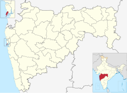
Mumbai City district is a district of Maharashtra in Konkan Division, India. As a city district, it has no headquarters or subdivisions. It, along with the Mumbai Suburban District, makes up the metropolis of Mumbai. This area is called the "Island City" or South Mumbai or Old Mumbai. It extends from Colaba in the south to Mahim and Sion in the north. The city has an area of 157 km2 (61 sq mi) and a population of 3,085,411. [1]

Contents

Proposed Talukas

Officer

Members of Parliament

Guardian Minister

Guardian Minister Mumbai City
पालकमंत्री मुंबई शहर
Emblem of India.svg
Emblem of India
Incumbent
Deepak Kesarkar
since 24 September 2022
Style The Honourable
Appointer Chief Minister of Maharashtra
Term length 5 years / No time limit
Website mumbaicity.gov.in/en/

list of Guardian Minister

NameTerm of office
Jayant Patil
Cabinet Minister
07 November 2009 10 November 2010
R. R. Patil
Cabinet Minister
11 November 2010 – 26 September 2014
Subash Desai
Cabinet Minister
31 October 2014 - 8 November 2019
Aslam Shaikh
Cabinet Minister
9 January 2020 - 29 June 2022
Deepak Kesarkar
Cabinet Minister
24 September 2022 - Incumbent

District Magistrate/Collector

District Magistrate / Collector Mumbai City
जिल्हाधिकारी तथा जिल्हदंडाधिकरी मुंबई शहर
Emblem of India.svg
Emblem of India
Incumbent
Shri Sanjay Yadav (IAS)
Residence At Mumbai City district
Appointer Government of Maharashtra
Term length No time limit
Website mumbaicity.gov.in/en/

list of District Magistrate / Collector

NameTerm of office
Shri Sanjay Yadav (IAS)2024 - Incumbent

History

Historical population
YearPop.±% p.a.
1901721,776    
1911893,481+2.16%
19211,073,685+1.85%
19311,087,191+0.13%
19411,401,059+2.57%
19512,329,020+5.21%
19612,771,933+1.76%
19713,070,378+1.03%
19813,285,040+0.68%
19913,174,889−0.34%
20013,338,031+0.50%
20113,085,411−0.78%
20213,304,000+0.69%
source: [2]

The city of Mumbai came in light in the year 150 CE through the geographical work of renowned geographer, Ptolemy. The city, consisting of several islands, was then ruled by native Agris and Kolis. These natives ruled the islands up to 1345. Thereafter, Mumbai's rulers changed through history until Islamic rulers conquered what is now Maharashtra and conquered some of the islands in 1534. Subsequently, sultan of Gujarat took over all the islands, which were then conquered by the Portuguese.

Following the continued support of England in the Anglo-Portuguese Alliance, stemming from the Anglo-Portuguese Treaty of 1373 and on the accession of a Catholic monarch in 1660, in 1661 the island of Mumbai was given to the British as part of a Royal Dowry, on the occasion of the marriage of King Charles II of England with the Portuguese Princess Infanta Catherine of Braganza. The island of Mumbai, was then to remain part of British Raj until 15 August 1947, when it became an autonomous dominion. Initially, Charles II entrusted the administration of Mumbai to the East India Company.

By a Royal Charter under the Regulation XIX of 1827, passed by the British Government, the Collector of Mumbai was made the Chief Controlling Authority of the Revenue Administration of Mumbai. The Collector of Mumbai enjoyed vast authority under the Mumbai Land Revenue Act 1876 which was repealed by the Maharashtra Land Revenue Code 1966.

Demographics

According to the 2011 census Mumbai City district has a population of 3,085,411, [3] roughly equal to the nation of Mongolia [4] or the US state of Iowa. [5] This gives it a ranking of 115th in India (out of a total of 640). [3] The district has a population density of 19,652 inhabitants per square kilometre (50,900/sq mi) . [1] Its population growth rate over the decade 2001-2011 was -7.57%. [1] Mumbai City has a sex ratio of 832 females for every 1000 males, [1] and a literacy rate of 89.21%. Scheduled Castes and Scheduled Tribes make up 7.13% and 0.81% of the population respectively. [1]

Religion

Religions in Mumbai City district (2011) [6]
ReligionPercent
Hinduism
65.73%
Islam
20.06%
Jainism
5.38%
Buddhism
4.35%
Christianity
2.74%
Other or not stated
1.01%
Sikhism
0.44%

Hinduism is the largest religion. Islam is the second-largest religion, Jainism is practiced by Gujaratis, while Buddhism is found among the Marathis. Mumbai also has the largest population of Parsis in the world, although their population is fast dwindling.

Language

Languages in Mumbai City district (2011) [7]

   Marathi (35.96%)
   Hindi (22.98%)
   Urdu (13.53%)
   Gujarati (11.34%)
   Tamil (2.93%)
   Marwadi (2.57%)
   Telugu (2.37%)
   Konkani (1.38%)
   Bengali (1.31%)
  Others (5.63%)

Marathi is the official and most spoken language of the district. However being one of the largest cities in the country, Mumbai has attracted speakers of a large number of languages. Other languages with significant number of speakers in the district include Hindi, Urdu, Gujarati, and Tamil.

At the time of the 2011 Census of India, 35.96% of the population in the district spoke Marathi, 22.98% Hindi, 13.53% Urdu, 11.34% Gujarati, 2.93% Tamil, 2.57% Marwadi, 2.37% Telugu, 1.38% Konkani and 1.31% Bengali as their first language. [7]

See also

Related Research Articles

<span class="mw-page-title-main">Chandrapur district</span> District of Maharashtra in India

Chandrapur district is a district in the Nagpur Division in the Indian state of Maharashtra. Chandrapur was the largest district in India until the Gadchiroli and Sironcha tehsils were separated as Gadchiroli district in 1981. In 2011, the district population was 2,204,307.

<span class="mw-page-title-main">Beed district</span> District in Maharashtra, India

Beed district is an administrative district in the state of Maharashtra in India. The district headquarters are located at Beed. The district occupies an area of 10,693 km² and has a population of 2,161,250 of which 17.91% were urban.

<span class="mw-page-title-main">Mumbai Suburban district</span> District of Maharashtra in India

Mumbai Suburban district is the second most populous district of Maharashtra in the Konkan Division. With its administrative headquarters in Bandra, the district consists of three subdivisions or tehsils (townships): Kurla, Andheri, and Borivali. The district along with Mumbai City district and other suburban localities make up Greater Mumbai. The district occupies an area of 446 km2.

<span class="mw-page-title-main">Washim district</span> District of Maharashtra in India

Washim district is a district in Maharashtra, India. The headquarters is at Washim. The area of the district is 5,150 km2 (1,990 sq mi).

<span class="mw-page-title-main">Pernem taluka</span> Sub-District in Goa, India

Pernem is a northmost administrative region or sub-district in North Goa in India. It acts as the Gateway of Goa from Maharashtra side. It is also the name of the town of Pernem, which is its headquarters. It has a Municipal Council. Geographically, Pernem is surrounded by Sawantwadi sub-district on East, Arabian Sea on West, Bardez and Bicholim sub-district on south and Sawantwadi sub-district on north. The two rivers which decide the boundary of this sub-district are Terekhol River and Chapora River. Terekhol river acts as a border of Maharashtra and Goa while Chapora river acts as a border of Pernem sub-district and Bardez sub-district.

<span class="mw-page-title-main">Pune division</span> Place in Maharashtra, India

Pune Division is one of the six administrative divisions of the Indian State of Maharashtra. Pune Division is bound by Konkan Division to the west, Nashik Division to the north, Aurangabad Division to the east, and the state of Karnataka to the south.

<span class="mw-page-title-main">Raigad district</span> District of Maharashtra in India

Raigad district, previously Colaba district, is a district in the Konkan division of Maharashtra, India. The headquarters of the district is Alibag. Other major cities in the district are Panvel, Karjat, Navi Mumbai, Khopoli, Shrivardhan and Mahad.

<span class="mw-page-title-main">Solapur district</span> District of Maharashtra in India

Solapur District is a district in Maharashtra state of India. The city of Solapur is the district headquarters. It is located on the south east edge of the state and lies entirely in the Bhima and Seena basins. The entire district is drained by the Bhima River.

Jat is a town and taluka headquarters in Miraj subdivision of Sangli district in southern Maharashtra.

Khanapur (Vita) is a village and taluka and a subdivision of Sangli district of Maharashtra in India.

<span class="mw-page-title-main">Rahata taluka</span> Tehsil in Maharashtra, India

Rahata taluka, is a taluka in Shrirampur subdivision of Ahmednagar district in Maharashtra State of India.

<span class="mw-page-title-main">Sangamner taluka</span> Tehsil in Maharashtra, India

Sangamner taluka, is a taluka in Sangamner subdivision of Ahmednagar district in Maharashtra state of India.

<span class="mw-page-title-main">Shevgaon taluka</span> Tehsil in Maharashtra, India

Shevgaon taluka is a taluka in Ahmednagar subdivision of Ahmednagar district in Maharashtra state of India.

<span class="mw-page-title-main">Haveli taluka</span> Tehsil in Maharashtra, India

Taluka Haveli is a subdivision of the district of Pune, Maharashtra. The Pune Municipal Corporation & Pimpri Chinchwad Municipal Corporation, Pune are at the center of & entirely surrounded by the taluka for administrative purposes. The region of Pune Metropolitan Region has claimed the major part of the same.

<span class="mw-page-title-main">Maval taluka</span> Tehsil in Maharashtra, India

Maval taluka is a taluka in Mawal subdivision of Pune district of state of Maharashtra in India.

<span class="mw-page-title-main">Pune City taluka</span> Tehsil in Maharashtra, India

Pune City taluka is the main taluka in the Pune district of state of Maharashtra in India.

<span class="mw-page-title-main">Barshi taluka</span> Tehsil in Maharashtra, India

Barshi Taluka is one of the 11 talukas of Solapur District in the Indian state of Maharashtra. This tehsil occupies the Northeast corner of the district and is bordered by Osmanabad District to the north and east, Madha Taluka to the west, Mohol Taluka to the southwest and North Solapur Taluka to the south. The tehsil headquarters is located at Barshi, which is also the largest city in the tehsil.

<span class="mw-page-title-main">Palghar district</span> District Of Maharashtra in India

Palghar District is a district in the state of Maharashtra in Konkan Division. The headquarters of the district is the town of Palghar. Other major cities in the district are Vasai-Virar, Talasari, Jawhar and Dahanu.

Thane taluka is a taluka in Thane district of Maharashtra state in Konkan division.

<span class="mw-page-title-main">Mormugao taluka</span> Tehsil in Goa, India

Morumugaotaluka is an administrative subdivision of South Goa district, Goa state, India, headquartered at Mormugao city. It is the state's only subdistrict to have all four modes of transport—air, road, rail, and sea.

References

  1. 1 2 3 4 5 "Mumbai City District Population Census 2011". Census 2011 India. Census Organization of India. Retrieved 10 July 2015.
  2. Decadal Variation In Population Since 1901
  3. 1 2 "District Census Hand Book – Mumbai City" (PDF). Census of India . Registrar General and Census Commissioner of India.
  4. US Directorate of Intelligence. "Country Comparison:Population". Archived from the original on 13 June 2007. Retrieved 1 October 2011. Mongolia 3,133,318 July 2011 est.
  5. "2010 Resident Population Data". U. S. Census Bureau. Retrieved 30 September 2011. N Iowa 3,046,355
  6. "Population by Religion - Mumbai City". censusindia.gov.in. Registrar General and Census Commissioner of India. 2011.
  7. 1 2 "Table C-16 Population by Mother Tongue: Maharashtra". censusindia.gov.in. Registrar General and Census Commissioner of India.