Related Research Articles

Malappuram, is one of the 14 districts in the Indian state of Kerala, with a coastline of 70 km (43 mi). The most populous district of Kerala, Malappuram is home to around 13% of the total population of the state. The district was formed on 16 June 1969, spanning an area of about 3,554 km2 (1,372 sq mi). It is the third-largest district of Kerala by area. It is bounded by Western Ghats and the Arabian Sea on either side. The district is divided into seven Taluks: Eranad, Kondotty, Nilambur, Perinthalmanna, Ponnani, Tirur, and Tirurangadi.
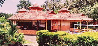
Nilambur is a major town, a municipality and a Taluk in the Malappuram district of the Indian state of Kerala. It is located close to the Nilgiris range of the Western Ghats on the banks of the Chaliyar River. This place is also known as 'Teak Town' because of the abundance of Nilambur teaks, which is a variety of a large, deciduous tree that occurs in mixed hardwood forests. Unlike many Municipalities of India; Nilambur is covered with large amounts of vegetation, making it very scenic.

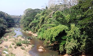
Chaliyar River is the fourth longest river in Kerala at 169 km in length. The Chaliyar is also known as Chulika River, Nilambur River or Beypore River as it is near the sea. Pothukal, Chungathara, Nilambur, Mampad, Edavanna, Kavanoor, Perakamanna, Areekode, Kizhuparamba, Elamaram, Cheekkode, Vazhakkad, Vazhayur, Cheruvadi, Edavannappara, Mavoor, Peruvayal, Perumanna, Feroke and Beypore are some of the towns/villages situated along the banks of the Chaliyar. It mainly flows through Malappuram district. Its tributaries flow through both the districts of Malappuram and Kozhikode. The bank of river Chaliyar in the Nilambur region is also known for its natural Gold fields. Explorations done at the valley of the river Chaliyar in Nilambur have shown reserves of the order of 2.5 million cubic meters of placers with 0.1 gram per cubic meter of gold. It originates at the Ilambaleri hills of Nilgiri Mountains in Nilgiris district, which is also near Wayanad-Malappuram district border. It flows mainly through the erstwhile region of Eranad, and finally empties into the Arabian Sea at Beypore port, opposite to Chaliyam harbour.

The Bhavani is an interstate Indian river which flows through Indian states of Kerala and Tamil Nadu, India. It originates from the Western Ghats and is one among the three rivers of Kerala which flows in eastward direction.

Attappadi (HQ:Agali) is a tribal taluk in Kerala state covering an area of 735 km2 (284 sq mi). It was carved out of Mannarkkad taluk in Palakkad district in February 2021. Attappadi Reserve Forest is a protected area comprising 249 km2 of land in the western parts of Attappadi. It is one of the reserved forests and protected forests of India. Attappadi valley in Palakkad district along with the neighbouring Chaliyar valley of the Nilambur region in Malappuram district is known for natural Gold fields which are also seen in the other regions of Nilgiri Biosphere Reserve.

Mannarkkad, formerly known as Mannarghat, is a major municipal town in Palakkad district of the Indian state of Kerala. The Silent Valley National Park and the Attappadi Reserve Forest are located in Mannarkkad Taluk. Mannarkkad is situated 36 km away from district headquarters Palakkad on National Highway 966. It is the traditional seat of the Mannarghat Moopil Nair.
Vellarimala Hills is a mountain range in Kerala, India, spread across Thiruvambady Panchayat in Kozhikode district and Meppadi Panchayat in Wayanad district.
Punnappuzha is a tributary of Karimpuzha, which is the biggest tributary of the Chaliyar river in Kerala, India.
The Maruthappuzha is a tributary of the Punnappuzha in Kerala, India, which merges with the Karimpuzha and thus finally joins the Chaliyar. The Maruthappuzha originates as two separate streams from the Devala and the Pandalur areas of Nilagiri district and join near Marutha to form the Maruthappuzha. The Muringamunda Puzha and Karakkodan puzha also joins with the Maruthappuzha at Palemad and Munda respectively.
Moothedam is a small town and panchayath in Nilambur taluk of the Malappuram district in the Indian State of Kerala. It is situated on the foothills of the Western Ghats near Mukurthi National Park in the Nilgiris district of Tamil Nadu. The panchayath is surrounded by two rivers, the Punnappuzha to the north and west and the Karimpuzha to the south.
Kanjirappuzha (കാഞ്ഞിരപ്പുഴ) is a small tributary of the Chaliyar river in Nilambur taluk of Malappuram district in Kerala, India. The river originates from the mountain region which lies between Malappuram and Kozhikode districts. The river flows through Chaliyar Panchayath in Malappuram district and ultimately join to Chaliyar near Chaliyarmukku where Karimpuzha also meet Chaliyar. The Adyanpara Waterfalls are on the river.
Kuthirappuzha is a tributary of Chaliyar in the Kerala state of India. The river joins Chaliyar at Vadapuram near Nilambur. Kuthirappuzha is originating from forests south-west of Upper Bhavani reservoir in Nilgiris district of Tamil Nadu. It flows through Pookkottum Padam town and on reaching Koorad, Kottappuzha joins with Kuthirappuzha.
Kuruvanpuzha is a tributary of Chaliyar river in Kerala, India. This river originates in the forests bordering Malappuram and Kozhikode districts in Nilambur taluk. It joins the Chaliyar near Vadapuram just before Kuthirappuzha meets Chaliyar, behind the Kerala State Wood Industries Limited. The Connolly's Plot, near the confluence of Kuruvanpuzha with Chaliyar, has the world's biggest and oldest teaks.

Mukurthi Peak is one of the highest peaks in the Western Ghats, situated on the border of Udagamandalam taluk, Nilgiris, Tamil Nadu, Nilambur taluk, Malappuram, and Kerala in India. It reaches an altitude of 2,554 m (8,379ft), and is the fifth-highest peak in South India.
Kottappuzha is a tributary of Kuthirappuzha which is a tributary of Chaliyar river in Kerala, India. Kottappuzha originates from the western slopes of Upper Bhavani reservoir in Nilgiris district of Tamil Nadu. Near Kottappuzha palam (bridge), about 1.5 km south of Pookkottumpadam 'Chokkadan puzha' a river from Kozhippara hills and which passes through Chokkad join with Kottappuzha. At Koorad, Kottappuzha meets Kuthirappuzha.
Eranad also known as Ernad refers to the erstwhile province in the midland area of Malabar, consisting of Malappuram and nearby regions such as Anakkayam, Manjeri, Kondotty, Nilambur, etc. Currently Eranad Taluk is a Taluk in Malappuram district. Eranad was ruled by a Samanthan Nair clan known as Eradis, similar to the Vellodis of neighbouring Valluvanad and Nedungadis of Nedunganad. The rulers of Eranad were known by the title Eralppad/Eradi. They also used the title Thirumulpad.
Nilambur–Nanjangud line also called The golden I. T. corridor or Wayanad Railway, is a railway project to create a 5 ft 6in broad gauge rail connection from the town of Nanjangud (Karnataka) to Nilambur (Kerala) through Wayanad district of Kerala and Nilgiri district of Tamil Nadu.
Kolaribetta is the second highest peak in the Nilgiri hills of the Western Ghats, located in Tamil Nadu, India.

South Malabar refers to a geographical area of the southwestern coast of India covering some parts of the present-day Kerala state. South Malabar covers the regions included in present-day Kozhikode and Thamarassery taluk of Kozhikode district, Wayanad district excluding Mananthavady taluk, the whole area of Malappuram district, Chavakkad taluk of Thrissur district, and Palakkad district, excluding parts of Chittur taluk. The Fort Kochi region of Kochi city also historically belongs to South Malabar. The term South Malabar refers to the region of the erstwhile Malabar District south to the river Korapuzha, and bears a high cultural similarity to both the Cochin and the North Malabar regions.

Karimpuzha Wildlife Sanctuary is located on the western slopes of Nilgiris, lies between the geographical limits of N 11o23’15’’to 11o12’43’’ latitudes and E 76o22’37’’ to 76o33’2’’ longitudes and falls in the Nilambur Taluk of Malappuram Revenue District in Kerala. Karimpuzha WLS area forms part of the revenue villages of Karulai, Moothedam and Amarambalam. The sharp topographical gradient of the hills ranging from 40 m to 2550 m is the primary reason for the unique biodiversity of the Karimpuzha WLS.
References
- ↑ technologies, Trice. "Karimpuzha Wild lifeSanctury". karimpuzhawildlifesanctuary.com. Retrieved 14 November 2024.
- ↑ Staff Reporter (3 July 2020). "Karimpuzha sanctuary comes into being". The Hindu. ISSN 0971-751X . Retrieved 14 November 2024.
11°18′N76°16′E / 11.300°N 76.267°E