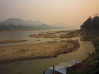
A tributary, or affluent, is a stream or river that flows into a larger stream or main stem river or a lake. A tributary does not flow directly into a sea or ocean. Tributaries and the main stem river drain the surrounding drainage basin of its surface water and groundwater, leading the water out into an ocean. The Irtysh is a chief tributary of the Ob river and is also the longest tributary river in the world with a length of 4,248 km (2,640 mi). The Madeira River is the largest tributary river by volume in the world with an average discharge of 31,200 m3/s (1.1 million cu ft/s).

The Salt River is a river in Gila and Maricopa counties in Arizona, United States, that is the largest tributary of the Gila River. The river is about 200 miles (320 km) long. Its drainage basin is about 13,700 square miles (35,000 km2) large. The longest of the Salt River's many tributaries is the 195-mile (314 km) Verde River. The Salt's headwaters tributaries, the Black River and East Fork, increase the river's total length to about 300 miles (480 km). The name Salt River comes from the fact that the river flows over large salt deposits shortly after the merging of the White and Black Rivers.

The Dearborn River is a tributary of the Missouri River, approximately 70 mi (113 km) long, in central Montana in the United States. It rises in the Lewis and Clark National Forest, near Scapegoat Mountain in the Lewis and Clark Range of the Rocky Mountains at the continental divide, in western Lewis and Clark County. It flows generally southeast through secluded canyons, and joins the Missouri near Craig.

The Mahanadi River is a major river in East Central India. It drains an area of around 132,100 square kilometres (51,000 sq mi) and has a total length of 900 kilometres (560 mi). Mahanadi is also known for the Hirakud Dam which was the first major multipurpose river valley project after India's independence in 1947. The river flows through the states of Chhattisgarh and Odisha and before finally ending in the Bay of Bengal.

A Ramsar site is a wetland site designated to be of international importance under the Ramsar Convention, also known as "The Convention on Wetlands", an international environmental treaty signed on 2 February 1971 in Ramsar, Iran, under the auspices of UNESCO. It came into force on 21 December 1975, when it was ratified by a sufficient number of nations. It provides for national action and international cooperation regarding the conservation of wetlands, and wise sustainable use of their resources. Ramsar identifies wetlands of international importance, especially those providing waterfowl habitat.

Penna is a river of southern India. This is a unique river in world where after originating from Nandi hills, it flows as two different streams, one in North and South directions. The Penna rises in the Nandi Hills in Chikkaballapur District of Karnataka state, and runs north and east through the states of Karnataka and Andhra Pradesh to empty into bay of bengal in Andhra Pradesh. It is 597 kilometres (371 mi) long, with a drainage basin covering 55,213 km2: 6,937 km2 in Karnataka and 48,276 km2 in Andhra Pradesh. Along with this main stream there is another stream south towards Tamilnadu with the name Then Pennai or south Pennar which further moves towards the east to empty into the Bay of Bengal.The Penna river basin lies in the rain shadow region of Eastern Ghats and receives 500 mm average rainfall annually.

The Wainganga is a river in India originating in the Mahadeo Hills in Mundara in Gondwana region near the village Gopalganj in Seoni, Madhya Pradesh. It is a key tributary of the Godavari. The river flows south in a winding course through the states of Madhya Pradesh and Maharashtra, roughly 580 km (360 mi). After joining the Wardha River, the united stream, which is known as the Pranahita River, empties into the Godavari River at Kaleshwaram, Telangana.

The Brahmani is a major seasonal river in the Odisha state of eastern India. The Brahmani is formed by the confluence of the Sankh and South Koel rivers, and flows through the districts of Sundargarh, Deogarh, Angul, Dhenkanal, Cuttack, Jajapur and Kendrapara. Also South Koel can be considered as upper reaches of Brahmani. Together with the river Baitarani, Brahmani forms a large delta before emptying into the Bay of Bengal at Dhamra. It is the second widest river in Odisha after Mahanadi.
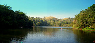
Pookode Lake is a scenic freshwater lake in the Wayanad district in Kerala, South India. A major tourist destination in the district, Pookode is a natural freshwater lake nestling amid evergreen forests and mountain slopes at an elevation of 770 meters above sea level. It is 15 km away from Kalpetta. It is the smallest and highest elevation freshwater lake in Kerala.

Superior National Forest, part of the United States National Forest system, is located in the Arrowhead Region of the state of Minnesota between the Canada–United States border and the north shore of Lake Superior. The area is part of the greater Boundary Waters region along the border of Minnesota and the Canadian province of Ontario, a historic and important thoroughfare in the fur trading and exploring days of New France and British North America.
Tearcoat Creek is an 18.3-mile-long (29.5 km) free-flowing tributary stream of the North River, itself a tributary of the Cacapon River, making it a part of the Potomac River and Chesapeake Bay watersheds. The creek is located in central Hampshire County, West Virginia. Its name is believed to have been derived from the tearing of the coats of British soldiers by low-hanging branches as they forded the stream during either the French and Indian or the American Revolutionary Wars.
Nash Stream is a 15.3-mile-long (24.6 km) river in northern New Hampshire in the United States. It is a tributary of the Upper Ammonoosuc River and part of the Connecticut River watershed.
The Warren River is a river in the South West region of Western Australia with a catchment encompassing the towns of Manjimup and Pemberton. The river was named by Governor James Stirling, probably after Admiral Sir John Borlase Warren under whom Stirling served whilst in action in North America in 1813.
The Kiul River is a tributary of Ganges. It originates in Giridih of Jharkhand and flows through Lakhisarai, Sheikhpura and Jamui districts of the Indian state of Bihar and joins Harohar river in the Diara region.
Bidyadhari River, is a river in the Indian state of West Bengal. It originates near Haringhata in Nadia district and then flows through Deganga, Habra and Barasat areas of North 24 Parganas before joining the Raimangal River in the Sundarbans.
A backwater is a part of a river in which there is little or no current. It can refer to a branch of a main river, which lies alongside it and then rejoins it, or to a body of water in a main river, backed up by the sea tide or by an obstruction such as a dam. Manmade restrictions to natural stream flow or temporary natural obstructions such as ice jams, vegetation blockage, or flooding of a lower stream can create backwater.
The Koina River flows through West Singhbhum in the Indian state of Jharkhand.
The Lhonak River is a tributary of the Teesta River in the Indian state of Sikkim.

Fresh Kills is a stream and freshwater estuary in the western portion of the New York City borough of Staten Island. It is the site of the Fresh Kills Landfill, formerly New York City's principal landfill.

Fresh water or freshwater is any naturally occurring liquid or frozen water containing low concentrations of dissolved salts and other total dissolved solids. Although the term specifically excludes seawater and brackish water, it does include non-salty mineral-rich waters such as chalybeate springs. Fresh water may encompass frozen and meltwater in ice sheets, ice caps, glaciers, snowfields and icebergs, natural precipitations such as rainfall, snowfall, hail/sleet and graupel, and surface runoffs that form inland bodies of water such as wetlands, ponds, lakes, rivers, streams, as well as groundwater contained in aquifers, subterranean rivers and lakes. Fresh water is the water resource that is of the most and immediate use to humans.