
Satara is a city located in the Satara District of Maharashtra state of India, near the confluence of the river Krishna and its tributary, the Venna. The city was established in the 16th century and was the seat of the Chhatrapati of Maratha Empire, Shahu I. It is the headquarters of Satara Tehsil, as well as the Satara District. The city gets its name from the seven forts (Sat-Tara) which are around the city. The city is known as a Soldier's city as well as Pensioner's city.

Ganpatipule (Gaṇpatīpuḷē) is a small town located 25 km north of the city of Ratnagiri in Ratnagiri district on the Konkan coast of Maharashtra, in the sub-continent of India. The town of Chiplun is located to its north.

Konkan Railway Corporation Limited (KRCL) is a Union Government Company headquartered at CBD Belapur in Navi Mumbai that operates Konkan Railway and also undertakes other railway-related projects. The railway (railroad) route of KRCL covers the coastal districts of Maharashtra, Goa and Karnataka states of India . The company started its full operations of trains on 26 January 1998.The first passenger train which ran on Konkan railway tracks on 20 March 1993 between Udupi and Mangalore. Konkan Railway Corporation is at the forefront of research and development of new technologies and concepts for Indian railways. During its initial years of operations in the mountainous Konkan region, a spate of accidents prompted Konkan Railway to investigate new technologies. The anti-collision devices, the Sky Bus and RORO are a few of Konkan Railyway's innovations.

Khed is a town with a municipal council in the Ratnagiri district of the state of Maharashtra, India. Situated on the Mumbai - Goa Highway, NH 66, it is surrounded by a number of villages.

Alore is a village in the Chiplun taluka of Ratnagiri district, Maharashtra, India. It lies on a bypass of the state highway linking the nearest town of Chiplun to Karad, and is located about 12.0 km (7.5 mi) east of the nearest town, that is Chiplun.

Kolkewadi Dam or Kolkiwadi Dam is a dam located in the Konkani region, Ratnagiri district of Maharashtra, India. It is located in Kolkiwadi, about 3.0 km (1.9 mi) near the village of Alore, near Chiplun.
Karhaḍe Brahmins are a Hindu Brahmin sub-caste mainly from the Indian state of Maharashtra.

Satara district is a district of Maharashtra state in western India with an area of 10,480 km² and a population of 3,003,741 of which 14.17% were urban. Satara is the capital of the district and other major towns include Medha, Wai, Karad, Koregaon, Dahiwadi, Koynanagar, Rahimatpur, Phaltan, Mahabaleshwar, Vaduj and Panchgani. This district comes under Pune Administrative Division along with Pune, Sangli, Solapur and Kolhapur. The district of Pune bounds it to the north, Raigad bounds it to the north-west, Solapur the east, Sangli to the south, and Ratnagiri to the west.

National Highway 4 was a major National Highway before National Highway renumbering in Western and Southern India. NH 4 linked four of the 10 most populous Indian cities - Mumbai, Pune, Bangalore, and Chennai. NH 4 was 1,235 km (767 mi) in length and passed through the states of Maharashtra, Karnataka and Tamil Nadu.
Pophali is a panchayat town in Chiplun taluka of Ratnagiri district in Maharashtra, India. The town is known for its power plant, which is a part of the Koyna Hydroelectric Project. It is also the last town in the Konkan side on the state highway (SH-78) that links the Konkan to the rest of Maharashtra. It is at the western end of the Kumbharli Ghat on this highway. Chiplun 15 km (9 mi) is the nearest big town.

Mahadpronunciation (help·info) is a city in Raigad district situated in the North Konkan region of Maharashtra state, India. It is located 108.5 km (67.4 mi) from District's Headquarter Alibag, and 167 km (104 mi) from Mumbai, the state capital of Maharashtra and economic capital of India, towards western coast. Historically, the city contains the Raigad fort, the capital of Maratha Empire in Shivaji Maharaj's era and revolutionary Mahad Satyagraha launched by Dr. Babasaheb Ambedkar at Chavdar Tale in the wake of Modern India.

Chiplunpronunciation (help·info) is a city in Ratnagiri district in the state of Maharashtra, India. It is the financial and commercial Hub of Ratnagiri, and the headquarters of Chiplun taluka. It is about 320 km south of Mumbai in the Konkan region of Maharashtra, on the Mumbai–Goa highway (NH-66). It has a long history and a strong cultural background. Recent decades have seen much industrial development in it and its and surrounding areas.

Karad is a city in Satara district of Indian state of Maharashtra and it is 320 km (180.19 miles) from Mumbai and 159 km from Pune. It lies at the confluence of Koyna River and the Krishna River known as the "Priti sangam". The two rivers originate at Mahabaleshwar, which is around 100 km from Karad. They diverge at their origin, and travel for about the same distance to meet again in Karad. The rivers meet exactly head on, thus forming letter "T" which is the only head on confluence in the world. Hence Krishna and Koyna river's confluence is called Preeti Sangam, meaning Confluence of Love. Karad is well known for sugar production and is known as the sugar bowl of Maharashtra owing to the presence of many sugar factories in and around Karad. It is considered as an important educational hub in Western Maharashtra due to the presence of many prestigious educational institutes. This place is also known for resting place or (Samadhi) of the first chief minister of Maharashtra Shri. Yashwantrao Chavan situated at the confluence of Krishna and Koyana river.
Helwak is a town on the Chiplun–Karad highway in the state of Maharashtra, India just off the Kumbharli Ghat. It is located near the Koyna Dam in Satara at an elevation of 588 metres (1,929 ft).

Ambenali Ghat is a mountain road in Maharashtra, India cutting across the Northern Western Ghats or the Sahyadri mountain range. It connects the coastal Raigad District Konkan region of Maharashtra with the Satara District Desh region on the Deccan plateau. It is one of few link roads between the Konkan and Ghatmaatha in Maharashtra. The road, state highway 72, is at an average elevation of 625 m (2,051 ft). The ghat, or mountain road, is about 40 km long. Its characteristic feature is that it takes many turns without gaining/losing much height. It links the cities of Poladpur and Mahabaleshwar. It ends in Poladpur. The road ascends/descends around 1300m from Mahabaleshwar to Poladpur. It is the longest ghat in Maharashtra.This ghat travels through the Javali forest area. Many animals like leopards are seen here. This 40 km long ghat is known for its deadly road, where many accidents take place. It is very scenic and its picturesque landscape makes it an ideal location for tourists who flock around the ghat in crowds.
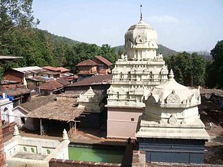
Parshuram Temple is a temple of Lord Parshurama, the sixth avatar of Vishnu in Hinduism located near Chiplun in Ratnagiri district of Maharashtra, India.
National Highway 66, commonly referred to as NH 66, is a 4 lane 1,608 km (999 mi) long busy National Highway that runs roughly north–south along the western coast of India, parallel to the Western Ghats. It connects Panvel to Cape Comorin (Kanyakumari), passing through the states of Maharashtra, Goa, Karnataka, Kerala and Tamil Nadu.

Ovali is a small village located in Chiplun Taluka of Ratnagiri district, Maharashtra with approximate total of 235 families residing with total population just above 994. It is one of 166 villages in chiplun block and along with the 12 other neighbouring villages together they form a community of people from different castes and religions.
Chiplun taluka is a taluka in Ratnagiri district of Maharashtra, India. As per Census 2011, there are 2 towns and 165 villages within Chiplun Taluka.

Satara railway station is the main railway station in the Satara district, in the city of Satara, Maharashtra. Its code is STR. The station lies on the Pune–Miraj line of the Central Railways and is administered by the Pune Railway Division.
